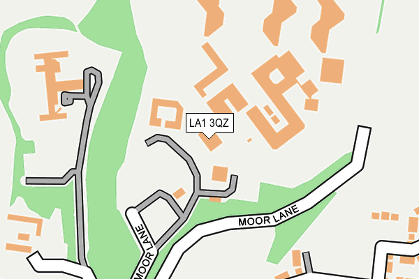
LA1 3QZ is located in the Bulk electoral ward, within the local authority district of Lancaster and the English Parliamentary constituency of Lancaster and Fleetwood. The Sub Integrated Care Board (ICB) Location is NHS Lancashire and South Cumbria ICB - 01K and the police force is Lancashire. This postcode has been in use since January 1993.


GetTheData
Source: OS OpenMap – Local (Ordnance Survey)
Source: OS VectorMap District (Ordnance Survey)
Licence: Open Government Licence (requires attribution)
| Easting | 349552 |
| Northing | 462136 |
| Latitude | 54.052700 |
| Longitude | -2.772066 |
GetTheData
Source: Open Postcode Geo
Licence: Open Government Licence
| Country | England |
| Postcode District | LA1 |
| ➜ LA1 open data dashboard ➜ See where LA1 is on a map ➜ Where is Lancaster? | |
GetTheData
Source: Land Registry Price Paid Data
Licence: Open Government Licence
Elevation or altitude of LA1 3QZ as distance above sea level:
| Metres | Feet | |
|---|---|---|
| Elevation | 70m | 230ft |
Elevation is measured from the approximate centre of the postcode, to the nearest point on an OS contour line from OS Terrain 50, which has contour spacing of ten vertical metres.
➜ How high above sea level am I? Find the elevation of your current position using your device's GPS.
GetTheData
Source: Open Postcode Elevation
Licence: Open Government Licence
| Ward | Bulk |
| Constituency | Lancaster And Fleetwood |
GetTheData
Source: ONS Postcode Database
Licence: Open Government Licence
| June 2022 | Violence and sexual offences | On or near Far Moor Lane | 207m |
| June 2022 | Anti-social behaviour | On or near Far Moor Lane | 207m |
| June 2022 | Other crime | On or near Far Moor Lane | 207m |
| ➜ Get more crime data in our Crime section | |||
GetTheData
Source: data.police.uk
Licence: Open Government Licence
| Lancaster Farms Prison (Far Moor Lane) | Standen Gate | 95m |
| Ridge Lea Hospital (Stone Row Head) | Standen Gate | 298m |
| Ridge Lea Hospital (Stone Row Head) | Standen Gate | 299m |
| Moor Hospital Gates (Quernmore Road) | Standen Gate | 523m |
| Parkgate Drive (Quernmore Road) | Standen Gate | 524m |
| Lancaster Station | 2.4km |
| Bare Lane Station | 4.8km |
GetTheData
Source: NaPTAN
Licence: Open Government Licence
GetTheData
Source: ONS Postcode Database
Licence: Open Government Licence


➜ Get more ratings from the Food Standards Agency
GetTheData
Source: Food Standards Agency
Licence: FSA terms & conditions
| Last Collection | |||
|---|---|---|---|
| Location | Mon-Fri | Sat | Distance |
| Quernmore Road | 16:00 | 12:15 | 568m |
| Ridge Post Office | 16:00 | 12:00 | 1,040m |
| 30 Windermere Road | 16:00 | 12:00 | 1,056m |
GetTheData
Source: Dracos
Licence: Creative Commons Attribution-ShareAlike
| Facility | Distance |
|---|---|
| Hmp Lancaster Farms Stone Row Head, Lancaster Artificial Grass Pitch | 0m |
| Far Moor Stone Row Head, Lancaster Grass Pitches | 269m |
| Lancaster Moor Hospital Cricket Club (Closed) Quernmore Road, Lancaster Grass Pitches | 481m |
GetTheData
Source: Active Places
Licence: Open Government Licence
| School | Phase of Education | Distance |
|---|---|---|
| Central Lancaster High School Crag Road, Lancaster, LA1 3LS | Secondary | 744m |
| Lancaster Christ Church Church of England Primary School Highfield, Derwent Road, Lancaster, LA1 3ES | Primary | 829m |
| Castle View Primary Academy Keswick Road, Lancaster, LA1 3LE | Primary | 977m |
GetTheData
Source: Edubase
Licence: Open Government Licence
The below table lists the International Territorial Level (ITL) codes (formerly Nomenclature of Territorial Units for Statistics (NUTS) codes) and Local Administrative Units (LAU) codes for LA1 3QZ:
| ITL 1 Code | Name |
|---|---|
| TLD | North West (England) |
| ITL 2 Code | Name |
| TLD4 | Lancashire |
| ITL 3 Code | Name |
| TLD44 | Lancaster and Wyre |
| LAU 1 Code | Name |
| E07000121 | Lancaster |
GetTheData
Source: ONS Postcode Directory
Licence: Open Government Licence
The below table lists the Census Output Area (OA), Lower Layer Super Output Area (LSOA), and Middle Layer Super Output Area (MSOA) for LA1 3QZ:
| Code | Name | |
|---|---|---|
| OA | E00127356 | |
| LSOA | E01025095 | Lancaster 013C |
| MSOA | E02005233 | Lancaster 013 |
GetTheData
Source: ONS Postcode Directory
Licence: Open Government Licence
| LA1 3FQ | Coleman Drive | 291m |
| LA1 3FY | Kershaw Drive | 325m |
| LA1 3SA | Campbell Drive | 362m |
| LA1 3FS | Dutton Drive | 404m |
| LA1 3FZ | Mallside Close | 419m |
| LA1 3SY | Kershaw Drive | 420m |
| LA1 3FT | Dutton Drive | 434m |
| LA1 3TG | Kershaw Drive | 457m |
| LA1 3RL | St Andrews Close | 537m |
| LA1 3FN | Parkgate Drive | 567m |
GetTheData
Source: Open Postcode Geo; Land Registry Price Paid Data
Licence: Open Government Licence