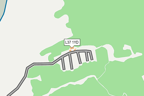
L37 1YD is located in the Harington electoral ward, within the metropolitan district of Sefton and the English Parliamentary constituency of Sefton Central. The Sub Integrated Care Board (ICB) Location is NHS Cheshire and Merseyside ICB - 01V and the police force is Merseyside. This postcode has been in use since March 1983.


GetTheData
Source: OS OpenMap – Local (Ordnance Survey)
Source: OS VectorMap District (Ordnance Survey)
Licence: Open Government Licence (requires attribution)
| Easting | 327715 |
| Northing | 408534 |
| Latitude | 53.568429 |
| Longitude | -3.092952 |
GetTheData
Source: Open Postcode Geo
Licence: Open Government Licence
| Country | England |
| Postcode District | L37 |
| ➜ L37 open data dashboard ➜ See where L37 is on a map | |
GetTheData
Source: Land Registry Price Paid Data
Licence: Open Government Licence
Elevation or altitude of L37 1YD as distance above sea level:
| Metres | Feet | |
|---|---|---|
| Elevation | 10m | 33ft |
Elevation is measured from the approximate centre of the postcode, to the nearest point on an OS contour line from OS Terrain 50, which has contour spacing of ten vertical metres.
➜ How high above sea level am I? Find the elevation of your current position using your device's GPS.
GetTheData
Source: Open Postcode Elevation
Licence: Open Government Licence
| Ward | Harington |
| Constituency | Sefton Central |
GetTheData
Source: ONS Postcode Database
Licence: Open Government Licence
| Squirrel Green (Harington Road) | Freshfield | 910m |
| Birch Green (Harington Road) | Freshfield | 935m |
| Shireburn Road (Victoria Road) | Freshfield | 1,084m |
| Shireburn Road (Victoria Road) | Freshfield | 1,130m |
| Dunes Drive (Harington Road) | Formby | 1,163m |
| Freshfield Station | 1.4km |
| Formby Station | 2.2km |
| Ainsdale Station | 5km |
GetTheData
Source: NaPTAN
Licence: Open Government Licence
GetTheData
Source: ONS Postcode Database
Licence: Open Government Licence


➜ Get more ratings from the Food Standards Agency
GetTheData
Source: Food Standards Agency
Licence: FSA terms & conditions
| Last Collection | |||
|---|---|---|---|
| Location | Mon-Fri | Sat | Distance |
| Freshfield Station | 17:00 | 12:00 | 1,633m |
| Freshfield Post Office | 17:15 | 12:00 | 1,901m |
| Formby Post Office | 17:15 | 12:00 | 2,419m |
GetTheData
Source: Dracos
Licence: Creative Commons Attribution-ShareAlike
| Facility | Distance |
|---|---|
| Formby Golf Club Golf Road, Liverpool Golf | 1.2km |
| Formby Ladies Golf Club Golf Road, Formby, Liverpool Golf | 1.3km |
| Woodlands Primary School (Formby) Woodlands Road, Formby, Liverpool Grass Pitches | 1.7km |
GetTheData
Source: Active Places
Licence: Open Government Licence
| School | Phase of Education | Distance |
|---|---|---|
| St Jerome's Catholic Primary School Greenloons Drive, Formby, Liverpool, L37 2LX | Primary | 1.5km |
| Woodlands Primary School Woodlands Road, Formby, Liverpool, L37 2JN | Primary | 1.7km |
| Formby High School Freshfield Road, Formby, Liverpool, L37 3HW | Secondary | 1.9km |
GetTheData
Source: Edubase
Licence: Open Government Licence
The below table lists the International Territorial Level (ITL) codes (formerly Nomenclature of Territorial Units for Statistics (NUTS) codes) and Local Administrative Units (LAU) codes for L37 1YD:
| ITL 1 Code | Name |
|---|---|
| TLD | North West (England) |
| ITL 2 Code | Name |
| TLD7 | Merseyside |
| ITL 3 Code | Name |
| TLD73 | Sefton |
| LAU 1 Code | Name |
| E08000014 | Sefton |
GetTheData
Source: ONS Postcode Directory
Licence: Open Government Licence
The below table lists the Census Output Area (OA), Lower Layer Super Output Area (LSOA), and Middle Layer Super Output Area (MSOA) for L37 1YD:
| Code | Name | |
|---|---|---|
| OA | E00035445 | |
| LSOA | E01006986 | Sefton 013B |
| MSOA | E02001441 | Sefton 013 |
GetTheData
Source: ONS Postcode Directory
Licence: Open Government Licence
| L37 1XU | Badgers Rake | 507m |
| L37 1LJ | Victoria Road | 708m |
| L37 1LS | Larkhill Lane | 747m |
| L37 1LP | Victoria Road | 761m |
| L37 1LX | Larkhill Lane | 773m |
| L37 1QA | Fairways Court | 785m |
| L37 1NZ | Squirrel Green | 821m |
| L37 1YX | Regents Field | 846m |
| L37 1NS | Harington Road | 848m |
| L37 1LT | Larkhill Lane | 879m |
GetTheData
Source: Open Postcode Geo; Land Registry Price Paid Data
Licence: Open Government Licence