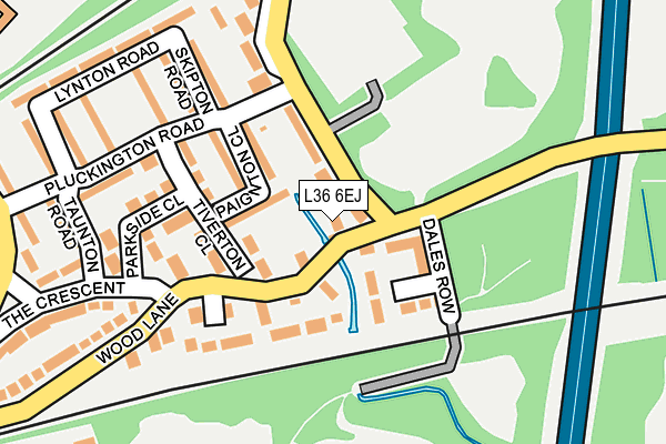
L36 6EJ is located in the St Gabriels electoral ward, within the metropolitan district of Knowsley and the English Parliamentary constituency of Knowsley. The Sub Integrated Care Board (ICB) Location is NHS Cheshire and Merseyside ICB - 01J and the police force is Merseyside. This postcode has been in use since January 1980.


GetTheData
Source: OS OpenMap – Local (Ordnance Survey)
Source: OS VectorMap District (Ordnance Survey)
Licence: Open Government Licence (requires attribution)
| Easting | 345803 |
| Northing | 390988 |
| Latitude | 53.412918 |
| Longitude | -2.816829 |
GetTheData
Source: Open Postcode Geo
Licence: Open Government Licence
| Country | England |
| Postcode District | L36 |
➜ See where L36 is on a map ➜ Where is Huyton with Roby? | |
GetTheData
Source: Land Registry Price Paid Data
Licence: Open Government Licence
Elevation or altitude of L36 6EJ as distance above sea level:
| Metres | Feet | |
|---|---|---|
| Elevation | 30m | 98ft |
Elevation is measured from the approximate centre of the postcode, to the nearest point on an OS contour line from OS Terrain 50, which has contour spacing of ten vertical metres.
➜ How high above sea level am I? Find the elevation of your current position using your device's GPS.
GetTheData
Source: Open Postcode Elevation
Licence: Open Government Licence
| Ward | St Gabriels |
| Constituency | Knowsley |
GetTheData
Source: ONS Postcode Database
Licence: Open Government Licence
| Whiston Lane (Wood Lane) | Huyton | 13m |
| Dales Row (Pottery Lane) | Huyton | 107m |
| The Cresent (Wood Lane) | Huyton | 259m |
| The Crescent (Longview Drive) | Huyton | 315m |
| Longview Drive (The Crescent) | Huyton | 351m |
| Whiston Station | 1.4km |
| Prescot Station | 1.7km |
| Huyton Station | 1.8km |
GetTheData
Source: NaPTAN
Licence: Open Government Licence
| Percentage of properties with Next Generation Access | 100.0% |
| Percentage of properties with Superfast Broadband | 100.0% |
| Percentage of properties with Ultrafast Broadband | 50.0% |
| Percentage of properties with Full Fibre Broadband | 0.0% |
Superfast Broadband is between 30Mbps and 300Mbps
Ultrafast Broadband is > 300Mbps
| Percentage of properties unable to receive 2Mbps | 0.0% |
| Percentage of properties unable to receive 5Mbps | 0.0% |
| Percentage of properties unable to receive 10Mbps | 0.0% |
| Percentage of properties unable to receive 30Mbps | 0.0% |
GetTheData
Source: Ofcom
Licence: Ofcom Terms of Use (requires attribution)
GetTheData
Source: ONS Postcode Database
Licence: Open Government Licence


➜ Get more ratings from the Food Standards Agency
GetTheData
Source: Food Standards Agency
Licence: FSA terms & conditions
| Last Collection | |||
|---|---|---|---|
| Location | Mon-Fri | Sat | Distance |
| Halsnead Avenue | 16:30 | 11:30 | 1,219m |
| The Boundary | 17:30 | 12:00 | 1,351m |
| Huyton Post Office | 17:45 | 12:00 | 1,502m |
GetTheData
Source: Dracos
Licence: Creative Commons Attribution-ShareAlike
| Risk of L36 6EJ flooding from rivers and sea | Medium |
| ➜ L36 6EJ flood map | |
GetTheData
Source: Open Flood Risk by Postcode
Licence: Open Government Licence
The below table lists the International Territorial Level (ITL) codes (formerly Nomenclature of Territorial Units for Statistics (NUTS) codes) and Local Administrative Units (LAU) codes for L36 6EJ:
| ITL 1 Code | Name |
|---|---|
| TLD | North West (England) |
| ITL 2 Code | Name |
| TLD7 | Merseyside |
| ITL 3 Code | Name |
| TLD71 | East Merseyside |
| LAU 1 Code | Name |
| E08000011 | Knowsley |
GetTheData
Source: ONS Postcode Directory
Licence: Open Government Licence
The below table lists the Census Output Area (OA), Lower Layer Super Output Area (LSOA), and Middle Layer Super Output Area (MSOA) for L36 6EJ:
| Code | Name | |
|---|---|---|
| OA | E00032825 | |
| LSOA | E01006477 | Knowsley 015A |
| MSOA | E02001341 | Knowsley 015 |
GetTheData
Source: ONS Postcode Directory
Licence: Open Government Licence
| L36 6HW | Whiston Lane | 26m |
| L36 6HL | Wood Lane | 53m |
| L36 6ET | Paignton Close | 94m |
| L36 6LS | Lauren Close | 94m |
| L36 6EN | Tiverton Close | 122m |
| L36 6LT | Gladica Close | 148m |
| L36 6HN | Whiston Lane | 154m |
| L36 6HA | Skipton Road | 177m |
| L36 6EL | Wood Lane | 183m |
| L36 6EX | Pluckington Road | 205m |
GetTheData
Source: Open Postcode Geo; Land Registry Price Paid Data
Licence: Open Government Licence