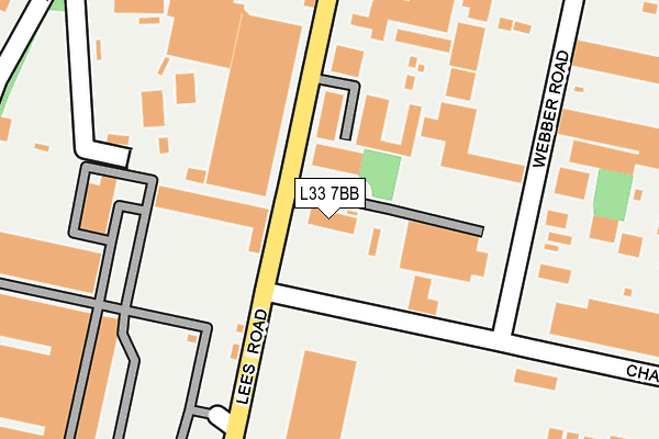
L33 7BB is located in the Northwood electoral ward, within the metropolitan district of Knowsley and the English Parliamentary constituency of Knowsley. The Sub Integrated Care Board (ICB) Location is NHS Cheshire and Merseyside ICB - 01J and the police force is Merseyside. This postcode has been in use since January 1993.


GetTheData
Source: OS OpenMap – Local (Ordnance Survey)
Source: OS VectorMap District (Ordnance Survey)
Licence: Open Government Licence (requires attribution)
| Easting | 342801 |
| Northing | 398375 |
| Latitude | 53.478975 |
| Longitude | -2.863333 |
GetTheData
Source: Open Postcode Geo
Licence: Open Government Licence
| Country | England |
| Postcode District | L33 |
| ➜ L33 open data dashboard ➜ See where L33 is on a map ➜ Where is Kirkby? | |
GetTheData
Source: Land Registry Price Paid Data
Licence: Open Government Licence
Elevation or altitude of L33 7BB as distance above sea level:
| Metres | Feet | |
|---|---|---|
| Elevation | 40m | 131ft |
Elevation is measured from the approximate centre of the postcode, to the nearest point on an OS contour line from OS Terrain 50, which has contour spacing of ten vertical metres.
➜ How high above sea level am I? Find the elevation of your current position using your device's GPS.
GetTheData
Source: Open Postcode Elevation
Licence: Open Government Licence
| Ward | Northwood |
| Constituency | Knowsley |
GetTheData
Source: ONS Postcode Database
Licence: Open Government Licence
| June 2022 | Criminal damage and arson | On or near Gladeswood Road | 21m |
| June 2022 | Anti-social behaviour | On or near Arbour Court | 493m |
| April 2022 | Public order | On or near Deltic Way | 350m |
| ➜ Get more crime data in our Crime section | |||
GetTheData
Source: data.police.uk
Licence: Open Government Licence
| Lees Road (Charleywood Road) | Knowsley Industrial Park | 100m |
| Charleywood Road (Webber Road) | Knowsley Industrial Park | 163m |
| Kirkby Bank Road (Webber Road) | Knowsley Industrial Park | 363m |
| County Road (Lees Road) | Knowsley Industrial Park | 406m |
| Lees Road (South Boundary Road) | Knowsley Industrial Park | 471m |
| Kirkby Station | 2.7km |
| Fazakerley Station | 5km |
| Maghull Station | 5.4km |
GetTheData
Source: NaPTAN
Licence: Open Government Licence
GetTheData
Source: ONS Postcode Database
Licence: Open Government Licence


➜ Get more ratings from the Food Standards Agency
GetTheData
Source: Food Standards Agency
Licence: FSA terms & conditions
| Last Collection | |||
|---|---|---|---|
| Location | Mon-Fri | Sat | Distance |
| Saxon Way/Washington Drive | 17:00 | 12:00 | 745m |
| Kirkby Post Office | 18:00 | 12:00 | 1,536m |
| Broad Lane/Medbourne Crescent | 17:00 | 12:00 | 1,838m |
GetTheData
Source: Dracos
Licence: Creative Commons Attribution-ShareAlike
| Facility | Distance |
|---|---|
| Liverpool Fc Academy The Liverpool Way, Liverpool Grass Pitches, Artificial Grass Pitch | 445m |
| David Lloyd (Liverpool Knowsley) Arbour Lane, Liverpool Sports Hall, Swimming Pool, Health and Fitness Gym, Indoor Tennis Centre, Studio, Squash Courts, Outdoor Tennis Courts | 460m |
| Broad Lane (Closed) Broad Lane, Kirkby, Liverpool Grass Pitches | 654m |
GetTheData
Source: Active Places
Licence: Open Government Licence
| School | Phase of Education | Distance |
|---|---|---|
| Park Brow Community Primary School Broad Lane, Southdene, Kirkby, Liverpool, L32 6QH | Primary | 896m |
| St Laurence's Catholic Primary School Leeside Avenue, Southdene, Kirkby, Liverpool, L32 9QX | Primary | 1.1km |
| St Marie's Catholic Primary School Bigdale Drive, Northwood, Kirkby, Liverpool, L33 6XL | Primary | 1.1km |
GetTheData
Source: Edubase
Licence: Open Government Licence
The below table lists the International Territorial Level (ITL) codes (formerly Nomenclature of Territorial Units for Statistics (NUTS) codes) and Local Administrative Units (LAU) codes for L33 7BB:
| ITL 1 Code | Name |
|---|---|
| TLD | North West (England) |
| ITL 2 Code | Name |
| TLD7 | Merseyside |
| ITL 3 Code | Name |
| TLD71 | East Merseyside |
| LAU 1 Code | Name |
| E08000011 | Knowsley |
GetTheData
Source: ONS Postcode Directory
Licence: Open Government Licence
The below table lists the Census Output Area (OA), Lower Layer Super Output Area (LSOA), and Middle Layer Super Output Area (MSOA) for L33 7BB:
| Code | Name | |
|---|---|---|
| OA | E00032679 | |
| LSOA | E01006446 | Knowsley 005G |
| MSOA | E02001331 | Knowsley 005 |
GetTheData
Source: ONS Postcode Directory
Licence: Open Government Licence
| L33 7SE | Lees Road | 224m |
| L33 7SW | Webber Road | 225m |
| L33 7SQ | Webber Road | 288m |
| L33 7XB | Arbour Lane | 366m |
| L33 7BA | Deltic Way | 385m |
| L33 7ET | Arbour Lane | 460m |
| L33 7XE | Arbour Court | 541m |
| L33 7RW | Lees Road | 551m |
| L33 5XB | Simonswood Lane | 561m |
| L33 7SY | Kirkby Bank Road | 564m |
GetTheData
Source: Open Postcode Geo; Land Registry Price Paid Data
Licence: Open Government Licence