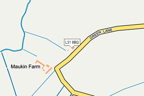
L31 8BQ lies on Green Lane in Maghull, Liverpool. L31 8BQ is located in the Park electoral ward, within the metropolitan district of Sefton and the English Parliamentary constituency of Sefton Central. The Sub Integrated Care Board (ICB) Location is NHS Cheshire and Merseyside ICB - 01T and the police force is Merseyside. This postcode has been in use since January 1980.


GetTheData
Source: OS OpenMap – Local (Ordnance Survey)
Source: OS VectorMap District (Ordnance Survey)
Licence: Open Government Licence (requires attribution)
| Easting | 336381 |
| Northing | 402872 |
| Latitude | 53.518653 |
| Longitude | -2.960968 |
GetTheData
Source: Open Postcode Geo
Licence: Open Government Licence
| Street | Green Lane |
| Locality | Maghull |
| Town/City | Liverpool |
| Country | England |
| Postcode District | L31 |
| ➜ L31 open data dashboard ➜ See where L31 is on a map | |
GetTheData
Source: Land Registry Price Paid Data
Licence: Open Government Licence
Elevation or altitude of L31 8BQ as distance above sea level:
| Metres | Feet | |
|---|---|---|
| Elevation | 10m | 33ft |
Elevation is measured from the approximate centre of the postcode, to the nearest point on an OS contour line from OS Terrain 50, which has contour spacing of ten vertical metres.
➜ How high above sea level am I? Find the elevation of your current position using your device's GPS.
GetTheData
Source: Open Postcode Elevation
Licence: Open Government Licence
| Ward | Park |
| Constituency | Sefton Central |
GetTheData
Source: ONS Postcode Database
Licence: Open Government Licence
| March 2022 | Anti-social behaviour | On or near Stangate | 492m |
| September 2021 | Burglary | On or near Stangate | 492m |
| July 2021 | Criminal damage and arson | On or near Stangate | 492m |
| ➜ Get more crime data in our Crime section | |||
GetTheData
Source: data.police.uk
Licence: Open Government Licence
| Milton Way (Green Lane) | Maghull | 753m |
| Shop Lane (Green Lane) | Maghull | 837m |
| Green Lane (Liverpool Road North) | Maghull | 927m |
| Nedens Lane (Southport Road) | Lydiate | 934m |
| Gordon Avenue (Liverpool Road North) | Maghull | 946m |
| Maghull Station | 2.4km |
| Old Roan Station | 3.6km |
| Town Green Station | 4.6km |
GetTheData
Source: NaPTAN
Licence: Open Government Licence
| Percentage of properties with Next Generation Access | 100.0% |
| Percentage of properties with Superfast Broadband | 100.0% |
| Percentage of properties with Ultrafast Broadband | 0.0% |
| Percentage of properties with Full Fibre Broadband | 0.0% |
Superfast Broadband is between 30Mbps and 300Mbps
Ultrafast Broadband is > 300Mbps
| Percentage of properties unable to receive 2Mbps | 0.0% |
| Percentage of properties unable to receive 5Mbps | 0.0% |
| Percentage of properties unable to receive 10Mbps | 0.0% |
| Percentage of properties unable to receive 30Mbps | 0.0% |
GetTheData
Source: Ofcom
Licence: Ofcom Terms of Use (requires attribution)
GetTheData
Source: ONS Postcode Database
Licence: Open Government Licence


➜ Get more ratings from the Food Standards Agency
GetTheData
Source: Food Standards Agency
Licence: FSA terms & conditions
| Last Collection | |||
|---|---|---|---|
| Location | Mon-Fri | Sat | Distance |
| Dodds Lane | 17:30 | 12:00 | 1,043m |
| Moss Lane | 17:15 | 12:00 | 1,105m |
| Sefton | 16:30 | 08:00 | 1,888m |
GetTheData
Source: Dracos
Licence: Creative Commons Attribution-ShareAlike
| Facility | Distance |
|---|---|
| St John Bosco Primary School Green Lane, Maghull, Liverpool Grass Pitches | 427m |
| Maghull Community Association Green Lane, Maghull, Liverpool Sports Hall | 818m |
| Active Soccer Sports Centre Sefton Lane, Liverpool Artificial Grass Pitch | 1.1km |
GetTheData
Source: Active Places
Licence: Open Government Licence
| School | Phase of Education | Distance |
|---|---|---|
| St John Bosco Catholic Primary School Green Lane, Maghull, Liverpool, L31 8BW | Primary | 427m |
| Green Park Primary School Green Lane, Maghull, Liverpool, L31 8BW | Primary | 476m |
| Lydiate Primary School Lambshear Lane, Lydiate, Liverpool, L31 2JZ | Primary | 1.3km |
GetTheData
Source: Edubase
Licence: Open Government Licence
The below table lists the International Territorial Level (ITL) codes (formerly Nomenclature of Territorial Units for Statistics (NUTS) codes) and Local Administrative Units (LAU) codes for L31 8BQ:
| ITL 1 Code | Name |
|---|---|
| TLD | North West (England) |
| ITL 2 Code | Name |
| TLD7 | Merseyside |
| ITL 3 Code | Name |
| TLD73 | Sefton |
| LAU 1 Code | Name |
| E08000014 | Sefton |
GetTheData
Source: ONS Postcode Directory
Licence: Open Government Licence
The below table lists the Census Output Area (OA), Lower Layer Super Output Area (LSOA), and Middle Layer Super Output Area (MSOA) for L31 8BQ:
| Code | Name | |
|---|---|---|
| OA | E00035816 | |
| LSOA | E01007070 | Sefton 017D |
| MSOA | E02001445 | Sefton 017 |
GetTheData
Source: ONS Postcode Directory
Licence: Open Government Licence
| L31 8BN | Green Lane | 132m |
| L31 8BE | Green Lane | 267m |
| L31 8DE | West Meade | 430m |
| L31 4LF | Mercer Court | 474m |
| L31 8DG | Stangate | 478m |
| L31 8DF | Peel Walk | 507m |
| L31 4EW | Bells Lane | 517m |
| L31 8DW | Green Link | 519m |
| L31 8DD | West Meade | 525m |
| L31 8EX | Empress Close | 537m |
GetTheData
Source: Open Postcode Geo; Land Registry Price Paid Data
Licence: Open Government Licence