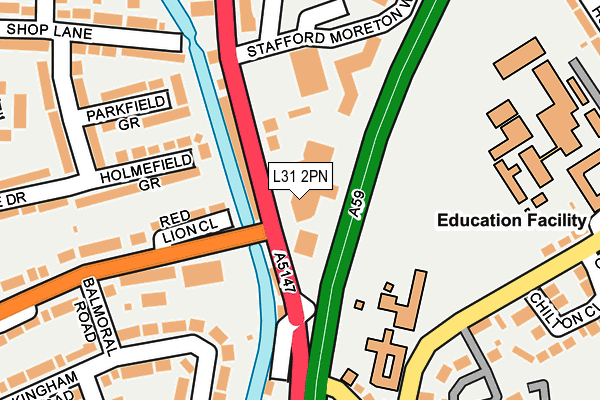
L31 2PN is located in the Park electoral ward, within the metropolitan district of Sefton and the English Parliamentary constituency of Sefton Central. The Sub Integrated Care Board (ICB) Location is NHS Cheshire and Merseyside ICB - 01T and the police force is Merseyside. This postcode has been in use since January 1993.


GetTheData
Source: OS OpenMap – Local (Ordnance Survey)
Source: OS VectorMap District (Ordnance Survey)
Licence: Open Government Licence (requires attribution)
| Easting | 337489 |
| Northing | 402230 |
| Latitude | 53.513016 |
| Longitude | -2.944131 |
GetTheData
Source: Open Postcode Geo
Licence: Open Government Licence
| Country | England |
| Postcode District | L31 |
| ➜ L31 open data dashboard ➜ See where L31 is on a map ➜ Where is Maghull? | |
GetTheData
Source: Land Registry Price Paid Data
Licence: Open Government Licence
Elevation or altitude of L31 2PN as distance above sea level:
| Metres | Feet | |
|---|---|---|
| Elevation | 20m | 66ft |
Elevation is measured from the approximate centre of the postcode, to the nearest point on an OS contour line from OS Terrain 50, which has contour spacing of ten vertical metres.
➜ How high above sea level am I? Find the elevation of your current position using your device's GPS.
GetTheData
Source: Open Postcode Elevation
Licence: Open Government Licence
| Ward | Park |
| Constituency | Sefton Central |
GetTheData
Source: ONS Postcode Database
Licence: Open Government Licence
| December 2023 | Violence and sexual offences | On or near Parking Area | 462m |
| December 2023 | Criminal damage and arson | On or near Parking Area | 462m |
| November 2023 | Shoplifting | On or near Parking Area | 462m |
| ➜ Get more crime data in our Crime section | |||
GetTheData
Source: data.police.uk
Licence: Open Government Licence
| Damfield Lane (Northway) | Maghull | 72m |
| Liverpool Road North (Northway) | Maghull | 107m |
| Maghull Library (Liverpool Road North) | Maghull | 111m |
| Stafford Moreton Way (Liverpool Road North) | Maghull | 167m |
| Northway (Damfield Lane) | Maghull | 208m |
| Maghull Station | 1.1km |
| Old Roan Station | 2.9km |
| Kirkby Station | 4.1km |
GetTheData
Source: NaPTAN
Licence: Open Government Licence
| Percentage of properties with Next Generation Access | 100.0% |
| Percentage of properties with Superfast Broadband | 100.0% |
| Percentage of properties with Ultrafast Broadband | 0.0% |
| Percentage of properties with Full Fibre Broadband | 0.0% |
Superfast Broadband is between 30Mbps and 300Mbps
Ultrafast Broadband is > 300Mbps
| Percentage of properties unable to receive 2Mbps | 0.0% |
| Percentage of properties unable to receive 5Mbps | 0.0% |
| Percentage of properties unable to receive 10Mbps | 0.0% |
| Percentage of properties unable to receive 30Mbps | 0.0% |
GetTheData
Source: Ofcom
Licence: Ofcom Terms of Use (requires attribution)
GetTheData
Source: ONS Postcode Database
Licence: Open Government Licence


➜ Get more ratings from the Food Standards Agency
GetTheData
Source: Food Standards Agency
Licence: FSA terms & conditions
| Last Collection | |||
|---|---|---|---|
| Location | Mon-Fri | Sat | Distance |
| Dodds Lane | 17:30 | 12:00 | 501m |
| Dover Road Post Office | 17:15 | 12:00 | 1,437m |
| Moorhey Road | 17:00 | 12:00 | 1,446m |
GetTheData
Source: Dracos
Licence: Creative Commons Attribution-ShareAlike
| Facility | Distance |
|---|---|
| St. Andrew's Maghull Ce Primary School Deyes Lane, Liverpool Grass Pitches | 147m |
| Anytime Fitness (Maghull) Stafford Moreton Way, Liverpool Health and Fitness Gym, Studio | 241m |
| Deyes High School Deyes Lane, Liverpool Health and Fitness Gym, Grass Pitches, Sports Hall | 273m |
GetTheData
Source: Active Places
Licence: Open Government Licence
| School | Phase of Education | Distance |
|---|---|---|
| Deyes High School Deyes Lane, Maghull, Liverpool, L31 6DE | Secondary | 278m |
| St Andrews Church of England Primary School, Maghull Deyes Lane, Maghull, Liverpool, L31 6DE | Primary | 280m |
| Maricourt Catholic High School Hall Lane, Maghull, Liverpool, L31 3DZ | Secondary | 701m |
GetTheData
Source: Edubase
Licence: Open Government Licence
The below table lists the International Territorial Level (ITL) codes (formerly Nomenclature of Territorial Units for Statistics (NUTS) codes) and Local Administrative Units (LAU) codes for L31 2PN:
| ITL 1 Code | Name |
|---|---|
| TLD | North West (England) |
| ITL 2 Code | Name |
| TLD7 | Merseyside |
| ITL 3 Code | Name |
| TLD73 | Sefton |
| LAU 1 Code | Name |
| E08000014 | Sefton |
GetTheData
Source: ONS Postcode Directory
Licence: Open Government Licence
The below table lists the Census Output Area (OA), Lower Layer Super Output Area (LSOA), and Middle Layer Super Output Area (MSOA) for L31 2PN:
| Code | Name | |
|---|---|---|
| OA | E00035821 | |
| LSOA | E01007072 | Sefton 020D |
| MSOA | E02001448 | Sefton 020 |
GetTheData
Source: ONS Postcode Directory
Licence: Open Government Licence
| L31 2HB | Liverpool Road North | 58m |
| L31 2HJ | Liverpool Road North | 68m |
| L31 7BA | Damfield Lane | 79m |
| L31 7DT | Red Lion Close | 111m |
| L31 2PH | Stafford Moreton Way | 134m |
| L31 7DL | Holmefield Grove | 138m |
| L31 7FB | Alexander Wharf | 170m |
| L31 7DJ | Liverpool Road South | 172m |
| L31 7DD | Parkfield Grove | 174m |
| L31 2HL | Liverpool Road North | 202m |
GetTheData
Source: Open Postcode Geo; Land Registry Price Paid Data
Licence: Open Government Licence