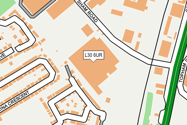
L30 6UR lies on Heysham Road in Bootle. L30 6UR is located in the Netherton and Orrell electoral ward, within the metropolitan district of Sefton and the English Parliamentary constituency of Bootle. The Sub Integrated Care Board (ICB) Location is NHS Cheshire and Merseyside ICB - 01T and the police force is Merseyside. This postcode has been in use since July 2005.


GetTheData
Source: OS OpenMap – Local (Ordnance Survey)
Source: OS VectorMap District (Ordnance Survey)
Licence: Open Government Licence (requires attribution)
| Easting | 336536 |
| Northing | 398474 |
| Latitude | 53.479146 |
| Longitude | -2.957739 |
GetTheData
Source: Open Postcode Geo
Licence: Open Government Licence
| Street | Heysham Road |
| Town/City | Bootle |
| Country | England |
| Postcode District | L30 |
| ➜ L30 open data dashboard ➜ See where L30 is on a map ➜ Where is Bootle? | |
GetTheData
Source: Land Registry Price Paid Data
Licence: Open Government Licence
Elevation or altitude of L30 6UR as distance above sea level:
| Metres | Feet | |
|---|---|---|
| Elevation | 20m | 66ft |
Elevation is measured from the approximate centre of the postcode, to the nearest point on an OS contour line from OS Terrain 50, which has contour spacing of ten vertical metres.
➜ How high above sea level am I? Find the elevation of your current position using your device's GPS.
GetTheData
Source: Open Postcode Elevation
Licence: Open Government Licence
| Ward | Netherton And Orrell |
| Constituency | Bootle |
GetTheData
Source: ONS Postcode Database
Licence: Open Government Licence
| December 2023 | Other theft | On or near Topham Drive | 497m |
| December 2023 | Shoplifting | On or near Topham Drive | 497m |
| November 2023 | Criminal damage and arson | On or near Topham Drive | 497m |
| ➜ Get more crime data in our Crime section | |||
GetTheData
Source: data.police.uk
Licence: Open Government Licence
| Heysham Road (Leckwith Road) | Netherton | 208m |
| Brenka Avenue (Ormskirk Road) | Aintree | 304m |
| Brenka Avenue (Ormskirk Road) | Aintree | 366m |
| Abbeystead Avenue (Park Lane) | Netherton | 413m |
| Raymond Avenue (Park Lane) | Netherton | 416m |
| Aintree Station | 0.6km |
| Old Roan Station | 1km |
| Fazakerley Station | 1.8km |
GetTheData
Source: NaPTAN
Licence: Open Government Licence
| Median download speed | 52.4Mbps |
| Average download speed | 53.9Mbps |
| Maximum download speed | 71.46Mbps |
| Median upload speed | 9.7Mbps |
| Average upload speed | 10.2Mbps |
| Maximum upload speed | 15.00Mbps |
GetTheData
Source: Ofcom
Licence: Ofcom Terms of Use (requires attribution)
GetTheData
Source: ONS Postcode Database
Licence: Open Government Licence


➜ Get more ratings from the Food Standards Agency
GetTheData
Source: Food Standards Agency
Licence: FSA terms & conditions
| Last Collection | |||
|---|---|---|---|
| Location | Mon-Fri | Sat | Distance |
| Old Roan Post Office | 16:40 | 12:00 | 968m |
| Winchester Avenue | 16:00 | 12:00 | 1,203m |
| Karonga Road | 16:00 | 12:00 | 1,210m |
GetTheData
Source: Dracos
Licence: Creative Commons Attribution-ShareAlike
| Facility | Distance |
|---|---|
| Puregym (Aintree) Grand National Avenue, Liverpool Health and Fitness Gym, Studio | 412m |
| Everton Fc Youth Development Centre (Closed) Park Lane, Netherton, Bootle Grass Pitches | 651m |
| Everlast Gyms (Aintree) Ormskirk Road, Liverpool Health and Fitness Gym, Studio | 683m |
GetTheData
Source: Active Places
Licence: Open Government Licence
| School | Phase of Education | Distance |
|---|---|---|
| Our Lady of Walsingham Primary School Stand Park avenue, Netherton, Bootle, L30 3SA | Primary | 936m |
| Aintree Davenhill Primary School Aintree Lane, Aintree Village, Aintree Davenhill Primary School, Liverpool, L10 8LE | Primary | 1.1km |
| St Oswald's Church of England Primary School Ronald Ross Avenue, Netherton, Bootle, L30 5RH | Primary | 1.2km |
GetTheData
Source: Edubase
Licence: Open Government Licence
The below table lists the International Territorial Level (ITL) codes (formerly Nomenclature of Territorial Units for Statistics (NUTS) codes) and Local Administrative Units (LAU) codes for L30 6UR:
| ITL 1 Code | Name |
|---|---|
| TLD | North West (England) |
| ITL 2 Code | Name |
| TLD7 | Merseyside |
| ITL 3 Code | Name |
| TLD73 | Sefton |
| LAU 1 Code | Name |
| E08000014 | Sefton |
GetTheData
Source: ONS Postcode Directory
Licence: Open Government Licence
The below table lists the Census Output Area (OA), Lower Layer Super Output Area (LSOA), and Middle Layer Super Output Area (MSOA) for L30 6UR:
| Code | Name | |
|---|---|---|
| OA | E00035742 | |
| LSOA | E01007046 | Sefton 027C |
| MSOA | E02001455 | Sefton 027 |
GetTheData
Source: ONS Postcode Directory
Licence: Open Government Licence
| L30 1RA | Longridge Drive | 100m |
| L30 1ST | Longridge Drive | 160m |
| L30 6TU | Heysham Road | 209m |
| L30 1RR | Marina Crescent | 218m |
| L30 1RL | Marina Crescent | 241m |
| L30 1RS | Marina Crescent | 246m |
| L30 1RP | Marina Crescent | 260m |
| L30 1PN | Abbeystead Avenue | 268m |
| L30 1RT | Lunt Avenue | 298m |
| L30 1PW | Abbeystead Avenue | 299m |
GetTheData
Source: Open Postcode Geo; Land Registry Price Paid Data
Licence: Open Government Licence