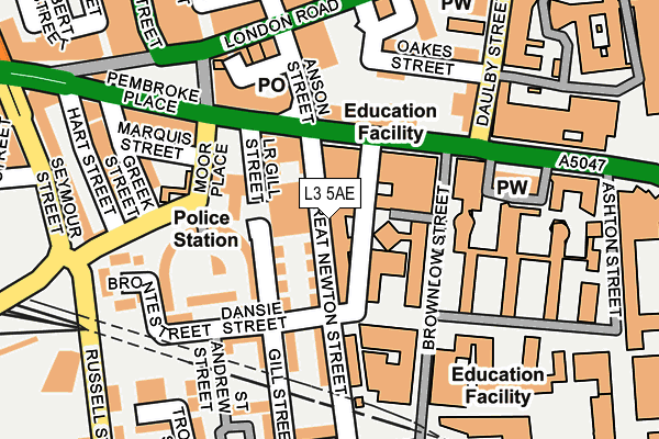
L3 5AE is located in the Brownlow Hill electoral ward, within the metropolitan district of Liverpool and the English Parliamentary constituency of Liverpool, Riverside. The Sub Integrated Care Board (ICB) Location is NHS Cheshire and Merseyside ICB - 99A and the police force is Merseyside. This postcode has been in use since October 2014.


GetTheData
Source: OS OpenMap – Local (Ordnance Survey)
Source: OS VectorMap District (Ordnance Survey)
Licence: Open Government Licence (requires attribution)
| Easting | 335606 |
| Northing | 390580 |
| Latitude | 53.408088 |
| Longitude | -2.970132 |
GetTheData
Source: Open Postcode Geo
Licence: Open Government Licence
| Country | England |
| Postcode District | L3 |
| ➜ L3 open data dashboard ➜ See where L3 is on a map ➜ Where is Liverpool? | |
GetTheData
Source: Land Registry Price Paid Data
Licence: Open Government Licence
Elevation or altitude of L3 5AE as distance above sea level:
| Metres | Feet | |
|---|---|---|
| Elevation | 40m | 131ft |
Elevation is measured from the approximate centre of the postcode, to the nearest point on an OS contour line from OS Terrain 50, which has contour spacing of ten vertical metres.
➜ How high above sea level am I? Find the elevation of your current position using your device's GPS.
GetTheData
Source: Open Postcode Elevation
Licence: Open Government Licence
| Ward | Brownlow Hill |
| Constituency | Liverpool, Riverside |
GetTheData
Source: ONS Postcode Database
Licence: Open Government Licence
| January 2024 | Drugs | On or near Parking Area | 324m |
| January 2024 | Drugs | On or near Finch Place | 330m |
| January 2024 | Public order | On or near Finch Place | 330m |
| ➜ Get more crime data in our Crime section | |||
GetTheData
Source: data.police.uk
Licence: Open Government Licence
| London Road (Pembroke Place) | Liverpool | 179m |
| London Road (Pembroke Place) | Liverpool | 203m |
| Gildart Street (London Road) | Liverpool | 203m |
| London Road (Pembroke Place) | Liverpool | 208m |
| London Road (Pembroke Place) | Liverpool | 216m |
| Liverpool Lime Street Low Level Station | 0.5km |
| Liverpool Lime Street Station | 0.5km |
| Liverpool Central Station | 0.7km |
GetTheData
Source: NaPTAN
Licence: Open Government Licence
| Percentage of properties with Next Generation Access | 0.0% |
| Percentage of properties with Superfast Broadband | 0.0% |
| Percentage of properties with Ultrafast Broadband | 0.0% |
| Percentage of properties with Full Fibre Broadband | 0.0% |
Superfast Broadband is between 30Mbps and 300Mbps
Ultrafast Broadband is > 300Mbps
| Percentage of properties unable to receive 2Mbps | 0.0% |
| Percentage of properties unable to receive 5Mbps | 0.0% |
| Percentage of properties unable to receive 10Mbps | 0.0% |
| Percentage of properties unable to receive 30Mbps | 100.0% |
GetTheData
Source: Ofcom
Licence: Ofcom Terms of Use (requires attribution)
GetTheData
Source: ONS Postcode Database
Licence: Open Government Licence


➜ Get more ratings from the Food Standards Agency
GetTheData
Source: Food Standards Agency
Licence: FSA terms & conditions
| Last Collection | |||
|---|---|---|---|
| Location | Mon-Fri | Sat | Distance |
| Monument Place Post Office | 17:30 | 12:00 | 173m |
| Pembroke Place | 17:30 | 12:00 | 188m |
| London Road | 17:30 | 12:00 | 357m |
GetTheData
Source: Dracos
Licence: Creative Commons Attribution-ShareAlike
| Facility | Distance |
|---|---|
| Momentum Leisure Club London Road, Liverpool Swimming Pool, Health and Fitness Gym | 286m |
| B Two Fitness Centre (Closed) Great Orford Street, Liverpool Sports Hall, Health and Fitness Gym, Artificial Grass Pitch | 335m |
| Spindles Health & Leisure (Liverpool) (Closed) Ranelagh Place, Liverpool Swimming Pool, Health and Fitness Gym, Studio, Squash Courts | 538m |
GetTheData
Source: Active Places
Licence: Open Government Licence
| School | Phase of Education | Distance |
|---|---|---|
| University of Liverpool The Foundation Building, 765 Brownlow Hill, Abercromby Square, Liverpool, L69 7ZX | Not applicable | 349m |
| St Nicholas Catholic Academy Orthes Street, Liverpool, L3 5XF | Primary | 373m |
| The City of Liverpool College Clarence Street, Liverpool, L3 5TP | 16 plus | 459m |
GetTheData
Source: Edubase
Licence: Open Government Licence
The below table lists the International Territorial Level (ITL) codes (formerly Nomenclature of Territorial Units for Statistics (NUTS) codes) and Local Administrative Units (LAU) codes for L3 5AE:
| ITL 1 Code | Name |
|---|---|
| TLD | North West (England) |
| ITL 2 Code | Name |
| TLD7 | Merseyside |
| ITL 3 Code | Name |
| TLD72 | Liverpool |
| LAU 1 Code | Name |
| E08000012 | Liverpool |
GetTheData
Source: ONS Postcode Directory
Licence: Open Government Licence
The below table lists the Census Output Area (OA), Lower Layer Super Output Area (LSOA), and Middle Layer Super Output Area (MSOA) for L3 5AE:
| Code | Name | |
|---|---|---|
| OA | E00176713 | |
| LSOA | E01006747 | Liverpool 031B |
| MSOA | E02001377 | Liverpool 031 |
GetTheData
Source: ONS Postcode Directory
Licence: Open Government Licence
| L3 5RL | Great Newton Street | 33m |
| L3 5PX | Pembroke Place | 91m |
| L3 5PH | Pembroke Place | 101m |
| L3 5RP | Great Newton Street | 124m |
| L3 5NY | Anson Street | 131m |
| L3 5NP | Riding Street | 157m |
| L3 5NH | Riding Street | 160m |
| L3 5NL | London Road | 187m |
| L3 8JN | London Road | 193m |
| L3 5XZ | St Andrew Street | 204m |
GetTheData
Source: Open Postcode Geo; Land Registry Price Paid Data
Licence: Open Government Licence