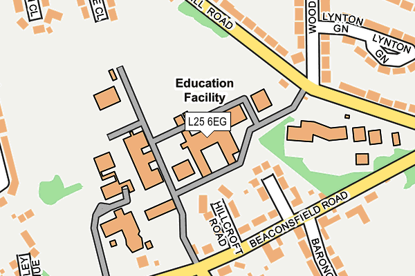
L25 6EG is located in the Woolton Village electoral ward, within the metropolitan district of Liverpool and the English Parliamentary constituency of Garston and Halewood. The Sub Integrated Care Board (ICB) Location is NHS Cheshire and Merseyside ICB - 99A and the police force is Merseyside. This postcode has been in use since January 1980.


GetTheData
Source: OS OpenMap – Local (Ordnance Survey)
Source: OS VectorMap District (Ordnance Survey)
Licence: Open Government Licence (requires attribution)
| Easting | 341544 |
| Northing | 387674 |
| Latitude | 53.382662 |
| Longitude | -2.880281 |
GetTheData
Source: Open Postcode Geo
Licence: Open Government Licence
| Country | England |
| Postcode District | L25 |
| ➜ L25 open data dashboard ➜ See where L25 is on a map ➜ Where is Liverpool? | |
GetTheData
Source: Land Registry Price Paid Data
Licence: Open Government Licence
Elevation or altitude of L25 6EG as distance above sea level:
| Metres | Feet | |
|---|---|---|
| Elevation | 80m | 262ft |
Elevation is measured from the approximate centre of the postcode, to the nearest point on an OS contour line from OS Terrain 50, which has contour spacing of ten vertical metres.
➜ How high above sea level am I? Find the elevation of your current position using your device's GPS.
GetTheData
Source: Open Postcode Elevation
Licence: Open Government Licence
| Ward | Woolton Village |
| Constituency | Garston And Halewood |
GetTheData
Source: ONS Postcode Database
Licence: Open Government Licence
| January 2024 | Possession of weapons | On or near Lynton Green | 273m |
| November 2023 | Vehicle crime | On or near Lynton Green | 273m |
| March 2023 | Vehicle crime | On or near Lynton Green | 273m |
| ➜ Get more crime data in our Crime section | |||
GetTheData
Source: data.police.uk
Licence: Open Government Licence
| Beaconsfield Road (Church Road) | Woolton | 366m |
| Woolton Hill Road (Church Road) | Woolton | 371m |
| Wood View Road (Woolton Road) | Woolton | 389m |
| Rockbourne Avenue (Woolton Road) | Woolton | 400m |
| Blackwood Avenue (Woolton Road) | Woolton | 470m |
| West Allerton Station | 2.3km |
| Mossley Hill Station | 2.4km |
| Broad Green Station | 2.8km |
GetTheData
Source: NaPTAN
Licence: Open Government Licence
GetTheData
Source: ONS Postcode Database
Licence: Open Government Licence


➜ Get more ratings from the Food Standards Agency
GetTheData
Source: Food Standards Agency
Licence: FSA terms & conditions
| Last Collection | |||
|---|---|---|---|
| Location | Mon-Fri | Sat | Distance |
| Beaconsfield Road | 16:45 | 12:00 | 159m |
| Woodview Road | 16:45 | 12:00 | 192m |
| Reservoir Road | 17:00 | 12:00 | 468m |
GetTheData
Source: Dracos
Licence: Creative Commons Attribution-ShareAlike
| Facility | Distance |
|---|---|
| St Francis Xaviers College Woolton Hill Road, Woolton, Liverpool Grass Pitches, Sports Hall, Swimming Pool, Squash Courts, Studio | 0m |
| Lower Lee School (Closed) Beaconsfield Road, Woolton, Liverpool Sports Hall | 330m |
| Calderstones Park Yew Tree Road, Allerton, Liverpool Outdoor Tennis Courts | 632m |
GetTheData
Source: Active Places
Licence: Open Government Licence
| School | Phase of Education | Distance |
|---|---|---|
| St Francis Xavier's College Woolton Hill Road, Woolton, Liverpool, L25 6EG | Secondary | 0m |
| SENDSCOPE The Pavillion, St Francis Xavier's College, Woolton Hill Road, Liverpool, L25 6EG | Not applicable | 48m |
| Woolton High School Woolton Hill Road, Woolton, Liverpool, L25 6JA | Not applicable | 134m |
GetTheData
Source: Edubase
Licence: Open Government Licence
The below table lists the International Territorial Level (ITL) codes (formerly Nomenclature of Territorial Units for Statistics (NUTS) codes) and Local Administrative Units (LAU) codes for L25 6EG:
| ITL 1 Code | Name |
|---|---|
| TLD | North West (England) |
| ITL 2 Code | Name |
| TLD7 | Merseyside |
| ITL 3 Code | Name |
| TLD72 | Liverpool |
| LAU 1 Code | Name |
| E08000012 | Liverpool |
GetTheData
Source: ONS Postcode Directory
Licence: Open Government Licence
The below table lists the Census Output Area (OA), Lower Layer Super Output Area (LSOA), and Middle Layer Super Output Area (MSOA) for L25 6EG:
| Code | Name | |
|---|---|---|
| OA | E00034434 | |
| LSOA | E01006796 | Liverpool 047E |
| MSOA | E02001393 | Liverpool 047 |
GetTheData
Source: ONS Postcode Directory
Licence: Open Government Licence
| L25 6EP | Newcroft Road | 109m |
| L25 6ER | Hillcroft Road | 114m |
| L25 6EQ | Beaconsfield Road | 140m |
| L25 6HU | Woolton Hill Road | 172m |
| L25 6EL | Beaconsfield Road | 192m |
| L25 6HZ | Woodview Road | 217m |
| L25 6HX | Woolton Hill Road | 245m |
| L25 6JD | Aldbourne Close | 263m |
| L25 6EH | Baroncroft Road | 270m |
| L25 6HY | Woodview Road | 273m |
GetTheData
Source: Open Postcode Geo; Land Registry Price Paid Data
Licence: Open Government Licence