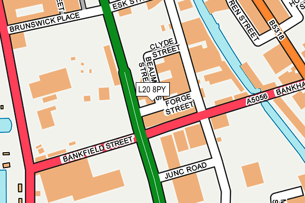
L20 8PY is located in the Waterfront North electoral ward, within the metropolitan district of Liverpool and the English Parliamentary constituency of Liverpool, Riverside. The Sub Integrated Care Board (ICB) Location is NHS Cheshire and Merseyside ICB - 99A and the police force is Merseyside. This postcode has been in use since January 1983.


GetTheData
Source: OS OpenMap – Local (Ordnance Survey)
Source: OS VectorMap District (Ordnance Survey)
Licence: Open Government Licence (requires attribution)
| Easting | 334028 |
| Northing | 393760 |
| Latitude | 53.436488 |
| Longitude | -2.994532 |
GetTheData
Source: Open Postcode Geo
Licence: Open Government Licence
| Country | England |
| Postcode District | L20 |
| ➜ L20 open data dashboard ➜ See where L20 is on a map ➜ Where is Liverpool? | |
GetTheData
Source: Land Registry Price Paid Data
Licence: Open Government Licence
Elevation or altitude of L20 8PY as distance above sea level:
| Metres | Feet | |
|---|---|---|
| Elevation | 10m | 33ft |
Elevation is measured from the approximate centre of the postcode, to the nearest point on an OS contour line from OS Terrain 50, which has contour spacing of ten vertical metres.
➜ How high above sea level am I? Find the elevation of your current position using your device's GPS.
GetTheData
Source: Open Postcode Elevation
Licence: Open Government Licence
| Ward | Waterfront North |
| Constituency | Liverpool, Riverside |
GetTheData
Source: ONS Postcode Database
Licence: Open Government Licence
| June 2022 | Anti-social behaviour | On or near Bankfield Street | 160m |
| June 2022 | Criminal damage and arson | On or near Dunnett Street | 313m |
| June 2022 | Public order | On or near Miskelly Street | 316m |
| ➜ Get more crime data in our Crime section | |||
GetTheData
Source: data.police.uk
Licence: Open Government Licence
| Forge Street (Derby Road) | Sandhills | 30m |
| Bankfield Street (Derby Road) | Sandhills | 52m |
| Esk Street (Derby Road) | Sandhills | 222m |
| Bankhall Fire Station (Derby Road) | Sandhills | 275m |
| Bankhall Fire Station (Derby Road) | Sandhills | 301m |
| Bank Hall Station | 0.5km |
| Sandhills Station | 0.8km |
| Kirkdale Station | 1km |
GetTheData
Source: NaPTAN
Licence: Open Government Licence
GetTheData
Source: ONS Postcode Database
Licence: Open Government Licence


➜ Get more ratings from the Food Standards Agency
GetTheData
Source: Food Standards Agency
Licence: FSA terms & conditions
| Last Collection | |||
|---|---|---|---|
| Location | Mon-Fri | Sat | Distance |
| Boundary Street | 16:15 | 12:00 | 188m |
| Lightbody Street | 17:15 | 12:00 | 1,549m |
| County Road Post Office | 17:00 | 12:00 | 1,581m |
GetTheData
Source: Dracos
Licence: Creative Commons Attribution-ShareAlike
| Facility | Distance |
|---|---|
| Kirkdale Community Centre Stanley Road, Everton, Liverpool Health and Fitness Gym, Sports Hall | 712m |
| Hurricane Combat & Fitness Stanley Road, Bootle Health and Fitness Gym, Sports Hall | 914m |
| William Collins Playing Fields Lambeth Road, Liverpool Grass Pitches | 961m |
GetTheData
Source: Active Places
Licence: Open Government Licence
| School | Phase of Education | Distance |
|---|---|---|
| Kirkdale St Lawrence CofE VA Primary School Fonthill Road, Liverpool, L4 1QD | Primary | 840m |
| Hugh Baird College Balliol Road, Bootle, L20 7EW | 16 plus | 1km |
| St John's Catholic Primary School Fountains Road, Kirkdale, Liverpool, L4 1UN | Primary | 1.2km |
GetTheData
Source: Edubase
Licence: Open Government Licence
The below table lists the International Territorial Level (ITL) codes (formerly Nomenclature of Territorial Units for Statistics (NUTS) codes) and Local Administrative Units (LAU) codes for L20 8PY:
| ITL 1 Code | Name |
|---|---|
| TLD | North West (England) |
| ITL 2 Code | Name |
| TLD7 | Merseyside |
| ITL 3 Code | Name |
| TLD72 | Liverpool |
| LAU 1 Code | Name |
| E08000012 | Liverpool |
GetTheData
Source: ONS Postcode Directory
Licence: Open Government Licence
The below table lists the Census Output Area (OA), Lower Layer Super Output Area (LSOA), and Middle Layer Super Output Area (MSOA) for L20 8PY:
| Code | Name | |
|---|---|---|
| OA | E00165715 | |
| LSOA | E01006778 | Liverpool 014E |
| MSOA | E02001360 | Liverpool 014 |
GetTheData
Source: ONS Postcode Directory
Licence: Open Government Licence
| L20 8EA | Derby Road | 36m |
| L20 8TD | Derby Road | 254m |
| L20 8HL | Brasenose Road | 261m |
| L20 8JD | Bankhall Street | 281m |
| L20 8JW | Forth Street | 337m |
| L20 8JB | Redfern Street | 408m |
| L20 1AB | Derby Road | 427m |
| L20 8EW | Bankhall Lane | 446m |
| L20 8LU | Lodwick Street | 466m |
| L20 8EX | Foster Street | 473m |
GetTheData
Source: Open Postcode Geo; Land Registry Price Paid Data
Licence: Open Government Licence