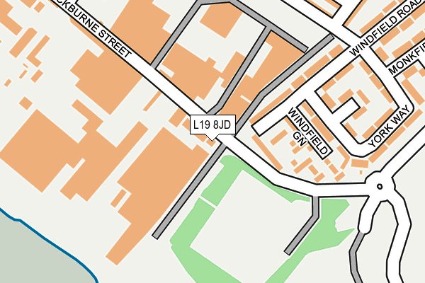
L19 8JD is located in the Garston electoral ward, within the metropolitan district of Liverpool and the English Parliamentary constituency of Garston and Halewood. The Sub Integrated Care Board (ICB) Location is NHS Cheshire and Merseyside ICB - 99A and the police force is Merseyside. This postcode has been in use since April 2007.


GetTheData
Source: OS OpenMap – Local (Ordnance Survey)
Source: OS VectorMap District (Ordnance Survey)
Licence: Open Government Licence (requires attribution)
| Easting | 340421 |
| Northing | 383452 |
| Latitude | 53.344591 |
| Longitude | -2.896364 |
GetTheData
Source: Open Postcode Geo
Licence: Open Government Licence
| Country | England |
| Postcode District | L19 |
| ➜ L19 open data dashboard ➜ See where L19 is on a map ➜ Where is Liverpool? | |
GetTheData
Source: Land Registry Price Paid Data
Licence: Open Government Licence
Elevation or altitude of L19 8JD as distance above sea level:
| Metres | Feet | |
|---|---|---|
| Elevation | 10m | 33ft |
Elevation is measured from the approximate centre of the postcode, to the nearest point on an OS contour line from OS Terrain 50, which has contour spacing of ten vertical metres.
➜ How high above sea level am I? Find the elevation of your current position using your device's GPS.
GetTheData
Source: Open Postcode Elevation
Licence: Open Government Licence
| Ward | Garston |
| Constituency | Garston And Halewood |
GetTheData
Source: ONS Postcode Database
Licence: Open Government Licence
| December 2023 | Other theft | On or near York Way | 210m |
| December 2023 | Violence and sexual offences | On or near York Way | 210m |
| December 2023 | Burglary | On or near York Way | 210m |
| ➜ Get more crime data in our Crime section | |||
GetTheData
Source: data.police.uk
Licence: Open Government Licence
| Banks Road (Windfield Road) | Garston | 358m |
| Banks Lane (Blackburne Street) | Garston | 430m |
| Banks Lane (Blackburne Street) | Garston | 435m |
| Shakespeare Street (Window Lane) | Garston | 495m |
| Windfield Road (Banks Road) | Garston | 534m |
| Liverpool South Parkway Station | 1.5km |
| Cressington Station | 1.9km |
| West Allerton Station | 2.8km |
GetTheData
Source: NaPTAN
Licence: Open Government Licence
GetTheData
Source: ONS Postcode Database
Licence: Open Government Licence


➜ Get more ratings from the Food Standards Agency
GetTheData
Source: Food Standards Agency
Licence: FSA terms & conditions
| Last Collection | |||
|---|---|---|---|
| Location | Mon-Fri | Sat | Distance |
| Windfield Road | 16:30 | 12:00 | 532m |
| King Street | 16:30 | 12:00 | 617m |
| Window Lane | 16:30 | 12:00 | 631m |
GetTheData
Source: Dracos
Licence: Creative Commons Attribution-ShareAlike
| Facility | Distance |
|---|---|
| Garston Urban Village Hall (Closed) Banks Road, Liverpool Sports Hall | 498m |
| 24/7 Fitness (Liverpool Speke) Speke Road, Garston, Liverpool Health and Fitness Gym, Studio | 1km |
| The Academy Of St Nicholas Horrocks Avenue, Liverpool Sports Hall, Health and Fitness Gym, Studio, Artificial Grass Pitch | 1.1km |
GetTheData
Source: Active Places
Licence: Open Government Licence
| School | Phase of Education | Distance |
|---|---|---|
| Banks Road Primary School Banks Road, Garston, Liverpool, L19 8JZ | Primary | 583m |
| Holy Trinity Catholic Primary School Banks Road, Liverpool, L19 8JY | Primary | 657m |
| ES Independent School 52 Wellington Street, Garston, Liverpool, Merseyside, L19 2LX | Not applicable | 1.1km |
GetTheData
Source: Edubase
Licence: Open Government Licence
The below table lists the International Territorial Level (ITL) codes (formerly Nomenclature of Territorial Units for Statistics (NUTS) codes) and Local Administrative Units (LAU) codes for L19 8JD:
| ITL 1 Code | Name |
|---|---|
| TLD | North West (England) |
| ITL 2 Code | Name |
| TLD7 | Merseyside |
| ITL 3 Code | Name |
| TLD72 | Liverpool |
| LAU 1 Code | Name |
| E08000012 | Liverpool |
GetTheData
Source: ONS Postcode Directory
Licence: Open Government Licence
The below table lists the Census Output Area (OA), Lower Layer Super Output Area (LSOA), and Middle Layer Super Output Area (MSOA) for L19 8JD:
| Code | Name | |
|---|---|---|
| OA | E00034182 | |
| LSOA | E01006740 | Liverpool 057A |
| MSOA | E02001403 | Liverpool 057 |
GetTheData
Source: ONS Postcode Directory
Licence: Open Government Licence
| L19 8LU | Windfield Road | 97m |
| L19 8LX | Windfield Green | 111m |
| L19 8JW | Windfield Road | 185m |
| L19 8JS | York Way | 218m |
| L19 8ER | York Street | 242m |
| L19 8JR | York Way | 251m |
| L19 8LD | Chesterton Street | 283m |
| L19 8LF | Lincoln Street | 301m |
| L19 8JT | Monkfield Way | 312m |
| L19 8LB | Chesterton Street | 318m |
GetTheData
Source: Open Postcode Geo; Land Registry Price Paid Data
Licence: Open Government Licence