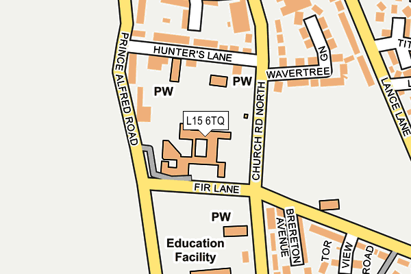
L15 6TQ is located in the Church electoral ward, within the metropolitan district of Liverpool and the English Parliamentary constituency of Liverpool, Wavertree. The Sub Integrated Care Board (ICB) Location is NHS Cheshire and Merseyside ICB - 99A and the police force is Merseyside. This postcode has been in use since January 1980.


GetTheData
Source: OS OpenMap – Local (Ordnance Survey)
Source: OS VectorMap District (Ordnance Survey)
Licence: Open Government Licence (requires attribution)
| Easting | 339156 |
| Northing | 389154 |
| Latitude | 53.395694 |
| Longitude | -2.916462 |
GetTheData
Source: Open Postcode Geo
Licence: Open Government Licence
| Country | England |
| Postcode District | L15 |
| ➜ L15 open data dashboard ➜ See where L15 is on a map ➜ Where is Liverpool? | |
GetTheData
Source: Land Registry Price Paid Data
Licence: Open Government Licence
Elevation or altitude of L15 6TQ as distance above sea level:
| Metres | Feet | |
|---|---|---|
| Elevation | 50m | 164ft |
Elevation is measured from the approximate centre of the postcode, to the nearest point on an OS contour line from OS Terrain 50, which has contour spacing of ten vertical metres.
➜ How high above sea level am I? Find the elevation of your current position using your device's GPS.
GetTheData
Source: Open Postcode Elevation
Licence: Open Government Licence
| Ward | Church |
| Constituency | Liverpool, Wavertree |
GetTheData
Source: ONS Postcode Database
Licence: Open Government Licence
| January 2024 | Vehicle crime | On or near Frederick Grove | 386m |
| December 2023 | Violence and sexual offences | On or near Tithebarn Grove | 328m |
| March 2023 | Violence and sexual offences | On or near Frederick Grove | 386m |
| ➜ Get more crime data in our Crime section | |||
GetTheData
Source: data.police.uk
Licence: Open Government Licence
| Woolton Road (Church Road) | Wavertree | 67m |
| Woolton Road (Church Road) | Wavertree | 137m |
| Hunters Lane (Church Road North) | Wavertree | 155m |
| Church Road (Woolton Road) | Wavertree | 159m |
| Childwall Road (Church Road North) | Wavertree | 195m |
| Wavertree Technology Park Station | 1.1km |
| Mossley Hill Station | 1.9km |
| Broad Green Station | 1.9km |
GetTheData
Source: NaPTAN
Licence: Open Government Licence
GetTheData
Source: ONS Postcode Database
Licence: Open Government Licence


➜ Get more ratings from the Food Standards Agency
GetTheData
Source: Food Standards Agency
Licence: FSA terms & conditions
| Last Collection | |||
|---|---|---|---|
| Location | Mon-Fri | Sat | Distance |
| Church Road | 16:15 | 12:00 | 95m |
| Mill Lane | 16:15 | 12:00 | 324m |
| Prince Alfred Road | 17:30 | 12:00 | 414m |
GetTheData
Source: Dracos
Licence: Creative Commons Attribution-ShareAlike
| Facility | Distance |
|---|---|
| The Blue Coat School (Wavertree) Church Road, Wavertree, Liverpool Health and Fitness Gym, Artificial Grass Pitch, Grass Pitches, Sports Hall, Studio, Outdoor Tennis Courts | 230m |
| Wavertree Athletics Centre Wellington Road, Wellington Road, Wavertree, Liverpool Athletics | 576m |
| Liverpool Tennis Centre Wellington Road, Wavertree, Liverpool Indoor Tennis Centre, Outdoor Tennis Courts | 628m |
GetTheData
Source: Active Places
Licence: Open Government Licence
| School | Phase of Education | Distance |
|---|---|---|
| Royal School for the Blind (Liverpool) Church Road North, Wavertree, Liverpool, L15 6TQ | Not applicable | 0m |
| Wavertree Church of England School Rose Villas, Wavertree, Liverpool, L15 8HJ | Primary | 295m |
| The Blue Coat School Church Road, Wavertree, Liverpool, L15 9EE | Secondary | 302m |
GetTheData
Source: Edubase
Licence: Open Government Licence
The below table lists the International Territorial Level (ITL) codes (formerly Nomenclature of Territorial Units for Statistics (NUTS) codes) and Local Administrative Units (LAU) codes for L15 6TQ:
| ITL 1 Code | Name |
|---|---|
| TLD | North West (England) |
| ITL 2 Code | Name |
| TLD7 | Merseyside |
| ITL 3 Code | Name |
| TLD72 | Liverpool |
| LAU 1 Code | Name |
| E08000012 | Liverpool |
GetTheData
Source: ONS Postcode Directory
Licence: Open Government Licence
The below table lists the Census Output Area (OA), Lower Layer Super Output Area (LSOA), and Middle Layer Super Output Area (MSOA) for L15 6TQ:
| Code | Name | |
|---|---|---|
| OA | E00033395 | |
| LSOA | E01006588 | Liverpool 042C |
| MSOA | E02001388 | Liverpool 042 |
GetTheData
Source: ONS Postcode Directory
Licence: Open Government Licence
| L15 8HL | Hunters Lane | 143m |
| L15 6TE | Church Road North | 170m |
| L15 6TF | Church Road North | 179m |
| L15 6TA | Wavertree Green | 192m |
| L15 6TJ | Brereton Avenue | 193m |
| L15 8HH | Prince Alfred Road | 198m |
| L15 8JR | Wrights Terrace | 208m |
| L15 8JW | Waterloo Street | 223m |
| L15 6DL | Church Road North | 256m |
| L15 9EQ | Church Road | 258m |
GetTheData
Source: Open Postcode Geo; Land Registry Price Paid Data
Licence: Open Government Licence