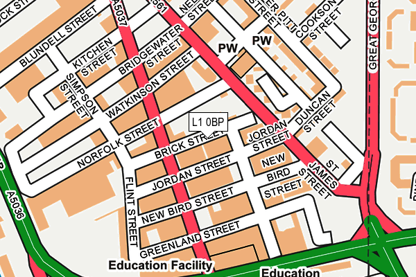
L1 0BP is located in the City Centre South electoral ward, within the metropolitan district of Liverpool and the English Parliamentary constituency of Liverpool, Riverside. The Sub Integrated Care Board (ICB) Location is NHS Cheshire and Merseyside ICB - 99A and the police force is Merseyside. This postcode has been in use since January 1980.


GetTheData
Source: OS OpenMap – Local (Ordnance Survey)
Source: OS VectorMap District (Ordnance Survey)
Licence: Open Government Licence (requires attribution)
| Easting | 334948 |
| Northing | 389239 |
| Latitude | 53.395972 |
| Longitude | -2.979752 |
GetTheData
Source: Open Postcode Geo
Licence: Open Government Licence
| Country | England |
| Postcode District | L1 |
| ➜ L1 open data dashboard ➜ See where L1 is on a map ➜ Where is Liverpool? | |
GetTheData
Source: Land Registry Price Paid Data
Licence: Open Government Licence
Elevation or altitude of L1 0BP as distance above sea level:
| Metres | Feet | |
|---|---|---|
| Elevation | 20m | 66ft |
Elevation is measured from the approximate centre of the postcode, to the nearest point on an OS contour line from OS Terrain 50, which has contour spacing of ten vertical metres.
➜ How high above sea level am I? Find the elevation of your current position using your device's GPS.
GetTheData
Source: Open Postcode Elevation
Licence: Open Government Licence
| Ward | City Centre South |
| Constituency | Liverpool, Riverside |
GetTheData
Source: ONS Postcode Database
Licence: Open Government Licence
| January 2024 | Violence and sexual offences | On or near Upper Pitt Street | 223m |
| December 2023 | Violence and sexual offences | On or near Prince Albert Mews | 118m |
| December 2023 | Violence and sexual offences | On or near Hardy Street | 197m |
| ➜ Get more crime data in our Crime section | |||
GetTheData
Source: data.police.uk
Licence: Open Government Licence
| Norfolk Street (St James Street) | Liverpool | 76m |
| Greenland Street | Liverpool | 124m |
| Hardy Street (St James Street) | Liverpool | 132m |
| Bridgewater Street | Liverpool | 163m |
| Parliament Street (Great George Street) | Liverpool | 259m |
| Liverpool Central Station | 1km |
| Liverpool Lime Street Station | 1.3km |
| Liverpool James Street Station | 1.3km |
GetTheData
Source: NaPTAN
Licence: Open Government Licence
Estimated total energy consumption in L1 0BP by fuel type, 2015.
| Consumption (kWh) | 96,185 |
|---|---|
| Meter count | 6 |
| Mean (kWh/meter) | 16,031 |
| Median (kWh/meter) | 16,207 |
GetTheData
Source: Postcode level gas estimates: 2015 (experimental)
Source: Postcode level electricity estimates: 2015 (experimental)
Licence: Open Government Licence
GetTheData
Source: ONS Postcode Database
Licence: Open Government Licence

➜ Get more ratings from the Food Standards Agency
GetTheData
Source: Food Standards Agency
Licence: FSA terms & conditions
| Last Collection | |||
|---|---|---|---|
| Location | Mon-Fri | Sat | Distance |
| St James Street | 18:15 | 12:00 | 151m |
| Wapping Dock | 18:30 | 12:00 | 395m |
| Windsor Street | 16:00 | 12:00 | 469m |
GetTheData
Source: Dracos
Licence: Creative Commons Attribution-ShareAlike
| Facility | Distance |
|---|---|
| Club Moativation (Liverpool) (Closed) Paradise Street, Liverpool Studio, Health and Fitness Gym, Swimming Pool | 942m |
| Toxteth Firefit Hub Upper Warwick Street, Liverpool Health and Fitness Gym, Sports Hall, Studio, Artificial Grass Pitch | 970m |
| Lifestyles Toxteth (Closed) Upper Hill Street, Liverpool Sports Hall, Health and Fitness Gym, Squash Courts, Artificial Grass Pitch | 978m |
GetTheData
Source: Active Places
Licence: Open Government Licence
| School | Phase of Education | Distance |
|---|---|---|
| Liverpool Life Sciences UTC 41 Greenland Street, Liverpool, L1 0BS | Secondary | 168m |
| The Studio School Liverpool 41 Greenland Street, Liverpool, L1 0BS | Secondary | 168m |
| Cities in Schools at Unit 302 Queens Dock Commercial Centre, Norkfolk Street, Liverpool, L1 0BG | Not applicable | 254m |
GetTheData
Source: Edubase
Licence: Open Government Licence
The below table lists the International Territorial Level (ITL) codes (formerly Nomenclature of Territorial Units for Statistics (NUTS) codes) and Local Administrative Units (LAU) codes for L1 0BP:
| ITL 1 Code | Name |
|---|---|
| TLD | North West (England) |
| ITL 2 Code | Name |
| TLD7 | Merseyside |
| ITL 3 Code | Name |
| TLD72 | Liverpool |
| LAU 1 Code | Name |
| E08000012 | Liverpool |
GetTheData
Source: ONS Postcode Directory
Licence: Open Government Licence
The below table lists the Census Output Area (OA), Lower Layer Super Output Area (LSOA), and Middle Layer Super Output Area (MSOA) for L1 0BP:
| Code | Name | |
|---|---|---|
| OA | E00033024 | |
| LSOA | E01006515 | Liverpool 037B |
| MSOA | E02001383 | Liverpool 037 |
GetTheData
Source: ONS Postcode Directory
Licence: Open Government Licence
| L1 0AB | St James Street | 93m |
| L1 0DN | New Bird Street | 106m |
| L1 0AR | Bridgewater Street | 158m |
| L1 7AG | Great George Place | 202m |
| L1 5HA | St James Street | 210m |
| L1 5EB | Nelson Street | 216m |
| L8 5RW | Parliament Street | 242m |
| L1 5EU | Cookson Street | 243m |
| L1 7BS | Alfred Mews | 268m |
| L1 0AJ | Blundell Street | 272m |
GetTheData
Source: Open Postcode Geo; Land Registry Price Paid Data
Licence: Open Government Licence