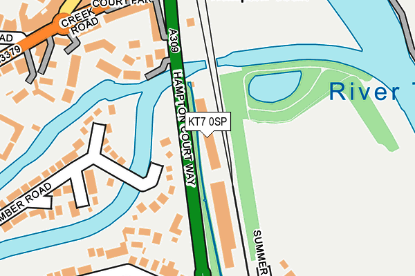
KT7 0SP is located in the Thames Ditton electoral ward, within the local authority district of Elmbridge and the English Parliamentary constituency of Esher and Walton. The Sub Integrated Care Board (ICB) Location is NHS Surrey Heartlands ICB - 92A and the police force is Surrey. This postcode has been in use since March 1988.


GetTheData
Source: OS OpenMap – Local (Ordnance Survey)
Source: OS VectorMap District (Ordnance Survey)
Licence: Open Government Licence (requires attribution)
| Easting | 515410 |
| Northing | 168074 |
| Latitude | 51.399967 |
| Longitude | -0.342331 |
GetTheData
Source: Open Postcode Geo
Licence: Open Government Licence
| Country | England |
| Postcode District | KT7 |
➜ See where KT7 is on a map | |
GetTheData
Source: Land Registry Price Paid Data
Licence: Open Government Licence
Elevation or altitude of KT7 0SP as distance above sea level:
| Metres | Feet | |
|---|---|---|
| Elevation | 10m | 33ft |
Elevation is measured from the approximate centre of the postcode, to the nearest point on an OS contour line from OS Terrain 50, which has contour spacing of ten vertical metres.
➜ How high above sea level am I? Find the elevation of your current position using your device's GPS.
GetTheData
Source: Open Postcode Elevation
Licence: Open Government Licence
| Ward | Thames Ditton |
| Constituency | Esher And Walton |
GetTheData
Source: ONS Postcode Database
Licence: Open Government Licence
| Summer Road (Hampton Court Way) | East Molesey | 159m |
| Bridge Road (Creek Road) | East Molesey | 265m |
| Bridge Road (Creek Road) | East Molesey | 280m |
| Summer Road (Hampton Court Way) | East Molesey | 282m |
| Hampton Court Railway Station (Off Hampton Court Way) | East Molesey | 313m |
| Hampton Court Station | 0.3km |
| Thames Ditton Station | 1.2km |
| Esher Station | 2.4km |
GetTheData
Source: NaPTAN
Licence: Open Government Licence
GetTheData
Source: ONS Postcode Database
Licence: Open Government Licence


➜ Get more ratings from the Food Standards Agency
GetTheData
Source: Food Standards Agency
Licence: FSA terms & conditions
| Last Collection | |||
|---|---|---|---|
| Location | Mon-Fri | Sat | Distance |
| Summer Road | 17:30 | 12:00 | 190m |
| Hampton Court Station | 17:45 | 12:15 | 250m |
| Bridge Road Post Office | 18:00 | 12:30 | 296m |
GetTheData
Source: Dracos
Licence: Creative Commons Attribution-ShareAlike
| Risk of KT7 0SP flooding from rivers and sea | Low |
| ➜ KT7 0SP flood map | |
GetTheData
Source: Open Flood Risk by Postcode
Licence: Open Government Licence
The below table lists the International Territorial Level (ITL) codes (formerly Nomenclature of Territorial Units for Statistics (NUTS) codes) and Local Administrative Units (LAU) codes for KT7 0SP:
| ITL 1 Code | Name |
|---|---|
| TLJ | South East (England) |
| ITL 2 Code | Name |
| TLJ2 | Surrey, East and West Sussex |
| ITL 3 Code | Name |
| TLJ25 | West Surrey |
| LAU 1 Code | Name |
| E07000207 | Elmbridge |
GetTheData
Source: ONS Postcode Directory
Licence: Open Government Licence
The below table lists the Census Output Area (OA), Lower Layer Super Output Area (LSOA), and Middle Layer Super Output Area (MSOA) for KT7 0SP:
| Code | Name | |
|---|---|---|
| OA | E00154819 | |
| LSOA | E01030351 | Elmbridge 005B |
| MSOA | E02006321 | Elmbridge 005 |
GetTheData
Source: ONS Postcode Directory
Licence: Open Government Licence
| KT8 9NF | Molember Road | 69m |
| KT8 9AA | Hampton Court Way | 122m |
| KT8 9AD | Hampton Court Way | 168m |
| KT8 9LZ | Gladstone Place | 182m |
| KT8 9FD | Queens Reach | 186m |
| KT8 9NJ | Molember Road | 213m |
| KT7 0QB | Summer Crossing | 220m |
| KT8 9DE | Queens Reach | 229m |
| KT8 9HE | Hampton Court Parade | 242m |
| KT8 9HJ | Oarsman Place | 267m |
GetTheData
Source: Open Postcode Geo; Land Registry Price Paid Data
Licence: Open Government Licence