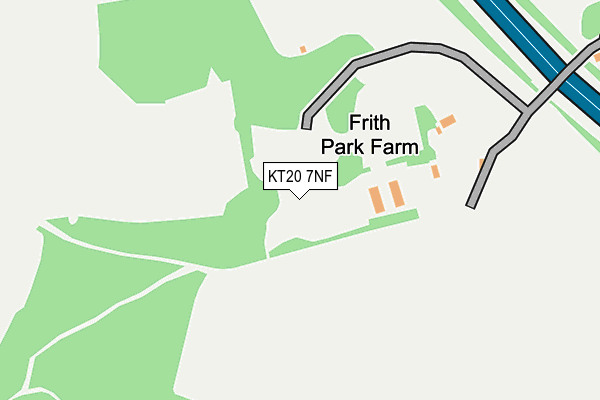
KT20 7NF is located in the Lower Kingswood, Tadworth & Walton electoral ward, within the local authority district of Reigate and Banstead and the English Parliamentary constituency of Reigate. The Sub Integrated Care Board (ICB) Location is NHS Surrey Heartlands ICB - 92A and the police force is Surrey. This postcode has been in use since January 1980.


GetTheData
Source: OS OpenMap – Local (Ordnance Survey)
Source: OS VectorMap District (Ordnance Survey)
Licence: Open Government Licence (requires attribution)
| Easting | 521581 |
| Northing | 153754 |
| Latitude | 51.269976 |
| Longitude | -0.258545 |
GetTheData
Source: Open Postcode Geo
Licence: Open Government Licence
| Country | England |
| Postcode District | KT20 |
| ➜ KT20 open data dashboard ➜ See where KT20 is on a map | |
GetTheData
Source: Land Registry Price Paid Data
Licence: Open Government Licence
Elevation or altitude of KT20 7NF as distance above sea level:
| Metres | Feet | |
|---|---|---|
| Elevation | 170m | 558ft |
Elevation is measured from the approximate centre of the postcode, to the nearest point on an OS contour line from OS Terrain 50, which has contour spacing of ten vertical metres.
➜ How high above sea level am I? Find the elevation of your current position using your device's GPS.
GetTheData
Source: Open Postcode Elevation
Licence: Open Government Licence
| Ward | Lower Kingswood, Tadworth & Walton |
| Constituency | Reigate |
GetTheData
Source: ONS Postcode Database
Licence: Open Government Licence
| June 2022 | Violence and sexual offences | On or near Hospital | 498m |
| June 2022 | Anti-social behaviour | On or near Hospital | 498m |
| June 2022 | Violence and sexual offences | On or near Hospital | 498m |
| ➜ Get more crime data in our Crime section | |||
GetTheData
Source: data.police.uk
Licence: Open Government Licence
| Pebble Close (Headley Common Road) | Pebblecombe | 754m |
| Pebble Close (Headley Common Road) | Pebblecombe | 784m |
| Headley Common Road | Pebblecombe | 938m |
| Headley Common Road | Pebblecombe | 963m |
| Headley Grove Farm (Headley Common Road) | Headley | 1,026m |
| Betchworth Station | 2.5km |
| Tadworth Station | 2.9km |
| Kingswood Station | 4.3km |
GetTheData
Source: NaPTAN
Licence: Open Government Licence
GetTheData
Source: ONS Postcode Database
Licence: Open Government Licence


➜ Get more ratings from the Food Standards Agency
GetTheData
Source: Food Standards Agency
Licence: FSA terms & conditions
| Last Collection | |||
|---|---|---|---|
| Location | Mon-Fri | Sat | Distance |
| Beechen Lane | 17:15 | 11:45 | 813m |
| Warners Corner | 17:30 | 11:45 | 1,373m |
| Tothill | 16:45 | 12:00 | 1,424m |
GetTheData
Source: Dracos
Licence: Creative Commons Attribution-ShareAlike
| Facility | Distance |
|---|---|
| Walton Heath Sports Club Recreation Ground Dorking Road, Walton On The Hill, Tadworth Grass Pitches | 1km |
| Howard Close Recreation Ground Howard Close, Walton On The Hill, Tadworth Grass Pitches | 1km |
| Breech Lane Playing Field Breech Lane, Walton On The Hill Grass Pitches | 1.2km |
GetTheData
Source: Active Places
Licence: Open Government Licence
| School | Phase of Education | Distance |
|---|---|---|
| Papillon House Pebble Close, Tadworth, KT20 7PA | Not applicable | 893m |
| Bramley Hill School Chequers Lane, Walton on the Hill, Tadworth, KT20 7ST | Not applicable | 1.3km |
| Walton-on-the-Hill Primary School Walton Street, Walton-on-the-Hill, Tadworth, KT20 7RR | Primary | 1.8km |
GetTheData
Source: Edubase
Licence: Open Government Licence
The below table lists the International Territorial Level (ITL) codes (formerly Nomenclature of Territorial Units for Statistics (NUTS) codes) and Local Administrative Units (LAU) codes for KT20 7NF:
| ITL 1 Code | Name |
|---|---|
| TLJ | South East (England) |
| ITL 2 Code | Name |
| TLJ2 | Surrey, East and West Sussex |
| ITL 3 Code | Name |
| TLJ26 | East Surrey |
| LAU 1 Code | Name |
| E07000211 | Reigate and Banstead |
GetTheData
Source: ONS Postcode Directory
Licence: Open Government Licence
The below table lists the Census Output Area (OA), Lower Layer Super Output Area (LSOA), and Middle Layer Super Output Area (MSOA) for KT20 7NF:
| Code | Name | |
|---|---|---|
| OA | E00156242 | |
| LSOA | E01030639 | Reigate and Banstead 006E |
| MSOA | E02006380 | Reigate and Banstead 006 |
GetTheData
Source: ONS Postcode Directory
Licence: Open Government Licence
| KT20 7RQ | Sturts Lane | 327m |
| KT20 7NJ | Dorking Road | 391m |
| KT20 7RG | Chequers Lane | 537m |
| KT20 7NY | Dorking Road | 635m |
| KT20 7RD | Chequers Lane | 658m |
| KT20 7RB | Chequers Lane | 705m |
| KT20 7QR | Nyefield Park | 731m |
| KT18 6NE | Headley Common Road | 767m |
| KT20 7NX | Buckland Lane | 769m |
| KT18 6NT | Headley Common Road | 815m |
GetTheData
Source: Open Postcode Geo; Land Registry Price Paid Data
Licence: Open Government Licence