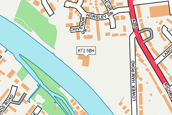
KT2 5BH is located in the Tudor electoral ward, within the London borough of Kingston upon Thames and the English Parliamentary constituency of Richmond Park. The Sub Integrated Care Board (ICB) Location is NHS South West London ICB - 36L and the police force is Metropolitan Police. This postcode has been in use since June 1996.


GetTheData
Source: OS OpenMap – Local (Ordnance Survey)
Source: OS VectorMap District (Ordnance Survey)
Licence: Open Government Licence (requires attribution)
| Easting | 517644 |
| Northing | 171120 |
| Latitude | 51.426885 |
| Longitude | -0.309221 |
GetTheData
Source: Open Postcode Geo
Licence: Open Government Licence
| Country | England |
| Postcode District | KT2 |
| ➜ KT2 open data dashboard ➜ See where KT2 is on a map ➜ Where is Kingston upon Thames? | |
GetTheData
Source: Land Registry Price Paid Data
Licence: Open Government Licence
Elevation or altitude of KT2 5BH as distance above sea level:
| Metres | Feet | |
|---|---|---|
| Elevation | 10m | 33ft |
Elevation is measured from the approximate centre of the postcode, to the nearest point on an OS contour line from OS Terrain 50, which has contour spacing of ten vertical metres.
➜ How high above sea level am I? Find the elevation of your current position using your device's GPS.
GetTheData
Source: Open Postcode Elevation
Licence: Open Government Licence
| Ward | Tudor |
| Constituency | Richmond Park |
GetTheData
Source: ONS Postcode Database
Licence: Open Government Licence
| November 2023 | Violence and sexual offences | On or near Chivenor Grove | 116m |
| November 2023 | Other theft | On or near Bucklands Road | 352m |
| November 2023 | Public order | On or near Bucklands Road | 352m |
| ➜ Get more crime data in our Crime section | |||
GetTheData
Source: data.police.uk
Licence: Open Government Licence
| Tiffin School For Girls (Richmond Road) | Ham | 265m |
| Tudor Drive (Richmond Road) | Ham | 274m |
| Tudor Drive (Richmond Road) | Ham | 344m |
| Tiffin School For Girls (Richmond Road) | Ham | 390m |
| Richmond Road Dukes Avenue (Dukes Avenue) | Ham | 407m |
| Hampton Wick Station | 1.4km |
| Teddington Station | 1.7km |
| Kingston Station | 1.7km |
GetTheData
Source: NaPTAN
Licence: Open Government Licence
GetTheData
Source: ONS Postcode Database
Licence: Open Government Licence


➜ Get more ratings from the Food Standards Agency
GetTheData
Source: Food Standards Agency
Licence: FSA terms & conditions
| Last Collection | |||
|---|---|---|---|
| Location | Mon-Fri | Sat | Distance |
| Northweald Lane | 17:30 | 12:00 | 304m |
| Half Mile | 17:30 | 12:00 | 306m |
| Fernhill Gardens | 17:30 | 12:00 | 327m |
GetTheData
Source: Dracos
Licence: Creative Commons Attribution-ShareAlike
| Facility | Distance |
|---|---|
| Ymca (Hawker) Lower Ham Road, Kingston Upon Thames Health and Fitness Gym, Grass Pitches, Studio, Outdoor Tennis Courts | 4m |
| Teddington Sports Centre Broom Road, Teddington Sports Hall, Artificial Grass Pitch, Squash Courts, Studio, Outdoor Tennis Courts | 404m |
| The Tiffin Girls' School Richmond Road, Kingston Upon Thames Sports Hall, Artificial Grass Pitch, Health and Fitness Gym, Outdoor Tennis Courts | 462m |
GetTheData
Source: Active Places
Licence: Open Government Licence
| School | Phase of Education | Distance |
|---|---|---|
| The Tiffin Girls' School Richmond Road, Kingston upon Thames, KT2 5PL | Secondary | 465m |
| Teddington School Broom Road, Teddington, TW11 9PJ | Secondary | 514m |
| Malden Oaks School and Tuition Service The Dukes Centre, Dukes Avenue, Kingston upon Thames, KT2 5QY | Not applicable | 550m |
GetTheData
Source: Edubase
Licence: Open Government Licence
The below table lists the International Territorial Level (ITL) codes (formerly Nomenclature of Territorial Units for Statistics (NUTS) codes) and Local Administrative Units (LAU) codes for KT2 5BH:
| ITL 1 Code | Name |
|---|---|
| TLI | London |
| ITL 2 Code | Name |
| TLI6 | Outer London - South |
| ITL 3 Code | Name |
| TLI63 | Merton, Kingston upon Thames and Sutton |
| LAU 1 Code | Name |
| E09000021 | Kingston upon Thames |
GetTheData
Source: ONS Postcode Directory
Licence: Open Government Licence
The below table lists the Census Output Area (OA), Lower Layer Super Output Area (LSOA), and Middle Layer Super Output Area (MSOA) for KT2 5BH:
| Code | Name | |
|---|---|---|
| OA | E00015144 | |
| LSOA | E01003006 | Kingston upon Thames 001A |
| MSOA | E02000598 | Kingston upon Thames 001 |
GetTheData
Source: ONS Postcode Directory
Licence: Open Government Licence
| KT2 5GE | Chivenor Grove | 99m |
| KT2 5GA | Wittering Close | 151m |
| KT2 5GQ | Horsley Drive | 157m |
| KT2 5GG | Horsley Drive | 182m |
| KT2 5PT | Richmond Road | 223m |
| KT2 5PR | Richmond Road | 226m |
| KT2 5GF | Manston Grove | 227m |
| TW11 9QQ | Sycamore Way | 228m |
| TW11 9QZ | Trowlock Island | 235m |
| KT2 5GD | Debden Close | 247m |
GetTheData
Source: Open Postcode Geo; Land Registry Price Paid Data
Licence: Open Government Licence