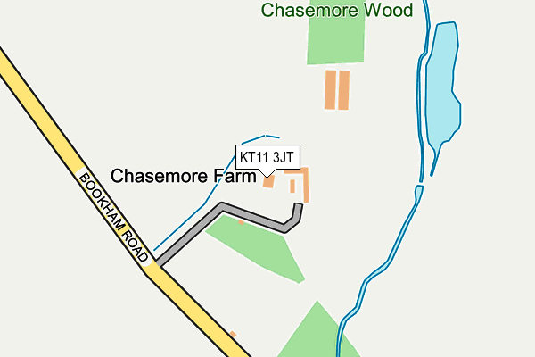
KT11 3JT is located in the Cobham and Downside electoral ward, within the local authority district of Elmbridge and the English Parliamentary constituency of Esher and Walton. The Sub Integrated Care Board (ICB) Location is NHS Surrey Heartlands ICB - 92A and the police force is Surrey. This postcode has been in use since January 1980.


GetTheData
Source: OS OpenMap – Local (Ordnance Survey)
Source: OS VectorMap District (Ordnance Survey)
Licence: Open Government Licence (requires attribution)
| Easting | 511974 |
| Northing | 157049 |
| Latitude | 51.301561 |
| Longitude | -0.395190 |
GetTheData
Source: Open Postcode Geo
Licence: Open Government Licence
| Country | England |
| Postcode District | KT11 |
| ➜ KT11 open data dashboard ➜ See where KT11 is on a map | |
GetTheData
Source: Land Registry Price Paid Data
Licence: Open Government Licence
Elevation or altitude of KT11 3JT as distance above sea level:
| Metres | Feet | |
|---|---|---|
| Elevation | 30m | 98ft |
Elevation is measured from the approximate centre of the postcode, to the nearest point on an OS contour line from OS Terrain 50, which has contour spacing of ten vertical metres.
➜ How high above sea level am I? Find the elevation of your current position using your device's GPS.
GetTheData
Source: Open Postcode Elevation
Licence: Open Government Licence
| Ward | Cobham And Downside |
| Constituency | Esher And Walton |
GetTheData
Source: ONS Postcode Database
Licence: Open Government Licence
| Middleton Road (Downside Common Road) | Downside | 1,337m |
| Bookham Railway Station (Bookham Station) | Little Bookham | 1,639m |
| Bookham Railway Station (Church Road) | Little Bookham | 1,683m |
| Bookham Station | 1.6km |
| Cobham & Stoke d'Abernon Station | 1.9km |
| Effingham Junction Station | 2.1km |
GetTheData
Source: NaPTAN
Licence: Open Government Licence
GetTheData
Source: ONS Postcode Database
Licence: Open Government Licence


➜ Get more ratings from the Food Standards Agency
GetTheData
Source: Food Standards Agency
Licence: FSA terms & conditions
| Last Collection | |||
|---|---|---|---|
| Location | Mon-Fri | Sat | Distance |
| Downside Common | 16:00 | 09:00 | 1,423m |
| Slyfield | 17:30 | 07:30 | 1,533m |
| Bookham Industrial Estate | 1,644m | ||
GetTheData
Source: Dracos
Licence: Creative Commons Attribution-ShareAlike
| Facility | Distance |
|---|---|
| Yehudi Menuhin School Cobham Road, Stoke D'abernon, Cobham Grass Pitches, Outdoor Tennis Courts, Swimming Pool | 1.3km |
| Chelsea Fc (Cobham Training Centre) Stoke Road, Stoke D'abernon, Cobham Grass Pitches, Artificial Grass Pitch | 1.5km |
| Stoke D'abernon Recreation Ground Stoke Road, Stoke D'abernon, Cobham Grass Pitches | 2.2km |
GetTheData
Source: Active Places
Licence: Open Government Licence
| School | Phase of Education | Distance |
|---|---|---|
| The Yehudi Menuhin School Stoke D'Abernon, Cobham, Surrey, Cobham, KT11 3QQ | Not applicable | 1.4km |
| St Matthew's CofE Aided Infant School, Cobham Downside, Cobham, KT11 3NA | Primary | 1.6km |
| Parkside School The Manor, Stoke D'abernon, Cobham, KT11 3PX | Not applicable | 1.7km |
GetTheData
Source: Edubase
Licence: Open Government Licence
The below table lists the International Territorial Level (ITL) codes (formerly Nomenclature of Territorial Units for Statistics (NUTS) codes) and Local Administrative Units (LAU) codes for KT11 3JT:
| ITL 1 Code | Name |
|---|---|
| TLJ | South East (England) |
| ITL 2 Code | Name |
| TLJ2 | Surrey, East and West Sussex |
| ITL 3 Code | Name |
| TLJ25 | West Surrey |
| LAU 1 Code | Name |
| E07000207 | Elmbridge |
GetTheData
Source: ONS Postcode Directory
Licence: Open Government Licence
The below table lists the Census Output Area (OA), Lower Layer Super Output Area (LSOA), and Middle Layer Super Output Area (MSOA) for KT11 3JT:
| Code | Name | |
|---|---|---|
| OA | E00154561 | |
| LSOA | E01030302 | Elmbridge 017C |
| MSOA | E02006333 | Elmbridge 017 |
GetTheData
Source: ONS Postcode Directory
Licence: Open Government Licence
| KT11 3JU | Bookham Road | 441m |
| KT23 3HY | Little Bookham Common | 671m |
| KT23 3HX | Little Bookham Common | 905m |
| KT11 3QJ | Cobham Road | 946m |
| KT23 3HZ | The Common | 955m |
| KT23 3HU | Little Bookham Common | 1239m |
| KT11 3QG | Cobham Road | 1251m |
| KT11 3QL | Cobham Road | 1265m |
| KT11 3NR | Middleton Road | 1298m |
| KT11 3NF | Alma Cottages | 1363m |
GetTheData
Source: Open Postcode Geo; Land Registry Price Paid Data
Licence: Open Government Licence