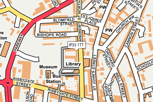
IP33 1TT is located in the Abbeygate electoral ward, within the local authority district of West Suffolk and the English Parliamentary constituency of Bury St Edmunds. The Sub Integrated Care Board (ICB) Location is NHS Suffolk and North East Essex ICB - 07K and the police force is Suffolk. This postcode has been in use since December 1995.


GetTheData
Source: OS OpenMap – Local (Ordnance Survey)
Source: OS VectorMap District (Ordnance Survey)
Licence: Open Government Licence (requires attribution)
| Easting | 585160 |
| Northing | 264595 |
| Latitude | 52.248392 |
| Longitude | 0.710956 |
GetTheData
Source: Open Postcode Geo
Licence: Open Government Licence
| Country | England |
| Postcode District | IP33 |
| ➜ IP33 open data dashboard ➜ See where IP33 is on a map ➜ Where is Bury St Edmunds? | |
GetTheData
Source: Land Registry Price Paid Data
Licence: Open Government Licence
Elevation or altitude of IP33 1TT as distance above sea level:
| Metres | Feet | |
|---|---|---|
| Elevation | 40m | 131ft |
Elevation is measured from the approximate centre of the postcode, to the nearest point on an OS contour line from OS Terrain 50, which has contour spacing of ten vertical metres.
➜ How high above sea level am I? Find the elevation of your current position using your device's GPS.
GetTheData
Source: Open Postcode Elevation
Licence: Open Government Licence
| Ward | Abbeygate |
| Constituency | Bury St Edmunds |
GetTheData
Source: ONS Postcode Database
Licence: Open Government Licence
| January 2024 | Anti-social behaviour | On or near Bus/Coach Station | 57m |
| January 2024 | Public order | On or near Bus/Coach Station | 57m |
| January 2024 | Anti-social behaviour | On or near Cannon Street | 266m |
| ➜ Get more crime data in our Crime section | |||
GetTheData
Source: data.police.uk
Licence: Open Government Licence
| Arc Shopping Centre | Bury St Edmunds | 281m |
| Arc Shopping Centre (St Andrews Street) | Bury St Edmunds | 308m |
| Schoolhall Lane (Northgate Street) | Bury St Edmunds | 377m |
| Schoolhall Lane (Northgate Street) | Bury St Edmunds | 388m |
| Springfield Road | Bury St Edmunds | 396m |
| Bury St Edmunds Station | 0.6km |
GetTheData
Source: NaPTAN
Licence: Open Government Licence
GetTheData
Source: ONS Postcode Database
Licence: Open Government Licence


➜ Get more ratings from the Food Standards Agency
GetTheData
Source: Food Standards Agency
Licence: FSA terms & conditions
| Last Collection | |||
|---|---|---|---|
| Location | Mon-Fri | Sat | Distance |
| St Andrews Street North | 17:30 | 139m | |
| 28 St. Johns Street | 17:30 | 11:30 | 154m |
| Market Cross | 18:00 | 12:30 | 287m |
GetTheData
Source: Dracos
Licence: Creative Commons Attribution-ShareAlike
| Facility | Distance |
|---|---|
| Fitness First Health Club (Bury St Edmunds) (Closed) Station Hill, Bury St. Edmunds Studio, Health and Fitness Gym | 383m |
| The Gym Group (Bury St Edmunds) Robert Boby Way, Bury St Edmunds Health and Fitness Gym | 515m |
| Abbey Gardens Angel Hill, Bury St Edmunds Outdoor Tennis Courts | 602m |
GetTheData
Source: Active Places
Licence: Open Government Licence
| School | Phase of Education | Distance |
|---|---|---|
| King Edward VI CEVC School Grove Road, Bury St Edmunds, IP33 3BH | Secondary | 542m |
| St Edmundsbury Church of England Voluntary Aided Primary School Grove Road, Bury St Edmunds, IP33 3BJ | Primary | 554m |
| West Suffolk College Out Risbygate, Bury St Edmunds, IP33 3RL | 16 plus | 738m |
GetTheData
Source: Edubase
Licence: Open Government Licence
The below table lists the International Territorial Level (ITL) codes (formerly Nomenclature of Territorial Units for Statistics (NUTS) codes) and Local Administrative Units (LAU) codes for IP33 1TT:
| ITL 1 Code | Name |
|---|---|
| TLH | East |
| ITL 2 Code | Name |
| TLH1 | East Anglia |
| ITL 3 Code | Name |
| TLH14 | Suffolk CC |
| LAU 1 Code | Name |
| E07000245 | West Suffolk |
GetTheData
Source: ONS Postcode Directory
Licence: Open Government Licence
The below table lists the Census Output Area (OA), Lower Layer Super Output Area (LSOA), and Middle Layer Super Output Area (MSOA) for IP33 1TT:
| Code | Name | |
|---|---|---|
| OA | E00153635 | |
| LSOA | E01033046 | St Edmundsbury 006F |
| MSOA | E02006278 | St Edmundsbury 006 |
GetTheData
Source: ONS Postcode Directory
Licence: Open Government Licence
| IP33 1TP | Sergeants Walk | 70m |
| IP33 1TZ | St Andrews Street North | 82m |
| IP33 1SJ | St Johns Street | 85m |
| IP33 1TQ | Bishops Road | 97m |
| IP33 1SN | St Johns Street | 100m |
| IP33 1TF | All Saints Court | 103m |
| IP33 1TH | St Andrews Street North | 105m |
| IP33 1EH | Orchard Street | 124m |
| IP33 3EY | Raes Yard | 129m |
| IP33 1SQ | St Johns Street | 142m |
GetTheData
Source: Open Postcode Geo; Land Registry Price Paid Data
Licence: Open Government Licence