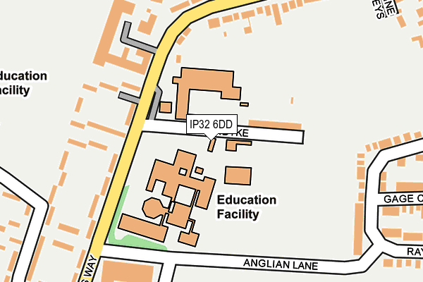
IP32 6DD is located in the Tollgate electoral ward, within the local authority district of West Suffolk and the English Parliamentary constituency of Bury St Edmunds. The Sub Integrated Care Board (ICB) Location is NHS Suffolk and North East Essex ICB - 07K and the police force is Suffolk. This postcode has been in use since January 1992.


GetTheData
Source: OS OpenMap – Local (Ordnance Survey)
Source: OS VectorMap District (Ordnance Survey)
Licence: Open Government Licence (requires attribution)
| Easting | 584557 |
| Northing | 265550 |
| Latitude | 52.257154 |
| Longitude | 0.702626 |
GetTheData
Source: Open Postcode Geo
Licence: Open Government Licence
| Country | England |
| Postcode District | IP32 |
| ➜ IP32 open data dashboard ➜ See where IP32 is on a map ➜ Where is Bury St Edmunds? | |
GetTheData
Source: Land Registry Price Paid Data
Licence: Open Government Licence
Elevation or altitude of IP32 6DD as distance above sea level:
| Metres | Feet | |
|---|---|---|
| Elevation | 40m | 131ft |
Elevation is measured from the approximate centre of the postcode, to the nearest point on an OS contour line from OS Terrain 50, which has contour spacing of ten vertical metres.
➜ How high above sea level am I? Find the elevation of your current position using your device's GPS.
GetTheData
Source: Open Postcode Elevation
Licence: Open Government Licence
| Ward | Tollgate |
| Constituency | Bury St Edmunds |
GetTheData
Source: ONS Postcode Database
Licence: Open Government Licence
| June 2022 | Other theft | On or near Beetons Way | 129m |
| June 2022 | Other theft | On or near Beetons Way | 211m |
| June 2022 | Vehicle crime | On or near Northumberland Avenue | 264m |
| ➜ Get more crime data in our Crime section | |||
GetTheData
Source: data.police.uk
Licence: Open Government Licence
| St Benedicts Catholic School (Klondike) | Bury St Edmunds | 91m |
| The Greengage | Bury St Edmunds | 190m |
| Lancaster Avenue (Northumberland Avenue) | Howard Estate | 282m |
| Lancaster Avenue (Northumberland Avenue) | Howard Estate | 292m |
| Resource Centre (Oakes Road) | Howard Estate | 313m |
| Bury St Edmunds Station | 0.8km |
GetTheData
Source: NaPTAN
Licence: Open Government Licence
GetTheData
Source: ONS Postcode Database
Licence: Open Government Licence


➜ Get more ratings from the Food Standards Agency
GetTheData
Source: Food Standards Agency
Licence: FSA terms & conditions
| Last Collection | |||
|---|---|---|---|
| Location | Mon-Fri | Sat | Distance |
| 26 Northgate Avenue | 17:00 | 11:30 | 435m |
| Post Office, St. Olaves Prcnt | 17:00 | 11:30 | 517m |
| Post Office, Sth Pde, Lake Ave | 17:00 | 11:30 | 712m |
GetTheData
Source: Dracos
Licence: Creative Commons Attribution-ShareAlike
| Facility | Distance |
|---|---|
| County Upper School Beetons Way, Bury St. Edmunds Sports Hall, Health and Fitness Gym, Grass Pitches, Artificial Grass Pitch, Outdoor Tennis Courts | 65m |
| St Benedict's Catholic School Beetons Way, Bury St. Edmunds Health and Fitness Gym, Grass Pitches, Sports Hall, Artificial Grass Pitch | 86m |
| Howard Park Northumberland Avenue, Bury St Edmunds Grass Pitches | 333m |
GetTheData
Source: Active Places
Licence: Open Government Licence
| School | Phase of Education | Distance |
|---|---|---|
| Bury St Edmunds County High School Beetons Way, Bury St Edmunds, IP32 6RF | Secondary | 65m |
| St Benedict's Catholic School Beetons Way, Bury St Edmunds, IP32 6RH | Secondary | 127m |
| Tollgate Primary School Tollgate Lane, Bury St Edmunds, IP32 6DG | Primary | 350m |
GetTheData
Source: Edubase
Licence: Open Government Licence
The below table lists the International Territorial Level (ITL) codes (formerly Nomenclature of Territorial Units for Statistics (NUTS) codes) and Local Administrative Units (LAU) codes for IP32 6DD:
| ITL 1 Code | Name |
|---|---|
| TLH | East |
| ITL 2 Code | Name |
| TLH1 | East Anglia |
| ITL 3 Code | Name |
| TLH14 | Suffolk CC |
| LAU 1 Code | Name |
| E07000245 | West Suffolk |
GetTheData
Source: ONS Postcode Directory
Licence: Open Government Licence
The below table lists the Census Output Area (OA), Lower Layer Super Output Area (LSOA), and Middle Layer Super Output Area (MSOA) for IP32 6DD:
| Code | Name | |
|---|---|---|
| OA | E00153642 | |
| LSOA | E01030137 | St Edmundsbury 006D |
| MSOA | E02006278 | St Edmundsbury 006 |
GetTheData
Source: ONS Postcode Directory
Licence: Open Government Licence
| IP32 6DB | Klondyke | 87m |
| IP32 6RQ | Beetons Way | 122m |
| IP32 6RG | Leech Walk | 172m |
| IP32 6RE | Beetons Way | 182m |
| IP32 6RJ | Eagle Walk | 196m |
| IP32 6DE | Tollgate Lane | 215m |
| IP32 6DF | Tollgate Lane | 225m |
| IP32 6LR | Northumberland Avenue | 237m |
| IP32 6RD | Le Grice Walk | 240m |
| IP32 6ED | Raynham Road | 270m |
GetTheData
Source: Open Postcode Geo; Land Registry Price Paid Data
Licence: Open Government Licence