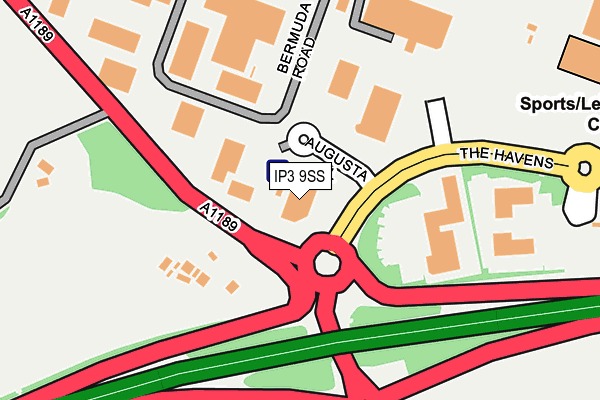
IP3 9SS is located in the Priory Heath electoral ward, within the local authority district of Ipswich and the English Parliamentary constituency of Ipswich. The Sub Integrated Care Board (ICB) Location is NHS Suffolk and North East Essex ICB - 06L and the police force is Suffolk. This postcode has been in use since June 1998.


GetTheData
Source: OS OpenMap – Local (Ordnance Survey)
Source: OS VectorMap District (Ordnance Survey)
Licence: Open Government Licence (requires attribution)
| Easting | 620139 |
| Northing | 241324 |
| Latitude | 52.026621 |
| Longitude | 1.207464 |
GetTheData
Source: Open Postcode Geo
Licence: Open Government Licence
| Country | England |
| Postcode District | IP3 |
| ➜ IP3 open data dashboard ➜ See where IP3 is on a map ➜ Where is Ipswich? | |
GetTheData
Source: Land Registry Price Paid Data
Licence: Open Government Licence
Elevation or altitude of IP3 9SS as distance above sea level:
| Metres | Feet | |
|---|---|---|
| Elevation | 40m | 131ft |
Elevation is measured from the approximate centre of the postcode, to the nearest point on an OS contour line from OS Terrain 50, which has contour spacing of ten vertical metres.
➜ How high above sea level am I? Find the elevation of your current position using your device's GPS.
GetTheData
Source: Open Postcode Elevation
Licence: Open Government Licence
| Ward | Priory Heath |
| Constituency | Ipswich |
GetTheData
Source: ONS Postcode Database
Licence: Open Government Licence
| June 2022 | Public order | On or near Nacton Road | 202m |
| June 2022 | Violence and sexual offences | On or near The Havens | 474m |
| June 2022 | Public order | On or near The Havens | 474m |
| ➜ Get more crime data in our Crime section | |||
GetTheData
Source: data.police.uk
Licence: Open Government Licence
| Courtyard Hotel (The Havens) | Ransomes Europark | 129m |
| Orwell Country Park (Nacton Road) | Ransomes Europark | 237m |
| Courtyard Hotel (The Havens) | Ransomes Europark | 241m |
| Foxtail Road | Ransomes Europark | 334m |
| Foxtail Road (Bluestem Road) | Ransomes Europark | 358m |
| Derby Road (Ipswich) Station | 3.2km |
| Ipswich Station | 5.1km |
GetTheData
Source: NaPTAN
Licence: Open Government Licence
GetTheData
Source: ONS Postcode Database
Licence: Open Government Licence


➜ Get more ratings from the Food Standards Agency
GetTheData
Source: Food Standards Agency
Licence: FSA terms & conditions
| Last Collection | |||
|---|---|---|---|
| Location | Mon-Fri | Sat | Distance |
| Bluestem Road | 18:30 | 12:30 | 480m |
| Ip3 Bluestem Road Business Box | 18:30 | 483m | |
| Reynolds Road Post Office | 17:30 | 12:15 | 488m |
GetTheData
Source: Dracos
Licence: Creative Commons Attribution-ShareAlike
| Facility | Distance |
|---|---|
| David Lloyd (Ipswich) The Havens, Ransomes Europark, Ipswich Sports Hall, Swimming Pool, Health and Fitness Gym, Indoor Tennis Centre, Studio, Squash Courts, Outdoor Tennis Courts | 397m |
| Ravenswood Community Primary School Ravenswood Avenue, Ipswich Grass Pitches | 939m |
| Alstons Sports Ground (Closed) Leslie Road, Ipswich Grass Pitches | 1.1km |
GetTheData
Source: Active Places
Licence: Open Government Licence
| School | Phase of Education | Distance |
|---|---|---|
| Ravenswood Community Primary School Ravenswood Avenue, Ipswich, IP3 9UA | Primary | 928m |
| New Skill Centre Wolsey House, 2-5 The Drift, Nacton Road, Ipswich, IP3 9QR | Not applicable | 1.1km |
| Ipswich Academy Braziers Wood Road, Ipswich, IP3 0SP | Secondary | 1.5km |
GetTheData
Source: Edubase
Licence: Open Government Licence
The below table lists the International Territorial Level (ITL) codes (formerly Nomenclature of Territorial Units for Statistics (NUTS) codes) and Local Administrative Units (LAU) codes for IP3 9SS:
| ITL 1 Code | Name |
|---|---|
| TLH | East |
| ITL 2 Code | Name |
| TLH1 | East Anglia |
| ITL 3 Code | Name |
| TLH14 | Suffolk CC |
| LAU 1 Code | Name |
| E07000202 | Ipswich |
GetTheData
Source: ONS Postcode Directory
Licence: Open Government Licence
The below table lists the Census Output Area (OA), Lower Layer Super Output Area (LSOA), and Middle Layer Super Output Area (MSOA) for IP3 9SS:
| Code | Name | |
|---|---|---|
| OA | E00170860 | |
| LSOA | E01033127 | Ipswich 014E |
| MSOA | E02006258 | Ipswich 014 |
GetTheData
Source: ONS Postcode Directory
Licence: Open Government Licence
| IP3 9RU | Bermuda Road | 181m |
| IP3 9RR | Bluestem Road | 423m |
| IP3 9SJ | The Havens | 471m |
| IP3 9GE | Havergate Road | 548m |
| IP3 9GL | Nene Drive | 556m |
| IP3 9GF | Minsmere Road | 583m |
| IP3 9GA | Breydon Way | 609m |
| IP3 9GH | Mansbrook Boulevard | 616m |
| IP3 9GB | Titchwell Drive | 625m |
| IP3 9GJ | Mansbrook Boulevard | 626m |
GetTheData
Source: Open Postcode Geo; Land Registry Price Paid Data
Licence: Open Government Licence