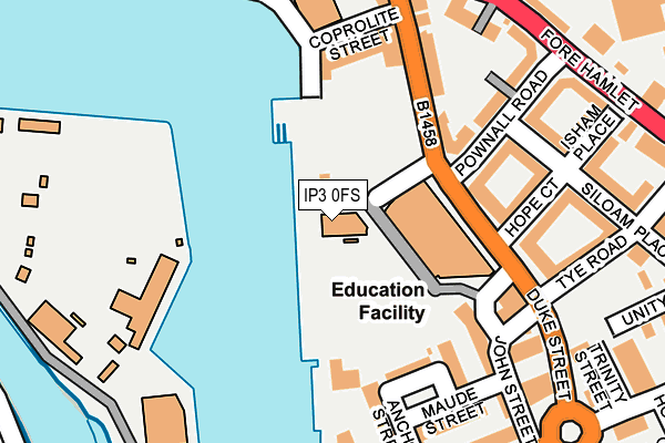
IP3 0FS is located in the Holywells electoral ward, within the local authority district of Ipswich and the English Parliamentary constituency of Ipswich. The Sub Integrated Care Board (ICB) Location is NHS Suffolk and North East Essex ICB - 06L and the police force is Suffolk. This postcode has been in use since March 2011.


GetTheData
Source: OS OpenMap – Local (Ordnance Survey)
Source: OS VectorMap District (Ordnance Survey)
Licence: Open Government Licence (requires attribution)
| Easting | 617016 |
| Northing | 243844 |
| Latitude | 52.050472 |
| Longitude | 1.163615 |
GetTheData
Source: Open Postcode Geo
Licence: Open Government Licence
| Country | England |
| Postcode District | IP3 |
➜ See where IP3 is on a map | |
GetTheData
Source: Land Registry Price Paid Data
Licence: Open Government Licence
Elevation or altitude of IP3 0FS as distance above sea level:
| Metres | Feet | |
|---|---|---|
| Elevation | 10m | 33ft |
Elevation is measured from the approximate centre of the postcode, to the nearest point on an OS contour line from OS Terrain 50, which has contour spacing of ten vertical metres.
➜ How high above sea level am I? Find the elevation of your current position using your device's GPS.
GetTheData
Source: Open Postcode Elevation
Licence: Open Government Licence
| Ward | Holywells |
| Constituency | Ipswich |
GetTheData
Source: ONS Postcode Database
Licence: Open Government Licence
| Coprolite Street (Duke Street) | Rose Hill | 158m |
| Coprolite Street (Duke Street) | Rose Hill | 179m |
| Holy Trinity Church (Fore Hamlet) | Rose Hill | 244m |
| Holy Trinity Church (Fore Hamlet) | Rose Hill | 255m |
| John Street (Duke Street) | Holywells Park | 264m |
| Derby Road (Ipswich) Station | 1.3km |
| Ipswich Station | 1.3km |
| Westerfield Station | 3.4km |
GetTheData
Source: NaPTAN
Licence: Open Government Licence
GetTheData
Source: ONS Postcode Database
Licence: Open Government Licence


➜ Get more ratings from the Food Standards Agency
GetTheData
Source: Food Standards Agency
Licence: FSA terms & conditions
| Last Collection | |||
|---|---|---|---|
| Location | Mon-Fri | Sat | Distance |
| Bishops Hill | 17:30 | 12:25 | 179m |
| Duke Street | 17:30 | 11:30 | 191m |
| Foxhall Road | 17:15 | 12:15 | 318m |
GetTheData
Source: Dracos
Licence: Creative Commons Attribution-ShareAlike
| Risk of IP3 0FS flooding from rivers and sea | Low |
| ➜ IP3 0FS flood map | |
GetTheData
Source: Open Flood Risk by Postcode
Licence: Open Government Licence
The below table lists the International Territorial Level (ITL) codes (formerly Nomenclature of Territorial Units for Statistics (NUTS) codes) and Local Administrative Units (LAU) codes for IP3 0FS:
| ITL 1 Code | Name |
|---|---|
| TLH | East |
| ITL 2 Code | Name |
| TLH1 | East Anglia |
| ITL 3 Code | Name |
| TLH14 | Suffolk CC |
| LAU 1 Code | Name |
| E07000202 | Ipswich |
GetTheData
Source: ONS Postcode Directory
Licence: Open Government Licence
The below table lists the Census Output Area (OA), Lower Layer Super Output Area (LSOA), and Middle Layer Super Output Area (MSOA) for IP3 0FS:
| Code | Name | |
|---|---|---|
| OA | E00170874 | |
| LSOA | E01033126 | Ipswich 011F |
| MSOA | E02006255 | Ipswich 011 |
GetTheData
Source: ONS Postcode Directory
Licence: Open Government Licence
| IP3 0BH | Duke Street | 124m |
| IP3 0DN | Pownall Road | 127m |
| IP3 0BW | Anchor Street | 146m |
| IP3 0DS | Pownall Road | 148m |
| IP3 0BN | Coprolite Street | 150m |
| IP3 0BX | Duke Street | 153m |
| IP3 0BL | Coprolite Street | 154m |
| IP3 0DT | Wykes Bishop Street | 155m |
| IP3 0AG | Duke Street | 165m |
| IP3 0BP | Anchor Street | 167m |
GetTheData
Source: Open Postcode Geo; Land Registry Price Paid Data
Licence: Open Government Licence