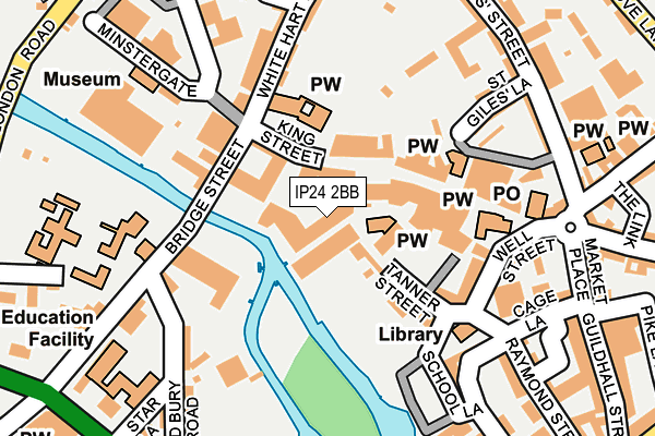
IP24 2BB lies on Riverside Walk in Thetford. IP24 2BB is located in the Thetford Castle electoral ward, within the local authority district of Breckland and the English Parliamentary constituency of South West Norfolk. The Sub Integrated Care Board (ICB) Location is NHS Norfolk and Waveney ICB - 26A and the police force is Norfolk. This postcode has been in use since January 1980.


GetTheData
Source: OS OpenMap – Local (Ordnance Survey)
Source: OS VectorMap District (Ordnance Survey)
Licence: Open Government Licence (requires attribution)
| Easting | 586961 |
| Northing | 283065 |
| Latitude | 52.413645 |
| Longitude | 0.747566 |
GetTheData
Source: Open Postcode Geo
Licence: Open Government Licence
| Street | Riverside Walk |
| Town/City | Thetford |
| Country | England |
| Postcode District | IP24 |
➜ See where IP24 is on a map ➜ Where is Thetford? | |
GetTheData
Source: Land Registry Price Paid Data
Licence: Open Government Licence
Elevation or altitude of IP24 2BB as distance above sea level:
| Metres | Feet | |
|---|---|---|
| Elevation | 10m | 33ft |
Elevation is measured from the approximate centre of the postcode, to the nearest point on an OS contour line from OS Terrain 50, which has contour spacing of ten vertical metres.
➜ How high above sea level am I? Find the elevation of your current position using your device's GPS.
GetTheData
Source: Open Postcode Elevation
Licence: Open Government Licence
| Ward | Thetford Castle |
| Constituency | South West Norfolk |
GetTheData
Source: ONS Postcode Database
Licence: Open Government Licence
| St Marys Church (Bury Road) | Thetford | 316m |
| St Marys Church (Bury Road) | Thetford | 323m |
| Grove Lane (Norwich Road) | Thetford | 352m |
| Lime Kiln Lane (Norwich Road) | Thetford | 440m |
| Priory Park (Station Road) | Thetford | 534m |
| Thetford Station | 0.6km |
GetTheData
Source: NaPTAN
Licence: Open Government Licence
| Median download speed | 22.0Mbps |
| Average download speed | 19.7Mbps |
| Maximum download speed | 24.38Mbps |
| Median upload speed | 1.1Mbps |
| Average upload speed | 1.0Mbps |
| Maximum upload speed | 1.21Mbps |
GetTheData
Source: Ofcom
Licence: Ofcom Terms of Use (requires attribution)
GetTheData
Source: ONS Postcode Database
Licence: Open Government Licence


➜ Get more ratings from the Food Standards Agency
GetTheData
Source: Food Standards Agency
Licence: FSA terms & conditions
| Last Collection | |||
|---|---|---|---|
| Location | Mon-Fri | Sat | Distance |
| Bell Hotel, King Street | 17:30 | 12:00 | 79m |
| Royal Mail, Market Place | 18:15 | 11:00 | 189m |
| Royal Mail, 1 Market Place | 18:15 | 12:30 | 190m |
GetTheData
Source: Dracos
Licence: Creative Commons Attribution-ShareAlike
| Risk of IP24 2BB flooding from rivers and sea | Medium |
| ➜ IP24 2BB flood map | |
GetTheData
Source: Open Flood Risk by Postcode
Licence: Open Government Licence
The below table lists the International Territorial Level (ITL) codes (formerly Nomenclature of Territorial Units for Statistics (NUTS) codes) and Local Administrative Units (LAU) codes for IP24 2BB:
| ITL 1 Code | Name |
|---|---|
| TLH | East |
| ITL 2 Code | Name |
| TLH1 | East Anglia |
| ITL 3 Code | Name |
| TLH17 | Breckland and South Norfolk |
| LAU 1 Code | Name |
| E07000143 | Breckland |
GetTheData
Source: ONS Postcode Directory
Licence: Open Government Licence
The below table lists the Census Output Area (OA), Lower Layer Super Output Area (LSOA), and Middle Layer Super Output Area (MSOA) for IP24 2BB:
| Code | Name | |
|---|---|---|
| OA | E00134514 | |
| LSOA | E01026468 | Breckland 016A |
| MSOA | E02005518 | Breckland 016 |
GetTheData
Source: ONS Postcode Directory
Licence: Open Government Licence
| IP24 2BG | Riverside Walk | 25m |
| IP24 2AU | King Street | 46m |
| IP24 2BQ | Tanner Street | 67m |
| IP24 2AN | King Street | 100m |
| IP24 2AP | King Street | 111m |
| IP24 2BL | Well Street | 149m |
| IP24 1AA | White Hart Street | 162m |
| IP24 1AD | White Hart Street | 181m |
| IP24 2AE | St Giles Lane | 194m |
| IP24 2AQ | Kings Court | 199m |
GetTheData
Source: Open Postcode Geo; Land Registry Price Paid Data
Licence: Open Government Licence