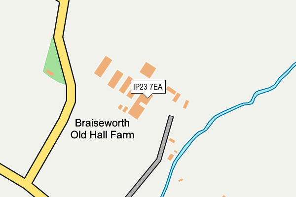
IP23 7EA is located in the Palgrave electoral ward, within the local authority district of Mid Suffolk and the English Parliamentary constituency of Central Suffolk and North Ipswich. The Sub Integrated Care Board (ICB) Location is NHS Suffolk and North East Essex ICB - 06L and the police force is Suffolk. This postcode has been in use since January 1980.


GetTheData
Source: OS OpenMap – Local (Ordnance Survey)
Source: OS VectorMap District (Ordnance Survey)
Licence: Open Government Licence (requires attribution)
| Easting | 613073 |
| Northing | 270695 |
| Latitude | 52.293046 |
| Longitude | 1.123050 |
GetTheData
Source: Open Postcode Geo
Licence: Open Government Licence
| Country | England |
| Postcode District | IP23 |
| ➜ IP23 open data dashboard ➜ See where IP23 is on a map | |
GetTheData
Source: Land Registry Price Paid Data
Licence: Open Government Licence
Elevation or altitude of IP23 7EA as distance above sea level:
| Metres | Feet | |
|---|---|---|
| Elevation | 40m | 131ft |
Elevation is measured from the approximate centre of the postcode, to the nearest point on an OS contour line from OS Terrain 50, which has contour spacing of ten vertical metres.
➜ How high above sea level am I? Find the elevation of your current position using your device's GPS.
GetTheData
Source: Open Postcode Elevation
Licence: Open Government Licence
| Ward | Palgrave |
| Constituency | Central Suffolk And North Ipswich |
GetTheData
Source: ONS Postcode Database
Licence: Open Government Licence
| November 2021 | Criminal damage and arson | On or near Stoke Road | 487m |
| November 2021 | Violence and sexual offences | On or near Stoke Road | 487m |
| October 2021 | Possession of weapons | On or near Stoke Road | 487m |
| ➜ Get more crime data in our Crime section | |||
GetTheData
Source: data.police.uk
Licence: Open Government Licence
| Black Horse (The Street) | Thorndon | 1,134m |
| Black Horse (The Street) | Thorndon | 1,149m |
| Church | Thorndon | 1,556m |
| Church | Thorndon | 1,568m |
| Post Office (The Street) | Stoke Ash | 1,590m |
GetTheData
Source: NaPTAN
Licence: Open Government Licence
| Percentage of properties with Next Generation Access | 100.0% |
| Percentage of properties with Superfast Broadband | 0.0% |
| Percentage of properties with Ultrafast Broadband | 0.0% |
| Percentage of properties with Full Fibre Broadband | 0.0% |
Superfast Broadband is between 30Mbps and 300Mbps
Ultrafast Broadband is > 300Mbps
| Percentage of properties unable to receive 2Mbps | 0.0% |
| Percentage of properties unable to receive 5Mbps | 0.0% |
| Percentage of properties unable to receive 10Mbps | 0.0% |
| Percentage of properties unable to receive 30Mbps | 100.0% |
GetTheData
Source: Ofcom
Licence: Ofcom Terms of Use (requires attribution)
GetTheData
Source: ONS Postcode Database
Licence: Open Government Licence
➜ Get more ratings from the Food Standards Agency
GetTheData
Source: Food Standards Agency
Licence: FSA terms & conditions
| Last Collection | |||
|---|---|---|---|
| Location | Mon-Fri | Sat | Distance |
| 1 Stanwell Green | 16:00 | 07:30 | 723m |
| The Orchards | 15:15 | 07:00 | 1,141m |
| High Street | 16:00 | 10:45 | 2,011m |
GetTheData
Source: Dracos
Licence: Creative Commons Attribution-ShareAlike
| Facility | Distance |
|---|---|
| Kerrison Trust Stoke Road, Thorndon, Eye Grass Pitches | 417m |
| The Cricket Field Thornham Magna, Eye Grass Pitches | 2.7km |
| Eye Town Moor Magdalen Street, Eye Grass Pitches | 3.2km |
GetTheData
Source: Active Places
Licence: Open Government Licence
| School | Phase of Education | Distance |
|---|---|---|
| Thorndon Church of England Primary School The Street, Thorndon, Eye, IP23 7JR | Primary | 1.5km |
| Occold Primary School The Street, Occold, Eye, IP23 7PL | Primary | 2.6km |
| Hartismere School Castleton Way, Eye, IP23 7BL | Secondary | 3.5km |
GetTheData
Source: Edubase
Licence: Open Government Licence
The below table lists the International Territorial Level (ITL) codes (formerly Nomenclature of Territorial Units for Statistics (NUTS) codes) and Local Administrative Units (LAU) codes for IP23 7EA:
| ITL 1 Code | Name |
|---|---|
| TLH | East |
| ITL 2 Code | Name |
| TLH1 | East Anglia |
| ITL 3 Code | Name |
| TLH14 | Suffolk CC |
| LAU 1 Code | Name |
| E07000203 | Mid Suffolk |
GetTheData
Source: ONS Postcode Directory
Licence: Open Government Licence
The below table lists the Census Output Area (OA), Lower Layer Super Output Area (LSOA), and Middle Layer Super Output Area (MSOA) for IP23 7EA:
| Code | Name | |
|---|---|---|
| OA | E00153358 | |
| LSOA | E01030087 | Mid Suffolk 007D |
| MSOA | E02006267 | Mid Suffolk 007 |
GetTheData
Source: ONS Postcode Directory
Licence: Open Government Licence
| IP23 7JG | Stoke Road | 441m |
| IP23 7JF | Clint Road | 605m |
| IP23 7DZ | Clay Lane | 715m |
| IP23 7JH | Stanwell Green | 722m |
| IP23 7JL | Stanwell Green | 863m |
| IP23 7ER | Grasshopper Lane | 867m |
| IP23 7DS | Braiseworth Road | 882m |
| IP23 7JN | The Street | 930m |
| IP23 7JJ | Thwaite Road | 958m |
| IP23 7GB | Soers Close | 1043m |
GetTheData
Source: Open Postcode Geo; Land Registry Price Paid Data
Licence: Open Government Licence