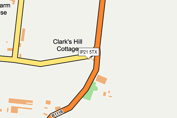
IP21 5TX lies on Clarks Hill in Weybread, Diss. IP21 5TX is located in the Fressingfield electoral ward, within the local authority district of Mid Suffolk and the English Parliamentary constituency of Central Suffolk and North Ipswich. The Sub Integrated Care Board (ICB) Location is NHS Suffolk and North East Essex ICB - 06L and the police force is Suffolk. This postcode has been in use since January 1980.


GetTheData
Source: OS OpenMap – Local (Ordnance Survey)
Source: OS VectorMap District (Ordnance Survey)
Licence: Open Government Licence (requires attribution)
| Easting | 624509 |
| Northing | 280802 |
| Latitude | 52.379231 |
| Longitude | 1.297228 |
GetTheData
Source: Open Postcode Geo
Licence: Open Government Licence
| Street | Clarks Hill |
| Locality | Weybread |
| Town/City | Diss |
| Country | England |
| Postcode District | IP21 |
| ➜ IP21 open data dashboard ➜ See where IP21 is on a map | |
GetTheData
Source: Land Registry Price Paid Data
Licence: Open Government Licence
Elevation or altitude of IP21 5TX as distance above sea level:
| Metres | Feet | |
|---|---|---|
| Elevation | 30m | 98ft |
Elevation is measured from the approximate centre of the postcode, to the nearest point on an OS contour line from OS Terrain 50, which has contour spacing of ten vertical metres.
➜ How high above sea level am I? Find the elevation of your current position using your device's GPS.
GetTheData
Source: Open Postcode Elevation
Licence: Open Government Licence
| Ward | Fressingfield |
| Constituency | Central Suffolk And North Ipswich |
GetTheData
Source: ONS Postcode Database
Licence: Open Government Licence
| April 2022 | Public order | On or near Sports/Recreation Area | 429m |
| ➜ Get more crime data in our Crime section | |||
GetTheData
Source: data.police.uk
Licence: Open Government Licence
| Church Road (B1116) | Weybread | 527m |
| Church Road (B1116) | Weybread | 548m |
| Telephone Box (B1116) | Weybread | 1,106m |
| Telephone Box (B1116) | Weybread | 1,110m |
| Village Hall (High Road) | Needham | 1,777m |
GetTheData
Source: NaPTAN
Licence: Open Government Licence
| Percentage of properties with Next Generation Access | 100.0% |
| Percentage of properties with Superfast Broadband | 100.0% |
| Percentage of properties with Ultrafast Broadband | 100.0% |
| Percentage of properties with Full Fibre Broadband | 100.0% |
Superfast Broadband is between 30Mbps and 300Mbps
Ultrafast Broadband is > 300Mbps
| Percentage of properties unable to receive 2Mbps | 0.0% |
| Percentage of properties unable to receive 5Mbps | 0.0% |
| Percentage of properties unable to receive 10Mbps | 0.0% |
| Percentage of properties unable to receive 30Mbps | 0.0% |
GetTheData
Source: Ofcom
Licence: Ofcom Terms of Use (requires attribution)
GetTheData
Source: ONS Postcode Database
Licence: Open Government Licence

➜ Get more ratings from the Food Standards Agency
GetTheData
Source: Food Standards Agency
Licence: FSA terms & conditions
| Last Collection | |||
|---|---|---|---|
| Location | Mon-Fri | Sat | Distance |
| One Eyed Lane | 15:45 | 08:30 | 471m |
| Upper Weybread | 15:45 | 07:45 | 1,877m |
| London Road | 16:30 | 10:30 | 2,152m |
GetTheData
Source: Dracos
Licence: Creative Commons Attribution-ShareAlike
| Facility | Distance |
|---|---|
| Harleston Magpies Hockey Club Syleham Road, Weybread, Diss Artificial Grass Pitch | 554m |
| Shotford Indoor Bowls Club Spirketts Lane, Harleston Indoor Bowls | 1.8km |
| Archbishop Sancroft High School Wilderness Lane, Harleston Sports Hall, Grass Pitches, Swimming Pool, Outdoor Tennis Courts | 2.2km |
GetTheData
Source: Active Places
Licence: Open Government Licence
| School | Phase of Education | Distance |
|---|---|---|
| The Harleston Sancroft Academy (a 3-16 Church of England School) Wilderness Lane, Harleston, IP20 9DD | All-through | 2.1km |
| Mendham Primary School Mendham, Harleston, IP20 0NJ | Primary | 3.5km |
| Fressingfield Church of England Primary School School Lane, Stradbroke Road, Fressingfield, Eye, IP21 5RU | Primary | 3.8km |
GetTheData
Source: Edubase
Licence: Open Government Licence
The below table lists the International Territorial Level (ITL) codes (formerly Nomenclature of Territorial Units for Statistics (NUTS) codes) and Local Administrative Units (LAU) codes for IP21 5TX:
| ITL 1 Code | Name |
|---|---|
| TLH | East |
| ITL 2 Code | Name |
| TLH1 | East Anglia |
| ITL 3 Code | Name |
| TLH14 | Suffolk CC |
| LAU 1 Code | Name |
| E07000203 | Mid Suffolk |
GetTheData
Source: ONS Postcode Directory
Licence: Open Government Licence
The below table lists the Census Output Area (OA), Lower Layer Super Output Area (LSOA), and Middle Layer Super Output Area (MSOA) for IP21 5TX:
| Code | Name | |
|---|---|---|
| OA | E00153170 | |
| LSOA | E01030053 | Mid Suffolk 003A |
| MSOA | E02006263 | Mid Suffolk 003 |
GetTheData
Source: ONS Postcode Directory
Licence: Open Government Licence
| IP21 5TU | Harleston Road | 285m |
| IP21 5TT | Hoxne Road | 413m |
| IP21 5TQ | The Street | 543m |
| IP21 5TS | Friars Meadow | 551m |
| IP21 5TP | Mill Lane | 621m |
| IP21 5TR | Church Road | 719m |
| IP21 5TY | Water Lane | 798m |
| IP21 5UD | Harleston Road | 819m |
| IP21 5UA | Withersdale Road | 906m |
| IP21 5TF | Fir Tree Close | 974m |
GetTheData
Source: Open Postcode Geo; Land Registry Price Paid Data
Licence: Open Government Licence