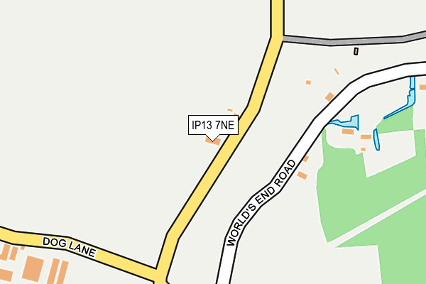
IP13 7NE is located in the Stradbroke & Laxfield electoral ward, within the local authority district of Mid Suffolk and the English Parliamentary constituency of Central Suffolk and North Ipswich. The Sub Integrated Care Board (ICB) Location is NHS Suffolk and North East Essex ICB - 06L and the police force is Suffolk. This postcode has been in use since January 1980.


GetTheData
Source: OS OpenMap – Local (Ordnance Survey)
Source: OS VectorMap District (Ordnance Survey)
Licence: Open Government Licence (requires attribution)
| Easting | 624832 |
| Northing | 266022 |
| Latitude | 52.246440 |
| Longitude | 1.292100 |
GetTheData
Source: Open Postcode Geo
Licence: Open Government Licence
| Country | England |
| Postcode District | IP13 |
| ➜ IP13 open data dashboard ➜ See where IP13 is on a map | |
GetTheData
Source: Land Registry Price Paid Data
Licence: Open Government Licence
Elevation or altitude of IP13 7NE as distance above sea level:
| Metres | Feet | |
|---|---|---|
| Elevation | 60m | 197ft |
Elevation is measured from the approximate centre of the postcode, to the nearest point on an OS contour line from OS Terrain 50, which has contour spacing of ten vertical metres.
➜ How high above sea level am I? Find the elevation of your current position using your device's GPS.
GetTheData
Source: Open Postcode Elevation
Licence: Open Government Licence
| Ward | Stradbroke & Laxfield |
| Constituency | Central Suffolk And North Ipswich |
GetTheData
Source: ONS Postcode Database
Licence: Open Government Licence
| May 2022 | Violence and sexual offences | On or near World'S End Road | 118m |
| January 2022 | Violence and sexual offences | On or near World'S End Road | 118m |
| January 2022 | Violence and sexual offences | On or near World'S End Road | 118m |
| ➜ Get more crime data in our Crime section | |||
GetTheData
Source: data.police.uk
Licence: Open Government Licence
| Home Lea (Chapel Road) | Saxtead Little Green | 191m |
| Home Lea (Chapel Road) | Saxtead Little Green | 192m |
| Telephone Box (Chapel Road) | Saxtead Little Green | 378m |
| Telephone Box (Chapel Road) | Saxtead Little Green | 379m |
| Malborough Road (Marlborough Road) | Saxtead Little Green | 462m |
GetTheData
Source: NaPTAN
Licence: Open Government Licence
| Percentage of properties with Next Generation Access | 100.0% |
| Percentage of properties with Superfast Broadband | 100.0% |
| Percentage of properties with Ultrafast Broadband | 0.0% |
| Percentage of properties with Full Fibre Broadband | 0.0% |
Superfast Broadband is between 30Mbps and 300Mbps
Ultrafast Broadband is > 300Mbps
| Percentage of properties unable to receive 2Mbps | 0.0% |
| Percentage of properties unable to receive 5Mbps | 0.0% |
| Percentage of properties unable to receive 10Mbps | 0.0% |
| Percentage of properties unable to receive 30Mbps | 0.0% |
GetTheData
Source: Ofcom
Licence: Ofcom Terms of Use (requires attribution)
GetTheData
Source: ONS Postcode Database
Licence: Open Government Licence


➜ Get more ratings from the Food Standards Agency
GetTheData
Source: Food Standards Agency
Licence: FSA terms & conditions
| Last Collection | |||
|---|---|---|---|
| Location | Mon-Fri | Sat | Distance |
| Pembroke Road | 16:45 | 08:45 | 3,473m |
| Clowes Corner | 11:30 | 11:00 | 3,895m |
| College Road | 16:30 | 09:00 | 4,041m |
GetTheData
Source: Dracos
Licence: Creative Commons Attribution-ShareAlike
| Facility | Distance |
|---|---|
| Worlingworth Cricket Club Earl Soham Road, Bedfield Grass Pitches | 1.7km |
| Bedfield Primary School Bedfield, Woodbridge Grass Pitches | 2.6km |
| Bedfield Playing Field Long Green, Bedfield Grass Pitches, Outdoor Tennis Courts | 2.9km |
GetTheData
Source: Active Places
Licence: Open Government Licence
| School | Phase of Education | Distance |
|---|---|---|
| Bedfield Church of England Primary School Bedfield, Woodbridge, IP13 7EA | Primary | 2.7km |
| Earl Soham Community Primary School Earl Soham, The Street, Earl Soham Primary School, Woodbridge, IP13 7SA | Primary | 3km |
| Thomas Mills High School Saxtead Road, Framlingham, Woodbridge, IP13 9HE | Secondary | 3.2km |
GetTheData
Source: Edubase
Licence: Open Government Licence
The below table lists the International Territorial Level (ITL) codes (formerly Nomenclature of Territorial Units for Statistics (NUTS) codes) and Local Administrative Units (LAU) codes for IP13 7NE:
| ITL 1 Code | Name |
|---|---|
| TLH | East |
| ITL 2 Code | Name |
| TLH1 | East Anglia |
| ITL 3 Code | Name |
| TLH14 | Suffolk CC |
| LAU 1 Code | Name |
| E07000203 | Mid Suffolk |
GetTheData
Source: ONS Postcode Directory
Licence: Open Government Licence
The below table lists the Census Output Area (OA), Lower Layer Super Output Area (LSOA), and Middle Layer Super Output Area (MSOA) for IP13 7NE:
| Code | Name | |
|---|---|---|
| OA | E00173699 | |
| LSOA | E01030090 | Mid Suffolk 003C |
| MSOA | E02006263 | Mid Suffolk 003 |
GetTheData
Source: ONS Postcode Directory
Licence: Open Government Licence
| IP13 9QY | 219m | |
| IP13 9QZ | 244m | |
| IP13 9RB | Chapel Road | 310m |
| IP13 9RA | Hollow Lane | 342m |
| IP13 7NF | 361m | |
| IP13 9QU | 455m | |
| IP13 9QX | Worlds End Road | 499m |
| IP13 7NG | 760m | |
| IP13 9QT | 854m | |
| IP13 9RD | Marlborough Road | 1180m |
GetTheData
Source: Open Postcode Geo; Land Registry Price Paid Data
Licence: Open Government Licence