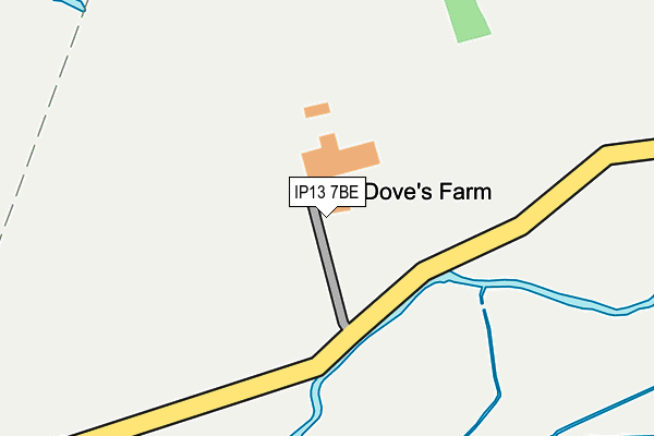
IP13 7BE is located in the Debenham electoral ward, within the local authority district of Mid Suffolk and the English Parliamentary constituency of Central Suffolk and North Ipswich. The Sub Integrated Care Board (ICB) Location is NHS Suffolk and North East Essex ICB - 06L and the police force is Suffolk. This postcode has been in use since January 1980.


GetTheData
Source: OS OpenMap – Local (Ordnance Survey)
Source: OS VectorMap District (Ordnance Survey)
Licence: Open Government Licence (requires attribution)
| Easting | 621628 |
| Northing | 260825 |
| Latitude | 52.201090 |
| Longitude | 1.241845 |
GetTheData
Source: Open Postcode Geo
Licence: Open Government Licence
| Country | England |
| Postcode District | IP13 |
| ➜ IP13 open data dashboard ➜ See where IP13 is on a map | |
GetTheData
Source: Land Registry Price Paid Data
Licence: Open Government Licence
Elevation or altitude of IP13 7BE as distance above sea level:
| Metres | Feet | |
|---|---|---|
| Elevation | 30m | 98ft |
Elevation is measured from the approximate centre of the postcode, to the nearest point on an OS contour line from OS Terrain 50, which has contour spacing of ten vertical metres.
➜ How high above sea level am I? Find the elevation of your current position using your device's GPS.
GetTheData
Source: Open Postcode Elevation
Licence: Open Government Licence
| Ward | Debenham |
| Constituency | Central Suffolk And North Ipswich |
GetTheData
Source: ONS Postcode Database
Licence: Open Government Licence
| New Bell (The Street) | Cretingham | 1,281m |
| New Bell (The Street) | Cretingham | 1,290m |
| Cretingham House (Cretingham Road) | Kittle's Corner | 1,720m |
| Cretingham House (Cretingham Road) | Kittle's Corner | 1,742m |
GetTheData
Source: NaPTAN
Licence: Open Government Licence
| Percentage of properties with Next Generation Access | 0.0% |
| Percentage of properties with Superfast Broadband | 0.0% |
| Percentage of properties with Ultrafast Broadband | 0.0% |
| Percentage of properties with Full Fibre Broadband | 0.0% |
Superfast Broadband is between 30Mbps and 300Mbps
Ultrafast Broadband is > 300Mbps
| Percentage of properties unable to receive 2Mbps | 0.0% |
| Percentage of properties unable to receive 5Mbps | 100.0% |
| Percentage of properties unable to receive 10Mbps | 100.0% |
| Percentage of properties unable to receive 30Mbps | 100.0% |
GetTheData
Source: Ofcom
Licence: Ofcom Terms of Use (requires attribution)
GetTheData
Source: ONS Postcode Database
Licence: Open Government Licence


➜ Get more ratings from the Food Standards Agency
GetTheData
Source: Food Standards Agency
Licence: FSA terms & conditions
| Last Collection | |||
|---|---|---|---|
| Location | Mon-Fri | Sat | Distance |
| Cretingham | 15:15 | 09:00 | 1,199m |
| Swan Inn | 10:20 | 09:35 | 1,458m |
| Post Office, The Street | 15:45 | 10:00 | 1,979m |
GetTheData
Source: Dracos
Licence: Creative Commons Attribution-ShareAlike
| Facility | Distance |
|---|---|
| Kingfishers Golf Club Cretingham, Woodbridge Swimming Pool, Golf | 1.7km |
| Brandeston Village Hall The Street, Brandeston Grass Pitches, Outdoor Tennis Courts | 3.1km |
| Brandeston Recreation Ground (Closed) The Street, Brandeston, Woodbridge Grass Pitches | 3.4km |
GetTheData
Source: Active Places
Licence: Open Government Licence
| School | Phase of Education | Distance |
|---|---|---|
| Helmingham Primary School and Nursery School Road, Helmingham, Stowmarket, IP14 6EX | Primary | 3km |
| Earl Soham Community Primary School Earl Soham, The Street, Earl Soham Primary School, Woodbridge, IP13 7SA | Primary | 3.1km |
| Sir Robert Hitcham Church of England Voluntary Aided School School Corner, Debenham, Stowmarket, IP14 6PL | Primary | 5.2km |
GetTheData
Source: Edubase
Licence: Open Government Licence
The below table lists the International Territorial Level (ITL) codes (formerly Nomenclature of Territorial Units for Statistics (NUTS) codes) and Local Administrative Units (LAU) codes for IP13 7BE:
| ITL 1 Code | Name |
|---|---|
| TLH | East |
| ITL 2 Code | Name |
| TLH1 | East Anglia |
| ITL 3 Code | Name |
| TLH14 | Suffolk CC |
| LAU 1 Code | Name |
| E07000203 | Mid Suffolk |
GetTheData
Source: ONS Postcode Directory
Licence: Open Government Licence
The below table lists the Census Output Area (OA), Lower Layer Super Output Area (LSOA), and Middle Layer Super Output Area (MSOA) for IP13 7BE:
| Code | Name | |
|---|---|---|
| OA | E00153371 | |
| LSOA | E01030090 | Mid Suffolk 003C |
| MSOA | E02006263 | Mid Suffolk 003 |
GetTheData
Source: ONS Postcode Directory
Licence: Open Government Licence
| IP14 6HN | 377m | |
| IP14 6LT | 423m | |
| IP13 7BB | 1147m | |
| IP13 7BH | Framsden Road | 1210m |
| IP14 6HP | Birds Lane | 1255m |
| IP13 7BG | The Street | 1268m |
| IP13 7BQ | Oak Corner | 1315m |
| IP13 7BJ | The Street | 1371m |
| IP14 6LU | 1385m | |
| IP13 7DR | Brandeston Road | 1412m |
GetTheData
Source: Open Postcode Geo; Land Registry Price Paid Data
Licence: Open Government Licence