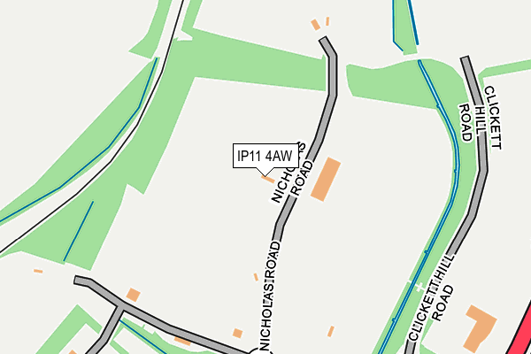
IP11 4AW is located in the Orwell & Villages electoral ward, within the local authority district of East Suffolk and the English Parliamentary constituency of Suffolk Coastal. The Sub Integrated Care Board (ICB) Location is NHS Suffolk and North East Essex ICB - 06L and the police force is Suffolk. This postcode has been in use since January 2005.


GetTheData
Source: OS OpenMap – Local (Ordnance Survey)
Source: OS VectorMap District (Ordnance Survey)
Licence: Open Government Licence (requires attribution)
| Easting | 628000 |
| Northing | 234957 |
| Latitude | 51.966315 |
| Longitude | 1.317645 |
GetTheData
Source: Open Postcode Geo
Licence: Open Government Licence
| Country | England |
| Postcode District | IP11 |
| ➜ IP11 open data dashboard ➜ See where IP11 is on a map ➜ Where is Felixstowe? | |
GetTheData
Source: Land Registry Price Paid Data
Licence: Open Government Licence
Elevation or altitude of IP11 4AW as distance above sea level:
| Metres | Feet | |
|---|---|---|
| Elevation | 10m | 33ft |
Elevation is measured from the approximate centre of the postcode, to the nearest point on an OS contour line from OS Terrain 50, which has contour spacing of ten vertical metres.
➜ How high above sea level am I? Find the elevation of your current position using your device's GPS.
GetTheData
Source: Open Postcode Elevation
Licence: Open Government Licence
| Ward | Orwell & Villages |
| Constituency | Suffolk Coastal |
GetTheData
Source: ONS Postcode Database
Licence: Open Government Licence
| June 2022 | Anti-social behaviour | On or near A14 | 367m |
| May 2022 | Vehicle crime | On or near Blyford Way | 480m |
| May 2022 | Burglary | On or near Blyford Way | 480m |
| ➜ Get more crime data in our Crime section | |||
GetTheData
Source: data.police.uk
Licence: Open Government Licence
| Morrisons (Grange Farm Avenue) | Grange Farm | 598m |
| Morrisons (Grange Farm Avenue) | Grange Farm | 613m |
| Nayland Road (Wesel Avenue) | Grange Farm | 688m |
| Nayland Road (Wesel Avenue) | Grange Farm | 699m |
| Hintlesham Drive (Grange Farm Avenue) | Grange Farm | 773m |
| Trimley Station | 1.1km |
| Felixstowe Station | 2.3km |
| Harwich Town Station | 3.3km |
GetTheData
Source: NaPTAN
Licence: Open Government Licence
GetTheData
Source: ONS Postcode Database
Licence: Open Government Licence


➜ Get more ratings from the Food Standards Agency
GetTheData
Source: Food Standards Agency
Licence: FSA terms & conditions
| Last Collection | |||
|---|---|---|---|
| Location | Mon-Fri | Sat | Distance |
| Langstons, Faulkeners Way | 17:00 | 07:00 | 1,565m |
| Arwela Road | 17:30 | 12:00 | 2,071m |
| Bent Hill Post Office | 17:30 | 12:30 | 2,380m |
GetTheData
Source: Dracos
Licence: Creative Commons Attribution-ShareAlike
| Facility | Distance |
|---|---|
| Anytime Fitness (Felixstowe) Ferry Lane, Ferry Lane, Felixstowe Health and Fitness Gym | 429m |
| Coronation Sports Ground Mill Lane, Felixstowe Grass Pitches | 1.1km |
| Felixstowe Academy High Street, Felixstowe Grass Pitches, Sports Hall, Health and Fitness Gym, Artificial Grass Pitch, Outdoor Tennis Courts | 1.2km |
GetTheData
Source: Active Places
Licence: Open Government Licence
| School | Phase of Education | Distance |
|---|---|---|
| Grange Community Primary School Grange Road, Felixstowe, IP11 2LA | Primary | 851m |
| Felixstowe School High Street, Felixstowe, IP11 9QR | Secondary | 1.2km |
| Set Felix Maidstone Road, Felixstowe, IP11 9ED | Primary | 1.3km |
GetTheData
Source: Edubase
Licence: Open Government Licence
The below table lists the International Territorial Level (ITL) codes (formerly Nomenclature of Territorial Units for Statistics (NUTS) codes) and Local Administrative Units (LAU) codes for IP11 4AW:
| ITL 1 Code | Name |
|---|---|
| TLH | East |
| ITL 2 Code | Name |
| TLH1 | East Anglia |
| ITL 3 Code | Name |
| TLH14 | Suffolk CC |
| LAU 1 Code | Name |
| E07000244 | East Suffolk |
GetTheData
Source: ONS Postcode Directory
Licence: Open Government Licence
The below table lists the Census Output Area (OA), Lower Layer Super Output Area (LSOA), and Middle Layer Super Output Area (MSOA) for IP11 4AW:
| Code | Name | |
|---|---|---|
| OA | E00154101 | |
| LSOA | E01030216 | Suffolk Coastal 012D |
| MSOA | E02006298 | Suffolk Coastal 012 |
GetTheData
Source: ONS Postcode Directory
Licence: Open Government Licence
| IP11 2FW | Blyford Way | 449m |
| IP11 2YJ | Brightwell Close | 465m |
| IP11 2XY | Wickhambrook Court | 514m |
| IP11 2FR | Capel Drive | 516m |
| IP11 2YN | Hintlesham Drive | 516m |
| IP11 2XU | Brandon Road | 518m |
| IP11 2YL | Hintlesham Drive | 522m |
| IP11 2YD | Euston Court | 524m |
| IP11 2XX | Lidgate Court | 556m |
| IP11 2YE | Thurston Court | 558m |
GetTheData
Source: Open Postcode Geo; Land Registry Price Paid Data
Licence: Open Government Licence