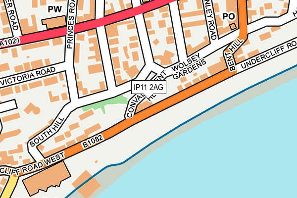
IP11 2AG is located in the Eastern Felixstowe electoral ward, within the local authority district of East Suffolk and the English Parliamentary constituency of Suffolk Coastal. The Sub Integrated Care Board (ICB) Location is NHS Suffolk and North East Essex ICB - 06L and the police force is Suffolk. This postcode has been in use since December 1999.


GetTheData
Source: OS OpenMap – Local (Ordnance Survey)
Source: OS VectorMap District (Ordnance Survey)
Licence: Open Government Licence (requires attribution)
| Easting | 630148 |
| Northing | 234284 |
| Latitude | 51.959376 |
| Longitude | 1.348376 |
GetTheData
Source: Open Postcode Geo
Licence: Open Government Licence
| Country | England |
| Postcode District | IP11 |
| ➜ IP11 open data dashboard ➜ See where IP11 is on a map ➜ Where is Felixstowe? | |
GetTheData
Source: Land Registry Price Paid Data
Licence: Open Government Licence
Elevation or altitude of IP11 2AG as distance above sea level:
| Metres | Feet | |
|---|---|---|
| Elevation | 10m | 33ft |
Elevation is measured from the approximate centre of the postcode, to the nearest point on an OS contour line from OS Terrain 50, which has contour spacing of ten vertical metres.
➜ How high above sea level am I? Find the elevation of your current position using your device's GPS.
GetTheData
Source: Open Postcode Elevation
Licence: Open Government Licence
| Ward | Eastern Felixstowe |
| Constituency | Suffolk Coastal |
GetTheData
Source: ONS Postcode Database
Licence: Open Government Licence
| January 2024 | Criminal damage and arson | On or near Parking Area | 312m |
| January 2024 | Violence and sexual offences | On or near Cavendish Road | 485m |
| December 2023 | Anti-social behaviour | On or near Parking Area | 172m |
| ➜ Get more crime data in our Crime section | |||
GetTheData
Source: data.police.uk
Licence: Open Government Licence
| Convalescent Hill (Undercliff Road West) | Felixstowe | 107m |
| Church (Princes Road) | Felixstowe | 207m |
| Church (Princes Road) | Felixstowe | 219m |
| Stanley Road (Orwell Road) | Felixstowe | 234m |
| Leisure Centre (Undercliff Road West) | Felixstowe | 262m |
| Felixstowe Station | 0.9km |
| Trimley Station | 2.8km |
| Harwich Town Station | 4.6km |
GetTheData
Source: NaPTAN
Licence: Open Government Licence
GetTheData
Source: ONS Postcode Database
Licence: Open Government Licence


➜ Get more ratings from the Food Standards Agency
GetTheData
Source: Food Standards Agency
Licence: FSA terms & conditions
| Last Collection | |||
|---|---|---|---|
| Location | Mon-Fri | Sat | Distance |
| Bent Hill Post Office | 17:30 | 12:30 | 220m |
| Arwela Road | 17:30 | 12:00 | 752m |
| 29 Foxgrove Ln | 17:15 | 12:00 | 2,136m |
GetTheData
Source: Dracos
Licence: Creative Commons Attribution-ShareAlike
| Facility | Distance |
|---|---|
| Felixstowe Leisure Centre Undercliff Road West, Felixstowe Indoor Bowls, Swimming Pool, Health and Fitness Gym, Sports Hall, Studio | 262m |
| Coastside Fitness Cobbold Road, Felixstowe Health and Fitness Gym, Studio | 519m |
| Felixstowe Lawn Tennis Club Bath Road, Felixstowe Outdoor Tennis Courts | 893m |
GetTheData
Source: Active Places
Licence: Open Government Licence
| School | Phase of Education | Distance |
|---|---|---|
| Langer Primary Academy Langer Road, Felixstowe, IP11 2HL | Primary | 1km |
| Fairfield Infant School High Road West, Felixstowe, IP11 9JB | Primary | 1km |
| Grange Community Primary School Grange Road, Felixstowe, IP11 2LA | Primary | 1.4km |
GetTheData
Source: Edubase
Licence: Open Government Licence
The below table lists the International Territorial Level (ITL) codes (formerly Nomenclature of Territorial Units for Statistics (NUTS) codes) and Local Administrative Units (LAU) codes for IP11 2AG:
| ITL 1 Code | Name |
|---|---|
| TLH | East |
| ITL 2 Code | Name |
| TLH1 | East Anglia |
| ITL 3 Code | Name |
| TLH14 | Suffolk CC |
| LAU 1 Code | Name |
| E07000244 | East Suffolk |
GetTheData
Source: ONS Postcode Directory
Licence: Open Government Licence
The below table lists the Census Output Area (OA), Lower Layer Super Output Area (LSOA), and Middle Layer Super Output Area (MSOA) for IP11 2AG:
| Code | Name | |
|---|---|---|
| OA | E00153788 | |
| LSOA | E01030162 | Suffolk Coastal 015A |
| MSOA | E02006301 | Suffolk Coastal 015 |
GetTheData
Source: ONS Postcode Directory
Licence: Open Government Licence
| IP11 7NU | Wolsey Gardens | 71m |
| IP11 2AF | Undercliff Road West | 81m |
| IP11 7NT | Wolsey Gardens | 89m |
| IP11 7NX | Tomline Road | 114m |
| IP11 7PQ | Wolsey Gardens | 135m |
| IP11 7PG | Queens Road | 138m |
| IP11 7PH | Wolsey Gardens | 139m |
| IP11 7NR | Leopold Road | 139m |
| IP11 7DJ | Stanley Road | 156m |
| IP11 7PJ | Princes Road | 174m |
GetTheData
Source: Open Postcode Geo; Land Registry Price Paid Data
Licence: Open Government Licence