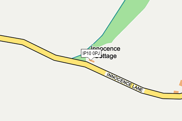
IP10 0PJ lies on Innocence Lane in Kirton, Ipswich. IP10 0PJ is located in the Orwell & Villages electoral ward, within the local authority district of East Suffolk and the English Parliamentary constituency of Suffolk Coastal. The Sub Integrated Care Board (ICB) Location is NHS Suffolk and North East Essex ICB - 06L and the police force is Suffolk. This postcode has been in use since January 1980.


GetTheData
Source: OS OpenMap – Local (Ordnance Survey)
Source: OS VectorMap District (Ordnance Survey)
Licence: Open Government Licence (requires attribution)
| Easting | 627096 |
| Northing | 239143 |
| Latitude | 52.004243 |
| Longitude | 1.307248 |
GetTheData
Source: Open Postcode Geo
Licence: Open Government Licence
| Street | Innocence Lane |
| Locality | Kirton |
| Town/City | Ipswich |
| Country | England |
| Postcode District | IP10 |
| ➜ IP10 open data dashboard ➜ See where IP10 is on a map | |
GetTheData
Source: Land Registry Price Paid Data
Licence: Open Government Licence
Elevation or altitude of IP10 0PJ as distance above sea level:
| Metres | Feet | |
|---|---|---|
| Elevation | 20m | 66ft |
Elevation is measured from the approximate centre of the postcode, to the nearest point on an OS contour line from OS Terrain 50, which has contour spacing of ten vertical metres.
➜ How high above sea level am I? Find the elevation of your current position using your device's GPS.
GetTheData
Source: Open Postcode Elevation
Licence: Open Government Licence
| Ward | Orwell & Villages |
| Constituency | Suffolk Coastal |
GetTheData
Source: ONS Postcode Database
Licence: Open Government Licence
| Primary School (Kirton Road) | Trimley St Martin | 735m |
| Primary School (Kirton Road) | Trimley St Martin | 743m |
| Bus Shelter (Trimley Road) | Kirton | 821m |
| Rectory Lane (Falkenham Road) | Kirton | 849m |
| White Horse (Bucklesham Road) | Kirton | 875m |
| Trimley Station | 3.2km |
| Felixstowe Station | 5.1km |
GetTheData
Source: NaPTAN
Licence: Open Government Licence
| Percentage of properties with Next Generation Access | 100.0% |
| Percentage of properties with Superfast Broadband | 0.0% |
| Percentage of properties with Ultrafast Broadband | 0.0% |
| Percentage of properties with Full Fibre Broadband | 0.0% |
Superfast Broadband is between 30Mbps and 300Mbps
Ultrafast Broadband is > 300Mbps
| Percentage of properties unable to receive 2Mbps | 0.0% |
| Percentage of properties unable to receive 5Mbps | 0.0% |
| Percentage of properties unable to receive 10Mbps | 0.0% |
| Percentage of properties unable to receive 30Mbps | 100.0% |
GetTheData
Source: Ofcom
Licence: Ofcom Terms of Use (requires attribution)
GetTheData
Source: ONS Postcode Database
Licence: Open Government Licence


➜ Get more ratings from the Food Standards Agency
GetTheData
Source: Food Standards Agency
Licence: FSA terms & conditions
| Last Collection | |||
|---|---|---|---|
| Location | Mon-Fri | Sat | Distance |
| White Horse P/H | 16:30 | 09:15 | 838m |
| Levington Marina | 17:00 | 11:30 | 1,031m |
| Post Office, 52 Falkenham Road | 16:45 | 09:15 | 1,034m |
GetTheData
Source: Dracos
Licence: Creative Commons Attribution-ShareAlike
| Facility | Distance |
|---|---|
| Trimley St Martin Primary School Kirton Road, Trimley St. Martin, Felixstowe Grass Pitches, Swimming Pool | 747m |
| Kirton & Falkenham Recreation Ground Back Road, Kirton Grass Pitches | 895m |
| Trimley Sports And Social Club High Road, Trimley St. Martin, Felixstowe Grass Pitches, Squash Courts | 1.5km |
GetTheData
Source: Active Places
Licence: Open Government Licence
| School | Phase of Education | Distance |
|---|---|---|
| Trimley St Martin Primary School Kirton Road, Trimley St Martin, Felixstowe, IP11 0QL | Primary | 697m |
| Trimley St Mary Primary School High Road, Trimley St Mary, Felixstowe, IP11 0ST | Primary | 2.9km |
| Bucklesham Primary School Main Road, Bucklesham, Ipswich, IP10 0AX | Primary | 3.4km |
GetTheData
Source: Edubase
Licence: Open Government Licence
The below table lists the International Territorial Level (ITL) codes (formerly Nomenclature of Territorial Units for Statistics (NUTS) codes) and Local Administrative Units (LAU) codes for IP10 0PJ:
| ITL 1 Code | Name |
|---|---|
| TLH | East |
| ITL 2 Code | Name |
| TLH1 | East Anglia |
| ITL 3 Code | Name |
| TLH14 | Suffolk CC |
| LAU 1 Code | Name |
| E07000244 | East Suffolk |
GetTheData
Source: ONS Postcode Directory
Licence: Open Government Licence
The below table lists the Census Output Area (OA), Lower Layer Super Output Area (LSOA), and Middle Layer Super Output Area (MSOA) for IP10 0PJ:
| Code | Name | |
|---|---|---|
| OA | E00154085 | |
| LSOA | E01030217 | Suffolk Coastal 012E |
| MSOA | E02006298 | Suffolk Coastal 012 |
GetTheData
Source: ONS Postcode Directory
Licence: Open Government Licence
| IP10 0NQ | Durilda Green | 602m |
| IP10 0GB | The Maltings | 640m |
| IP10 0QN | Trimley Road | 699m |
| IP11 0QL | Kirton Road | 701m |
| IP10 0NS | Oakdene | 768m |
| IP10 0NT | Falkenham Road | 803m |
| IP10 0NP | Falkenham Road | 836m |
| IP10 0NY | Walnut Meadow | 866m |
| IP10 0NW | Falkenham Road | 867m |
| IP10 0NX | Bucklesham Road | 890m |
GetTheData
Source: Open Postcode Geo; Land Registry Price Paid Data
Licence: Open Government Licence