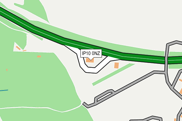
IP10 0NZ is located in the Priory Heath electoral ward, within the local authority district of Ipswich and the English Parliamentary constituency of Ipswich. The Sub Integrated Care Board (ICB) Location is NHS Suffolk and North East Essex ICB - 06L and the police force is Suffolk. This postcode has been in use since October 2008.


GetTheData
Source: OS OpenMap – Local (Ordnance Survey)
Source: OS VectorMap District (Ordnance Survey)
Licence: Open Government Licence (requires attribution)
| Easting | 618746 |
| Northing | 240915 |
| Latitude | 52.023500 |
| Longitude | 1.186932 |
GetTheData
Source: Open Postcode Geo
Licence: Open Government Licence
| Country | England |
| Postcode District | IP10 |
| ➜ IP10 open data dashboard ➜ See where IP10 is on a map | |
GetTheData
Source: Land Registry Price Paid Data
Licence: Open Government Licence
Elevation or altitude of IP10 0NZ as distance above sea level:
| Metres | Feet | |
|---|---|---|
| Elevation | 40m | 131ft |
Elevation is measured from the approximate centre of the postcode, to the nearest point on an OS contour line from OS Terrain 50, which has contour spacing of ten vertical metres.
➜ How high above sea level am I? Find the elevation of your current position using your device's GPS.
GetTheData
Source: Open Postcode Elevation
Licence: Open Government Licence
| Ward | Priory Heath |
| Constituency | Ipswich |
GetTheData
Source: ONS Postcode Database
Licence: Open Government Licence
| June 2022 | Violence and sexual offences | On or near Petrol Station | 14m |
| May 2022 | Violence and sexual offences | On or near Petrol Station | 14m |
| May 2022 | Vehicle crime | On or near Petrol Station | 14m |
| ➜ Get more crime data in our Crime section | |||
GetTheData
Source: data.police.uk
Licence: Open Government Licence
| Shelter (Downham Boulevard) | Ravenswood | 593m |
| Shelter (Downham Boulevard) | Ravenswood | 617m |
| Cranberry Square (Alnesbourn Crescent) | Ravenswood | 778m |
| Cranberry Square (Alnesbourn Crescent) | Ravenswood | 783m |
| Primary School (Ravenswood Road) | Ravenswood | 891m |
| Derby Road (Ipswich) Station | 3km |
| Ipswich Station | 4.2km |
GetTheData
Source: NaPTAN
Licence: Open Government Licence
GetTheData
Source: ONS Postcode Database
Licence: Open Government Licence


➜ Get more ratings from the Food Standards Agency
GetTheData
Source: Food Standards Agency
Licence: FSA terms & conditions
| Last Collection | |||
|---|---|---|---|
| Location | Mon-Fri | Sat | Distance |
| Alnesbourne Priory | 17:30 | 09:00 | 277m |
| Ravenswood Avenue | 17:30 | 12:00 | 866m |
| Felixstowe Road Post Office | 17:30 | 12:15 | 984m |
GetTheData
Source: Dracos
Licence: Creative Commons Attribution-ShareAlike
| Facility | Distance |
|---|---|
| Ipswich Academy Braziers Wood Road, Ipswich Artificial Grass Pitch, Studio, Sports Hall | 762m |
| Priory Park Golf Course Priory Park, Nacton Golf | 860m |
| Ravenswood Community Primary School Ravenswood Avenue, Ipswich Grass Pitches | 862m |
GetTheData
Source: Active Places
Licence: Open Government Licence
| School | Phase of Education | Distance |
|---|---|---|
| Ipswich Academy Braziers Wood Road, Ipswich, IP3 0SP | Secondary | 748m |
| Ravenswood Community Primary School Ravenswood Avenue, Ipswich, IP3 9UA | Primary | 855m |
| Morland Church of England Primary School Morland Road, Ipswich, IP3 0LH | Primary | 932m |
GetTheData
Source: Edubase
Licence: Open Government Licence
The below table lists the International Territorial Level (ITL) codes (formerly Nomenclature of Territorial Units for Statistics (NUTS) codes) and Local Administrative Units (LAU) codes for IP10 0NZ:
| ITL 1 Code | Name |
|---|---|
| TLH | East |
| ITL 2 Code | Name |
| TLH1 | East Anglia |
| ITL 3 Code | Name |
| TLH14 | Suffolk CC |
| LAU 1 Code | Name |
| E07000202 | Ipswich |
GetTheData
Source: ONS Postcode Directory
Licence: Open Government Licence
The below table lists the Census Output Area (OA), Lower Layer Super Output Area (LSOA), and Middle Layer Super Output Area (MSOA) for IP10 0NZ:
| Code | Name | |
|---|---|---|
| OA | E00170866 | |
| LSOA | E01033127 | Ipswich 014E |
| MSOA | E02006258 | Ipswich 014 |
GetTheData
Source: ONS Postcode Directory
Licence: Open Government Licence
| IP10 0JR | Alnesbourne Priory | 318m |
| IP3 9UZ | Fen Bight Walk | 407m |
| IP3 9WF | Dunwich Close | 486m |
| IP3 9WE | Elvedon Close | 505m |
| IP3 0SQ | Braziers Wood Road | 526m |
| IP3 9GW | Alnesbourn Crescent | 550m |
| IP3 0SG | Platters Close | 588m |
| IP3 0SB | Braziers Wood Road | 601m |
| IP3 9UU | Boysenberry Walk | 611m |
| IP3 9UX | Fen Bight Circle | 612m |
GetTheData
Source: Open Postcode Geo; Land Registry Price Paid Data
Licence: Open Government Licence