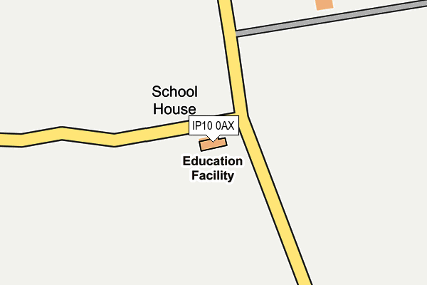
IP10 0AX is located in the Orwell & Villages electoral ward, within the local authority district of East Suffolk and the English Parliamentary constituency of Suffolk Coastal. The Sub Integrated Care Board (ICB) Location is NHS Suffolk and North East Essex ICB - 06L and the police force is Suffolk. This postcode has been in use since January 1980.


GetTheData
Source: OS OpenMap – Local (Ordnance Survey)
Source: OS VectorMap District (Ordnance Survey)
Licence: Open Government Licence (requires attribution)
| Easting | 625096 |
| Northing | 241858 |
| Latitude | 52.029426 |
| Longitude | 1.279945 |
GetTheData
Source: Open Postcode Geo
Licence: Open Government Licence
| Country | England |
| Postcode District | IP10 |
| ➜ IP10 open data dashboard ➜ See where IP10 is on a map | |
GetTheData
Source: Land Registry Price Paid Data
Licence: Open Government Licence
Elevation or altitude of IP10 0AX as distance above sea level:
| Metres | Feet | |
|---|---|---|
| Elevation | 20m | 66ft |
Elevation is measured from the approximate centre of the postcode, to the nearest point on an OS contour line from OS Terrain 50, which has contour spacing of ten vertical metres.
➜ How high above sea level am I? Find the elevation of your current position using your device's GPS.
GetTheData
Source: Open Postcode Elevation
Licence: Open Government Licence
| Ward | Orwell & Villages |
| Constituency | Suffolk Coastal |
GetTheData
Source: ONS Postcode Database
Licence: Open Government Licence
| School (A1094) | Bucklesham | 30m |
| School (A1094) | Bucklesham | 35m |
| School (Main Road) | Bucklesham | 47m |
| School (Main Road) | Bucklesham | 57m |
| Shannon (Bucklesham Road) | Bucklesham | 719m |
GetTheData
Source: NaPTAN
Licence: Open Government Licence
GetTheData
Source: ONS Postcode Database
Licence: Open Government Licence


➜ Get more ratings from the Food Standards Agency
GetTheData
Source: Food Standards Agency
Licence: FSA terms & conditions
| Last Collection | |||
|---|---|---|---|
| Location | Mon-Fri | Sat | Distance |
| Limetree Cottage | 16:30 | 10:15 | 834m |
| Post Office 39 Levington Lane | 16:15 | 09:30 | 846m |
| Forge Close | 16:00 | 09:30 | 1,062m |
GetTheData
Source: Dracos
Licence: Creative Commons Attribution-ShareAlike
| Facility | Distance |
|---|---|
| Bucklesham Primary School Bucklesham, Ipswich Grass Pitches | 0m |
| Bucklesham Playing Field Field View, Bucklesham, Ipswich Grass Pitches | 1km |
| Amberfield School (Closed) Nacton, Ipswich Grass Pitches, Sports Hall | 2.9km |
GetTheData
Source: Active Places
Licence: Open Government Licence
| School | Phase of Education | Distance |
|---|---|---|
| Bucklesham Primary School Main Road, Bucklesham, Ipswich, IP10 0AX | Primary | 9m |
| Birchwood Primary School Valiant Road, Martlesham Heath, Ipswich, IP5 3SP | Primary | 3.5km |
| Nacton Church of England Primary School The Street, Nacton, Ipswich, IP10 0EU | Primary | 3.6km |
GetTheData
Source: Edubase
Licence: Open Government Licence
The below table lists the International Territorial Level (ITL) codes (formerly Nomenclature of Territorial Units for Statistics (NUTS) codes) and Local Administrative Units (LAU) codes for IP10 0AX:
| ITL 1 Code | Name |
|---|---|
| TLH | East |
| ITL 2 Code | Name |
| TLH1 | East Anglia |
| ITL 3 Code | Name |
| TLH14 | Suffolk CC |
| LAU 1 Code | Name |
| E07000244 | East Suffolk |
GetTheData
Source: ONS Postcode Directory
Licence: Open Government Licence
The below table lists the Census Output Area (OA), Lower Layer Super Output Area (LSOA), and Middle Layer Super Output Area (MSOA) for IP10 0AX:
| Code | Name | |
|---|---|---|
| OA | E00153972 | |
| LSOA | E01030198 | Suffolk Coastal 010F |
| MSOA | E02006296 | Suffolk Coastal 010 |
GetTheData
Source: ONS Postcode Directory
Licence: Open Government Licence
| IP10 0AY | 515m | |
| IP10 0EA | Green Crescent | 673m |
| IP10 0DY | St Marys Park | 718m |
| IP10 0BN | Heath Cottages | 741m |
| IP10 0DX | Church Lane | 753m |
| IP10 0DR | Main Road | 793m |
| IP10 0DZ | Levington Lane | 803m |
| IP10 0EF | Street Farm Close | 815m |
| IP10 0DU | Church Close | 835m |
| IP10 0BW | 848m |
GetTheData
Source: Open Postcode Geo; Land Registry Price Paid Data
Licence: Open Government Licence