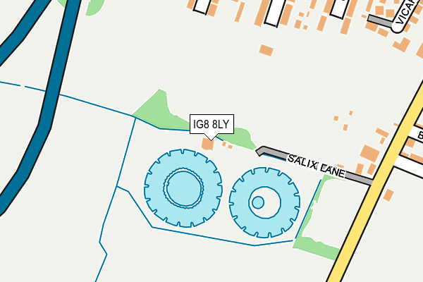
IG8 8LY is located in the Fullwell electoral ward, within the London borough of Redbridge and the English Parliamentary constituency of Ilford North. The Sub Integrated Care Board (ICB) Location is NHS North East London ICB - A3A8R and the police force is Metropolitan Police. This postcode has been in use since March 2011.


GetTheData
Source: OS OpenMap – Local (Ordnance Survey)
Source: OS VectorMap District (Ordnance Survey)
Licence: Open Government Licence (requires attribution)
| Easting | 542109 |
| Northing | 190900 |
| Latitude | 51.599023 |
| Longitude | 0.050424 |
GetTheData
Source: Open Postcode Geo
Licence: Open Government Licence
| Country | England |
| Postcode District | IG8 |
| ➜ IG8 open data dashboard ➜ See where IG8 is on a map ➜ Where is Woodford? | |
GetTheData
Source: Land Registry Price Paid Data
Licence: Open Government Licence
Elevation or altitude of IG8 8LY as distance above sea level:
| Metres | Feet | |
|---|---|---|
| Elevation | 20m | 66ft |
Elevation is measured from the approximate centre of the postcode, to the nearest point on an OS contour line from OS Terrain 50, which has contour spacing of ten vertical metres.
➜ How high above sea level am I? Find the elevation of your current position using your device's GPS.
GetTheData
Source: Open Postcode Elevation
Licence: Open Government Licence
| Ward | Fullwell |
| Constituency | Ilford North |
GetTheData
Source: ONS Postcode Database
Licence: Open Government Licence
| June 2022 | Vehicle crime | On or near Roding Lane North | 256m |
| June 2022 | Anti-social behaviour | On or near Pedestrian Subway | 317m |
| June 2022 | Anti-social behaviour | On or near Highfield Road | 396m |
| ➜ Get more crime data in our Crime section | |||
GetTheData
Source: data.police.uk
Licence: Open Government Licence
| Beaumaris Drive (Chigwell Road) | Woodford Bridge | 502m |
| Chigwell Road Broadmead Road (Chigwell Road) | Woodford Bridge | 525m |
| Beaumaris Drive | Woodford Bridge | 532m |
| Broadmead Road Woodford Bridge (Chigwell Road) | Woodford Bridge | 578m |
| Broadmead Road Chigwell Road (Broadmead Road) | Woodford Bridge | 602m |
| Woodford Underground Station | Woodford | 1,436m |
| Highams Park Station | 3.7km |
| Wood Street Station | 3.9km |
| Ilford Station | 4.6km |
GetTheData
Source: NaPTAN
Licence: Open Government Licence
GetTheData
Source: ONS Postcode Database
Licence: Open Government Licence


➜ Get more ratings from the Food Standards Agency
GetTheData
Source: Food Standards Agency
Licence: FSA terms & conditions
| Last Collection | |||
|---|---|---|---|
| Location | Mon-Fri | Sat | Distance |
| Uplands Road | 17:15 | 12:00 | 410m |
| Highfield Road | 17:30 | 12:00 | 419m |
| Beaumaris Drive | 17:00 | 12:00 | 529m |
GetTheData
Source: Dracos
Licence: Creative Commons Attribution-ShareAlike
| Facility | Distance |
|---|---|
| South Woodford Cricket And Sports Ground Highfield Road, Woodford Green Grass Pitches | 158m |
| Wanstead Rugby Club Roding Lane North, Roding Lane North, Woodford Green Grass Pitches | 275m |
| Caterham High School Sports Ground Wensleydale Avenue, Ilford Grass Pitches | 401m |
GetTheData
Source: Active Places
Licence: Open Government Licence
| School | Phase of Education | Distance |
|---|---|---|
| Roding Primary School Roding Lane North, Woodford Bridge, Woodford Green, IG8 8NP | Primary | 636m |
| Glade Primary School Atherton Road, Clayhall, Ilford, IG5 0PF | Primary | 720m |
| Caterham High School Caterham Avenue, Clayhall, Ilford, IG5 0QW | Secondary | 999m |
GetTheData
Source: Edubase
Licence: Open Government Licence
The below table lists the International Territorial Level (ITL) codes (formerly Nomenclature of Territorial Units for Statistics (NUTS) codes) and Local Administrative Units (LAU) codes for IG8 8LY:
| ITL 1 Code | Name |
|---|---|
| TLI | London |
| ITL 2 Code | Name |
| TLI5 | Outer London - East and North East |
| ITL 3 Code | Name |
| TLI53 | Redbridge and Waltham Forest |
| LAU 1 Code | Name |
| E09000026 | Redbridge |
GetTheData
Source: ONS Postcode Directory
Licence: Open Government Licence
The below table lists the Census Output Area (OA), Lower Layer Super Output Area (LSOA), and Middle Layer Super Output Area (MSOA) for IG8 8LY:
| Code | Name | |
|---|---|---|
| OA | E00018914 | |
| LSOA | E01003763 | Redbridge 009E |
| MSOA | E02000759 | Redbridge 009 |
GetTheData
Source: ONS Postcode Directory
Licence: Open Government Licence
| IG8 8JH | Canfield Road | 265m |
| IG8 8NA | Roding Lane North | 267m |
| IG8 8JJ | Canfield Road | 283m |
| IG8 8JB | Highfield Road | 292m |
| IG8 8JD | Highfield Road | 300m |
| IG8 8JW | Uplands Road | 306m |
| IG8 8NJ | Vicarage Road | 313m |
| IG8 8FJ | Fitzherbert Close | 313m |
| IG8 8JP | Uplands Road | 328m |
| IG8 8JF | Crownhill Road | 328m |
GetTheData
Source: Open Postcode Geo; Land Registry Price Paid Data
Licence: Open Government Licence