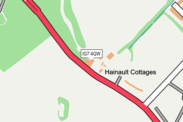
IG7 4QW is located in the Hainault electoral ward, within the London borough of Redbridge and the English Parliamentary constituency of Ilford North. The Sub Integrated Care Board (ICB) Location is NHS North East London ICB - A3A8R and the police force is Metropolitan Police. This postcode has been in use since January 1980.


GetTheData
Source: OS OpenMap – Local (Ordnance Survey)
Source: OS VectorMap District (Ordnance Survey)
Licence: Open Government Licence (requires attribution)
| Easting | 547892 |
| Northing | 191831 |
| Latitude | 51.605902 |
| Longitude | 0.134251 |
GetTheData
Source: Open Postcode Geo
Licence: Open Government Licence
| Country | England |
| Postcode District | IG7 |
| ➜ IG7 open data dashboard ➜ See where IG7 is on a map | |
GetTheData
Source: Land Registry Price Paid Data
Licence: Open Government Licence
Elevation or altitude of IG7 4QW as distance above sea level:
| Metres | Feet | |
|---|---|---|
| Elevation | 50m | 164ft |
Elevation is measured from the approximate centre of the postcode, to the nearest point on an OS contour line from OS Terrain 50, which has contour spacing of ten vertical metres.
➜ How high above sea level am I? Find the elevation of your current position using your device's GPS.
GetTheData
Source: Open Postcode Elevation
Licence: Open Government Licence
| Ward | Hainault |
| Constituency | Ilford North |
GetTheData
Source: ONS Postcode Database
Licence: Open Government Licence
| June 2022 | Vehicle crime | On or near Whalebone Lane North | 473m |
| June 2022 | Vehicle crime | On or near Whalebone Lane North | 473m |
| June 2022 | Vehicle crime | On or near Whalebone Lane North | 473m |
| ➜ Get more crime data in our Crime section | |||
GetTheData
Source: data.police.uk
Licence: Open Government Licence
| Hainault Forest Golf Club (Romford Road) | Hainault | 87m |
| Hainault Forest Golf Club (Romford Road) | Hainault | 100m |
| Forest Road (Ig7) (Romford Road) | Hainault | 409m |
| Forest Road (Ig7) (Romford Road) | Hainault | 410m |
| Whalebone Lane North (Romford Road) | Hainault | 434m |
| Chadwell Heath Station | 4.2km |
| Goodmayes Station | 4.8km |
| Romford Station | 4.8km |
GetTheData
Source: NaPTAN
Licence: Open Government Licence
| Percentage of properties with Next Generation Access | 0.0% |
| Percentage of properties with Superfast Broadband | 0.0% |
| Percentage of properties with Ultrafast Broadband | 0.0% |
| Percentage of properties with Full Fibre Broadband | 0.0% |
Superfast Broadband is between 30Mbps and 300Mbps
Ultrafast Broadband is > 300Mbps
| Percentage of properties unable to receive 2Mbps | 0.0% |
| Percentage of properties unable to receive 5Mbps | 100.0% |
| Percentage of properties unable to receive 10Mbps | 100.0% |
| Percentage of properties unable to receive 30Mbps | 100.0% |
GetTheData
Source: Ofcom
Licence: Ofcom Terms of Use (requires attribution)
GetTheData
Source: ONS Postcode Database
Licence: Open Government Licence


➜ Get more ratings from the Food Standards Agency
GetTheData
Source: Food Standards Agency
Licence: FSA terms & conditions
| Last Collection | |||
|---|---|---|---|
| Location | Mon-Fri | Sat | Distance |
| Falconer Road | 17:30 | 12:00 | 1,068m |
| New North Road Post Office | 17:30 | 12:15 | 1,237m |
| Regarder Road | 17:30 | 12:00 | 1,532m |
GetTheData
Source: Dracos
Licence: Creative Commons Attribution-ShareAlike
| Facility | Distance |
|---|---|
| Hainault Golf Club Romford Road, Chigwell Golf | 63m |
| Redbridge Cycling Centre Forest Road, Ilford Cycling | 431m |
| Elmbridge The Venue (Closed) Forest Road, Ilford Grass Pitches | 1.2km |
GetTheData
Source: Active Places
Licence: Open Government Licence
| School | Phase of Education | Distance |
|---|---|---|
| Forest Academy Harbourer Road, Hainault, Ilford, IG6 3TN | Secondary | 1.4km |
| Coppice Primary School Coppice Primary School, Manford Way, Chigwell, IG7 4AL | Primary | 1.6km |
| John Bramston Primary School Newcastle Avenue, New North Road, Hainault, IG6 3EE | Primary | 1.9km |
GetTheData
Source: Edubase
Licence: Open Government Licence
The below table lists the International Territorial Level (ITL) codes (formerly Nomenclature of Territorial Units for Statistics (NUTS) codes) and Local Administrative Units (LAU) codes for IG7 4QW:
| ITL 1 Code | Name |
|---|---|
| TLI | London |
| ITL 2 Code | Name |
| TLI5 | Outer London - East and North East |
| ITL 3 Code | Name |
| TLI53 | Redbridge and Waltham Forest |
| LAU 1 Code | Name |
| E09000026 | Redbridge |
GetTheData
Source: ONS Postcode Directory
Licence: Open Government Licence
The below table lists the Census Output Area (OA), Lower Layer Super Output Area (LSOA), and Middle Layer Super Output Area (MSOA) for IG7 4QW:
| Code | Name | |
|---|---|---|
| OA | E00018715 | |
| LSOA | E01003726 | Redbridge 002D |
| MSOA | E02000752 | Redbridge 002 |
GetTheData
Source: ONS Postcode Directory
Licence: Open Government Licence
| IG7 4QP | Five Oaks Lane | 303m |
| RM5 2DP | Romford Road | 645m |
| IG6 3UT | Fowler Road | 799m |
| IG6 3JP | Forest Road | 805m |
| IG6 3SZ | Peregrine Road | 842m |
| IG6 3UF | Roebuck Road | 858m |
| IG6 3SS | Peregrine Road | 968m |
| IG6 3SU | Sylvester Gardens | 1019m |
| IG6 3ST | Falconer Road | 1020m |
| IG6 3TU | Roebuck Road | 1049m |
GetTheData
Source: Open Postcode Geo; Land Registry Price Paid Data
Licence: Open Government Licence