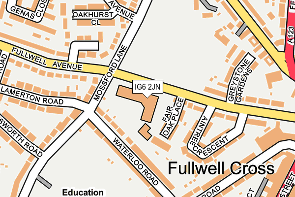
IG6 2JN is located in the Fullwell electoral ward, within the London borough of Redbridge and the English Parliamentary constituency of Ilford North. The Sub Integrated Care Board (ICB) Location is NHS North East London ICB - A3A8R and the police force is Metropolitan Police. This postcode has been in use since June 1999.


GetTheData
Source: OS OpenMap – Local (Ordnance Survey)
Source: OS VectorMap District (Ordnance Survey)
Licence: Open Government Licence (requires attribution)
| Easting | 544180 |
| Northing | 190430 |
| Latitude | 51.594273 |
| Longitude | 0.080085 |
GetTheData
Source: Open Postcode Geo
Licence: Open Government Licence
| Country | England |
| Postcode District | IG6 |
| ➜ IG6 open data dashboard ➜ See where IG6 is on a map ➜ Where is London? | |
GetTheData
Source: Land Registry Price Paid Data
Licence: Open Government Licence
Elevation or altitude of IG6 2JN as distance above sea level:
| Metres | Feet | |
|---|---|---|
| Elevation | 30m | 98ft |
Elevation is measured from the approximate centre of the postcode, to the nearest point on an OS contour line from OS Terrain 50, which has contour spacing of ten vertical metres.
➜ How high above sea level am I? Find the elevation of your current position using your device's GPS.
GetTheData
Source: Open Postcode Elevation
Licence: Open Government Licence
| Ward | Fullwell |
| Constituency | Ilford North |
GetTheData
Source: ONS Postcode Database
Licence: Open Government Licence
| January 2024 | Violence and sexual offences | On or near Genas Close | 317m |
| January 2024 | Anti-social behaviour | On or near Genas Close | 317m |
| January 2024 | Other theft | On or near Parking Area | 390m |
| ➜ Get more crime data in our Crime section | |||
GetTheData
Source: data.police.uk
Licence: Open Government Licence
| Aintree Crescent | Fulwell Cross | 91m |
| Aintree Crescent | Fulwell Cross | 104m |
| Mossford Lane Fullwell Avenue (Fullwell Avenue) | Fulwell Cross | 127m |
| Mossford Lane Fullwell Avenue (Fullwell Avenue) | Fulwell Cross | 173m |
| Fencepiece Road (Tomswood Hill) | Fulwell Cross | 253m |
| Fairlop Underground Station | Fulwell Cross | 771m |
| Barkingside Underground Station | Barkingside | 1,122m |
| Hainault Underground Station | Hainault | 1,397m |
| Seven Kings Station | 3.6km |
| Goodmayes Station | 3.8km |
| Ilford Station | 4km |
GetTheData
Source: NaPTAN
Licence: Open Government Licence
GetTheData
Source: ONS Postcode Database
Licence: Open Government Licence


➜ Get more ratings from the Food Standards Agency
GetTheData
Source: Food Standards Agency
Licence: FSA terms & conditions
| Last Collection | |||
|---|---|---|---|
| Location | Mon-Fri | Sat | Distance |
| Barkingside Broadway | 17:30 | 12:15 | 330m |
| High Street | 17:30 | 551m | |
| High Street Barkingside | 17:30 | 12:00 | 553m |
GetTheData
Source: Dracos
Licence: Creative Commons Attribution-ShareAlike
| Facility | Distance |
|---|---|
| Ilford County High School Fremantle Road, Ilford Sports Hall, Health and Fitness Gym, Grass Pitches, Swimming Pool | 339m |
| Fullwell Cross Leisure Centre High Street, Barkingside, Ilford Swimming Pool, Health and Fitness Gym, Studio | 370m |
| Kantor King Solomon High School Forest Road, Ilford Sports Hall, Grass Pitches | 523m |
GetTheData
Source: Active Places
Licence: Open Government Licence
| School | Phase of Education | Distance |
|---|---|---|
| Clore Tikva School 115 Fullwell Avenue, Barkingside, Clore Tikva School, Ilford, IG6 2JN | Primary | 0m |
| Mossford Green Primary School Fairlop Road, Barkingside, Ilford, IG6 2EW | Primary | 315m |
| Ilford County High School Fremantle Road, Barkingside, Ilford, IG6 2JB | Secondary | 339m |
GetTheData
Source: Edubase
Licence: Open Government Licence
The below table lists the International Territorial Level (ITL) codes (formerly Nomenclature of Territorial Units for Statistics (NUTS) codes) and Local Administrative Units (LAU) codes for IG6 2JN:
| ITL 1 Code | Name |
|---|---|
| TLI | London |
| ITL 2 Code | Name |
| TLI5 | Outer London - East and North East |
| ITL 3 Code | Name |
| TLI53 | Redbridge and Waltham Forest |
| LAU 1 Code | Name |
| E09000026 | Redbridge |
GetTheData
Source: ONS Postcode Directory
Licence: Open Government Licence
The below table lists the Census Output Area (OA), Lower Layer Super Output Area (LSOA), and Middle Layer Super Output Area (MSOA) for IG6 2JN:
| Code | Name | |
|---|---|---|
| OA | E00018652 | |
| LSOA | E01003705 | Redbridge 010A |
| MSOA | E02000760 | Redbridge 010 |
GetTheData
Source: ONS Postcode Directory
Licence: Open Government Licence
| IG6 2GY | Fair Oak Place | 85m |
| IG6 2HE | Fullwell Avenue | 99m |
| IG6 2EG | Waterloo Road | 133m |
| IG6 2HF | Fullwell Avenue | 140m |
| IG6 2HD | Aintree Crescent | 153m |
| IG6 2HZ | Mossford Lane | 155m |
| IG6 2HB | Fullwell Avenue | 166m |
| IG6 2LR | Mossford Lane | 184m |
| IG6 2JQ | Fullwell Avenue | 193m |
| IG6 2HH | Greystone Gardens | 205m |
GetTheData
Source: Open Postcode Geo; Land Registry Price Paid Data
Licence: Open Government Licence