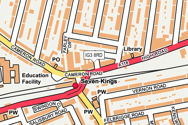
IG3 8RD is located in the Seven Kings electoral ward, within the London borough of Redbridge and the English Parliamentary constituency of Ilford South. The Sub Integrated Care Board (ICB) Location is NHS North East London ICB - A3A8R and the police force is Metropolitan Police. This postcode has been in use since January 1980.


GetTheData
Source: OS OpenMap – Local (Ordnance Survey)
Source: OS VectorMap District (Ordnance Survey)
Licence: Open Government Licence (requires attribution)
| Easting | 545522 |
| Northing | 187161 |
| Latitude | 51.564555 |
| Longitude | 0.098091 |
GetTheData
Source: Open Postcode Geo
Licence: Open Government Licence
| Country | England |
| Postcode District | IG3 |
| ➜ IG3 open data dashboard ➜ See where IG3 is on a map ➜ Where is London? | |
GetTheData
Source: Land Registry Price Paid Data
Licence: Open Government Licence
Elevation or altitude of IG3 8RD as distance above sea level:
| Metres | Feet | |
|---|---|---|
| Elevation | 10m | 33ft |
Elevation is measured from the approximate centre of the postcode, to the nearest point on an OS contour line from OS Terrain 50, which has contour spacing of ten vertical metres.
➜ How high above sea level am I? Find the elevation of your current position using your device's GPS.
GetTheData
Source: Open Postcode Elevation
Licence: Open Government Licence
| Ward | Seven Kings |
| Constituency | Ilford South |
GetTheData
Source: ONS Postcode Database
Licence: Open Government Licence
| January 2024 | Anti-social behaviour | On or near Parking Area | 163m |
| January 2024 | Anti-social behaviour | On or near Parking Area | 163m |
| January 2024 | Anti-social behaviour | On or near Parking Area | 163m |
| ➜ Get more crime data in our Crime section | |||
GetTheData
Source: data.police.uk
Licence: Open Government Licence
| Seven Kings (High Road) | Seven Kings | 37m |
| Seven Kings (High Road) | Seven Kings | 59m |
| New Road High Road (High Road) | Seven Kings | 251m |
| Chester Road (Ig3) | Seven Kings | 299m |
| Chester Road (Ig3) | Seven Kings | 314m |
| Newbury Park Underground Station | Newbury Park | 1,363m |
| Seven Kings Station | 0.1km |
| Goodmayes Station | 0.9km |
| Ilford Station | 2.1km |
GetTheData
Source: NaPTAN
Licence: Open Government Licence
GetTheData
Source: ONS Postcode Database
Licence: Open Government Licence


➜ Get more ratings from the Food Standards Agency
GetTheData
Source: Food Standards Agency
Licence: FSA terms & conditions
| Last Collection | |||
|---|---|---|---|
| Location | Mon-Fri | Sat | Distance |
| Seven Kings Post Office | 17:30 | 12:30 | 58m |
| High Road | 17:15 | 12:00 | 219m |
| Gartmore Road | 16:45 | 12:00 | 414m |
GetTheData
Source: Dracos
Licence: Creative Commons Attribution-ShareAlike
| Facility | Distance |
|---|---|
| Palmer Catholic Academy Aldborough Road South, Ilford Sports Hall, Health and Fitness Gym | 385m |
| Ark Isaac Newton Academy Cricklefield Place, Ilford Sports Hall, Artificial Grass Pitch, Studio | 546m |
| Cricklefields Athletics Ground Cricklefield Place, Ilford Grass Pitches, Athletics | 624m |
GetTheData
Source: Active Places
Licence: Open Government Licence
| School | Phase of Education | Distance |
|---|---|---|
| The Palmer Catholic Academy Aldborough Road South, Seven Kings, Ilford, IG3 8EU | Secondary | 248m |
| Ark Isaac Newton Academy 1 Cricklefield Place, Ilford, IG1 1FY | All-through | 552m |
| St Aidan's Catholic Primary Academy Benton Road, Ilford, IG1 4AS | Primary | 624m |
GetTheData
Source: Edubase
Licence: Open Government Licence
The below table lists the International Territorial Level (ITL) codes (formerly Nomenclature of Territorial Units for Statistics (NUTS) codes) and Local Administrative Units (LAU) codes for IG3 8RD:
| ITL 1 Code | Name |
|---|---|
| TLI | London |
| ITL 2 Code | Name |
| TLI5 | Outer London - East and North East |
| ITL 3 Code | Name |
| TLI53 | Redbridge and Waltham Forest |
| LAU 1 Code | Name |
| E09000026 | Redbridge |
GetTheData
Source: ONS Postcode Directory
Licence: Open Government Licence
The below table lists the Census Output Area (OA), Lower Layer Super Output Area (LSOA), and Middle Layer Super Output Area (MSOA) for IG3 8RD:
| Code | Name | |
|---|---|---|
| OA | E00018938 | |
| LSOA | E01003767 | Redbridge 024B |
| MSOA | E02000774 | Redbridge 024 |
GetTheData
Source: ONS Postcode Directory
Licence: Open Government Licence
| IG3 8RA | High Road | 9m |
| IG3 8RG | High Road | 13m |
| IG3 8LU | Cambridge Road | 59m |
| IG3 8LA | Cameron Road | 67m |
| IG3 8RQ | High Road | 123m |
| IG3 8LT | Farley Drive | 130m |
| IG3 8LB | Cameron Road | 135m |
| IG3 8BY | Seven Kings Road | 152m |
| IG3 8DH | Balmoral Gardens | 153m |
| IG3 8NE | Lansdowne Road | 167m |
GetTheData
Source: Open Postcode Geo; Land Registry Price Paid Data
Licence: Open Government Licence