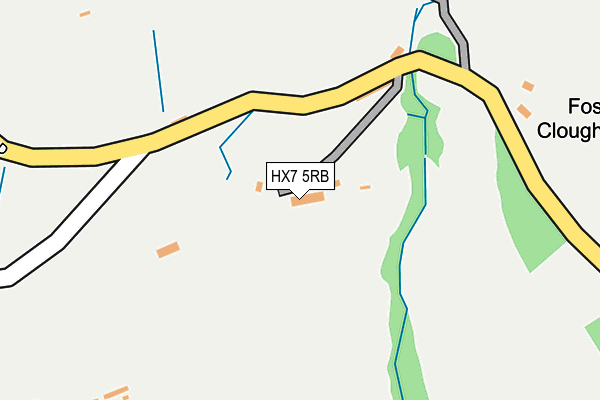
HX7 5RB is located in the Luddendenfoot electoral ward, within the metropolitan district of Calderdale and the English Parliamentary constituency of Calder Valley. The Sub Integrated Care Board (ICB) Location is NHS West Yorkshire ICB - 02T and the police force is West Yorkshire. This postcode has been in use since January 1980.


GetTheData
Source: OS OpenMap – Local (Ordnance Survey)
Source: OS VectorMap District (Ordnance Survey)
Licence: Open Government Licence (requires attribution)
| Easting | 401747 |
| Northing | 426984 |
| Latitude | 53.739238 |
| Longitude | -1.974993 |
GetTheData
Source: Open Postcode Geo
Licence: Open Government Licence
| Country | England |
| Postcode District | HX7 |
| ➜ HX7 open data dashboard ➜ See where HX7 is on a map | |
GetTheData
Source: Land Registry Price Paid Data
Licence: Open Government Licence
Elevation or altitude of HX7 5RB as distance above sea level:
| Metres | Feet | |
|---|---|---|
| Elevation | 240m | 787ft |
Elevation is measured from the approximate centre of the postcode, to the nearest point on an OS contour line from OS Terrain 50, which has contour spacing of ten vertical metres.
➜ How high above sea level am I? Find the elevation of your current position using your device's GPS.
GetTheData
Source: Open Postcode Elevation
Licence: Open Government Licence
| Ward | Luddendenfoot |
| Constituency | Calder Valley |
GetTheData
Source: ONS Postcode Database
Licence: Open Government Licence
| Hullet Drive | Mytholmroyd | 524m |
| Hullet Close | Mytholmroyd | 546m |
| Banksfield Crescent (Bankfields Avenue) | Mytholmroyd | 651m |
| Bankfields Ave Birchenlee Close (Bankfields Avenue) | Mytholmroyd | 683m |
| Midgley Road Spring Villas (Midgley Road) | Mytholmroyd | 685m |
| Mytholmroyd Station | 1.2km |
| Hebden Bridge Station | 2.3km |
| Sowerby Bridge Station | 5.7km |
GetTheData
Source: NaPTAN
Licence: Open Government Licence
| Percentage of properties with Next Generation Access | 100.0% |
| Percentage of properties with Superfast Broadband | 71.4% |
| Percentage of properties with Ultrafast Broadband | 0.0% |
| Percentage of properties with Full Fibre Broadband | 0.0% |
Superfast Broadband is between 30Mbps and 300Mbps
Ultrafast Broadband is > 300Mbps
| Percentage of properties unable to receive 2Mbps | 0.0% |
| Percentage of properties unable to receive 5Mbps | 0.0% |
| Percentage of properties unable to receive 10Mbps | 0.0% |
| Percentage of properties unable to receive 30Mbps | 28.6% |
GetTheData
Source: Ofcom
Licence: Ofcom Terms of Use (requires attribution)
Estimated total energy consumption in HX7 5RB by fuel type, 2015.
| Consumption (kWh) | 21,537 |
|---|---|
| Meter count | 6 |
| Mean (kWh/meter) | 3,589 |
| Median (kWh/meter) | 3,602 |
GetTheData
Source: Postcode level gas estimates: 2015 (experimental)
Source: Postcode level electricity estimates: 2015 (experimental)
Licence: Open Government Licence
GetTheData
Source: ONS Postcode Database
Licence: Open Government Licence


➜ Get more ratings from the Food Standards Agency
GetTheData
Source: Food Standards Agency
Licence: FSA terms & conditions
| Last Collection | |||
|---|---|---|---|
| Location | Mon-Fri | Sat | Distance |
| Mytholmroyd P.o. Box | 17:15 | 12:00 | 1,079m |
| Railway Station Mytholmroyd | 16:15 | 10:30 | 1,205m |
| 2 Cragg Road | 16:45 | 10:30 | 1,477m |
GetTheData
Source: Dracos
Licence: Creative Commons Attribution-ShareAlike
| Facility | Distance |
|---|---|
| The Calder High School Midgley Road, Mytholmroyd, Hebden Bridge Grass Pitches, Sports Hall, Outdoor Tennis Courts | 737m |
| Hebden Bridge Golf Club Wadsworth, Hebden Bridge Golf | 886m |
| White Lee Recreation Ground Burnley Road, Mytholmroyd, Hebden Bridge Grass Pitches | 925m |
GetTheData
Source: Active Places
Licence: Open Government Licence
| School | Phase of Education | Distance |
|---|---|---|
| The Calder Learning Trust Brier Hey Lane, Mytholmroyd, Hebden Bridge, HX7 5QN | All-through | 736m |
| Burnley Road Academy Burnley Road, Mytholmroyd, Hebden Bridge, HX7 5DE | Primary | 1km |
| Scout Road Academy Scout Road, Mytholmyroyd, Hebden Bridge, HX7 5JR | Primary | 1.3km |
GetTheData
Source: Edubase
Licence: Open Government Licence
The below table lists the International Territorial Level (ITL) codes (formerly Nomenclature of Territorial Units for Statistics (NUTS) codes) and Local Administrative Units (LAU) codes for HX7 5RB:
| ITL 1 Code | Name |
|---|---|
| TLE | Yorkshire and The Humber |
| ITL 2 Code | Name |
| TLE4 | West Yorkshire |
| ITL 3 Code | Name |
| TLE44 | Calderdale and Kirklees |
| LAU 1 Code | Name |
| E08000033 | Calderdale |
GetTheData
Source: ONS Postcode Directory
Licence: Open Government Licence
The below table lists the Census Output Area (OA), Lower Layer Super Output Area (LSOA), and Middle Layer Super Output Area (MSOA) for HX7 5RB:
| Code | Name | |
|---|---|---|
| OA | E00055054 | |
| LSOA | E01010917 | Calderdale 007A |
| MSOA | E02002250 | Calderdale 007 |
GetTheData
Source: ONS Postcode Directory
Licence: Open Government Licence
| HX7 5RA | Rough Bottom | 141m |
| HX7 5QZ | Foster Clough | 151m |
| HX7 5QT | Midgley Road | 409m |
| HX7 5RD | Hill House Lane Top | 468m |
| HX7 5RF | 476m | |
| HX7 5QR | Hullett Drive | 551m |
| HX7 5PP | Lee Clough Drive | 585m |
| HX7 5QP | Hullett Close | 587m |
| HX7 5QS | White Lee Croft | 607m |
| HX7 5NE | Birchenlee Close | 609m |
GetTheData
Source: Open Postcode Geo; Land Registry Price Paid Data
Licence: Open Government Licence