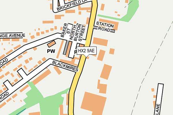
HX2 9AE is located in the Illingworth and Mixenden electoral ward, within the metropolitan district of Calderdale and the English Parliamentary constituency of Halifax. The Sub Integrated Care Board (ICB) Location is NHS West Yorkshire ICB - 02T and the police force is West Yorkshire. This postcode has been in use since January 1980.


GetTheData
Source: OS OpenMap – Local (Ordnance Survey)
Source: OS VectorMap District (Ordnance Survey)
Licence: Open Government Licence (requires attribution)
| Easting | 408247 |
| Northing | 428085 |
| Latitude | 53.749072 |
| Longitude | -1.876420 |
GetTheData
Source: Open Postcode Geo
Licence: Open Government Licence
| Country | England |
| Postcode District | HX2 |
| ➜ HX2 open data dashboard ➜ See where HX2 is on a map ➜ Where is Halifax? | |
GetTheData
Source: Land Registry Price Paid Data
Licence: Open Government Licence
Elevation or altitude of HX2 9AE as distance above sea level:
| Metres | Feet | |
|---|---|---|
| Elevation | 200m | 656ft |
Elevation is measured from the approximate centre of the postcode, to the nearest point on an OS contour line from OS Terrain 50, which has contour spacing of ten vertical metres.
➜ How high above sea level am I? Find the elevation of your current position using your device's GPS.
GetTheData
Source: Open Postcode Elevation
Licence: Open Government Licence
| Ward | Illingworth And Mixenden |
| Constituency | Halifax |
GetTheData
Source: ONS Postcode Database
Licence: Open Government Licence
| June 2022 | Violence and sexual offences | On or near Livingstone Street North | 57m |
| June 2022 | Burglary | On or near Shay Lane | 65m |
| June 2022 | Criminal damage and arson | On or near Blackmires | 82m |
| ➜ Get more crime data in our Crime section | |||
GetTheData
Source: data.police.uk
Licence: Open Government Licence
| Shay Lane Beechwood Rd (Shay Lane) | Holmfield | 23m |
| Shay Lane Beechwood Rd (Shay Lane) | Holmfield | 41m |
| Beechwood Rd Kingdom Hall (Beechwood Road) | Holmfield | 63m |
| Beechwood Rd Kingdom Hall (Beechwood Road) | Holmfield | 73m |
| Beechwood Rd Shay Ln (Beechwood Road) | Holmfield | 83m |
| Halifax Station | 3.5km |
| Sowerby Bridge Station | 5km |
GetTheData
Source: NaPTAN
Licence: Open Government Licence
| Percentage of properties with Next Generation Access | 100.0% |
| Percentage of properties with Superfast Broadband | 100.0% |
| Percentage of properties with Ultrafast Broadband | 0.0% |
| Percentage of properties with Full Fibre Broadband | 0.0% |
Superfast Broadband is between 30Mbps and 300Mbps
Ultrafast Broadband is > 300Mbps
| Percentage of properties unable to receive 2Mbps | 0.0% |
| Percentage of properties unable to receive 5Mbps | 0.0% |
| Percentage of properties unable to receive 10Mbps | 0.0% |
| Percentage of properties unable to receive 30Mbps | 0.0% |
GetTheData
Source: Ofcom
Licence: Ofcom Terms of Use (requires attribution)
GetTheData
Source: ONS Postcode Database
Licence: Open Government Licence


➜ Get more ratings from the Food Standards Agency
GetTheData
Source: Food Standards Agency
Licence: FSA terms & conditions
| Last Collection | |||
|---|---|---|---|
| Location | Mon-Fri | Sat | Distance |
| 115 Haley Hill | 17:30 | 11:45 | 2,144m |
| King Cross P.o. Box | 17:30 | 12:00 | 2,549m |
| North Bridge Business Box | 18:30 | 11:45 | 2,673m |
GetTheData
Source: Dracos
Licence: Creative Commons Attribution-ShareAlike
| Facility | Distance |
|---|---|
| Beechwood Park Heathy Lane, Illingworth, Halifax Grass Pitches | 308m |
| Holmfield Recreation Ground Shay Lane, Halifax Grass Pitches | 360m |
| The Treadmill Gym Holdsworth Road, Halifax Health and Fitness Gym, Sports Hall | 426m |
GetTheData
Source: Active Places
Licence: Open Government Licence
| School | Phase of Education | Distance |
|---|---|---|
| Trinity Academy Halifax Shay Lane, Halifax, HX2 9TZ | Secondary | 460m |
| Moorside Community Primary School Keighley Road, Ovenden, Halifax, HX2 8AP | Primary | 670m |
| The North Halifax Grammar School Moorbottom Road, Illingworth, Halifax, HX2 9SU | Secondary | 844m |
GetTheData
Source: Edubase
Licence: Open Government Licence
The below table lists the International Territorial Level (ITL) codes (formerly Nomenclature of Territorial Units for Statistics (NUTS) codes) and Local Administrative Units (LAU) codes for HX2 9AE:
| ITL 1 Code | Name |
|---|---|
| TLE | Yorkshire and The Humber |
| ITL 2 Code | Name |
| TLE4 | West Yorkshire |
| ITL 3 Code | Name |
| TLE44 | Calderdale and Kirklees |
| LAU 1 Code | Name |
| E08000033 | Calderdale |
GetTheData
Source: ONS Postcode Directory
Licence: Open Government Licence
The below table lists the Census Output Area (OA), Lower Layer Super Output Area (LSOA), and Middle Layer Super Output Area (MSOA) for HX2 9AE:
| Code | Name | |
|---|---|---|
| OA | E00055165 | |
| LSOA | E01010940 | Calderdale 006B |
| MSOA | E02002249 | Calderdale 006 |
GetTheData
Source: ONS Postcode Directory
Licence: Open Government Licence
| HX2 9AD | Shay Lane | 22m |
| HX2 9AF | Spindle Street | 22m |
| HX2 9AA | Blackmires | 65m |
| HX2 9AL | Livingstone Street North | 69m |
| HX2 9AH | Stanley Street North | 89m |
| HX2 9AJ | Burton Street | 91m |
| HX2 9AN | Baker Street North | 105m |
| HX2 9AY | Station Road | 139m |
| HX2 9AQ | Horners Buildings | 162m |
| HX2 9HE | Summerfield Court | 171m |
GetTheData
Source: Open Postcode Geo; Land Registry Price Paid Data
Licence: Open Government Licence