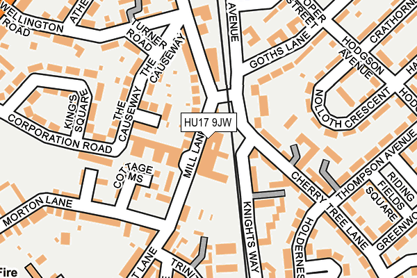
HU17 9JW is located in the Minster and Woodmansey electoral ward, within the unitary authority of East Riding of Yorkshire and the English Parliamentary constituency of Beverley and Holderness. The Sub Integrated Care Board (ICB) Location is NHS Humber and North Yorkshire ICB - 02Y and the police force is Humberside. This postcode has been in use since February 1990.


GetTheData
Source: OS OpenMap – Local (Ordnance Survey)
Source: OS VectorMap District (Ordnance Survey)
Licence: Open Government Licence (requires attribution)
| Easting | 503798 |
| Northing | 439921 |
| Latitude | 53.845168 |
| Longitude | -0.423814 |
GetTheData
Source: Open Postcode Geo
Licence: Open Government Licence
| Country | England |
| Postcode District | HU17 |
| ➜ HU17 open data dashboard ➜ See where HU17 is on a map ➜ Where is Beverley? | |
GetTheData
Source: Land Registry Price Paid Data
Licence: Open Government Licence
Elevation or altitude of HU17 9JW as distance above sea level:
| Metres | Feet | |
|---|---|---|
| Elevation | 10m | 33ft |
Elevation is measured from the approximate centre of the postcode, to the nearest point on an OS contour line from OS Terrain 50, which has contour spacing of ten vertical metres.
➜ How high above sea level am I? Find the elevation of your current position using your device's GPS.
GetTheData
Source: Open Postcode Elevation
Licence: Open Government Licence
| Ward | Minster And Woodmansey |
| Constituency | Beverley And Holderness |
GetTheData
Source: ONS Postcode Database
Licence: Open Government Licence
| January 2024 | Criminal damage and arson | On or near Knights Way | 127m |
| January 2024 | Other theft | On or near Knights Way | 127m |
| January 2024 | Other crime | On or near Knights Way | 127m |
| ➜ Get more crime data in our Crime section | |||
GetTheData
Source: data.police.uk
Licence: Open Government Licence
| Beverley Sample Avenue (Sample Avenue) | Beverley | 236m |
| Beverley Greenwood Ave (Greenwood Avenue) | Beverley | 349m |
| Beverley Norwood (Norwood) | Beverley | 359m |
| Beverley Railway Stn (Trinity Lane) | Beverley | 365m |
| Beverley Rail Station (Trinity Lane) | Beverley | 366m |
| Beverley Station | 0.3km |
| Arram Station | 4.4km |
GetTheData
Source: NaPTAN
Licence: Open Government Licence
GetTheData
Source: ONS Postcode Database
Licence: Open Government Licence


➜ Get more ratings from the Food Standards Agency
GetTheData
Source: Food Standards Agency
Licence: FSA terms & conditions
| Last Collection | |||
|---|---|---|---|
| Location | Mon-Fri | Sat | Distance |
| Railway Station | 17:00 | 12:00 | 339m |
| Coltman Avenue | 17:30 | 12:30 | 436m |
| Wednesday Market | 17:30 | 11:45 | 478m |
GetTheData
Source: Dracos
Licence: Creative Commons Attribution-ShareAlike
| Facility | Distance |
|---|---|
| Beverley Swimming Pool (Beverley) (Closed) Mill Lane, Beverley Swimming Pool | 117m |
| Church Lads & Church Girls Brigade George Street, Beverley Sports Hall | 273m |
| Time Out Ladies Health Studio (Closed) Butcher Row, Beverley Health and Fitness Gym, Studio | 451m |
GetTheData
Source: Active Places
Licence: Open Government Licence
| School | Phase of Education | Distance |
|---|---|---|
| Beverley High School Norwood, Beverley, HU17 9EX | Secondary | 473m |
| Swinemoor Primary School Burden Road, Beverley, HU17 9LW | Primary | 594m |
| Cambian Beverley School Units 19-20 Priory Road Industrial Estate, Beverley, HU17 0EW | Not applicable | 597m |
GetTheData
Source: Edubase
Licence: Open Government Licence
The below table lists the International Territorial Level (ITL) codes (formerly Nomenclature of Territorial Units for Statistics (NUTS) codes) and Local Administrative Units (LAU) codes for HU17 9JW:
| ITL 1 Code | Name |
|---|---|
| TLE | Yorkshire and The Humber |
| ITL 2 Code | Name |
| TLE1 | East Yorkshire and Northern Lincolnshire |
| ITL 3 Code | Name |
| TLE12 | East Riding of Yorkshire |
| LAU 1 Code | Name |
| E06000011 | East Riding of Yorkshire |
GetTheData
Source: ONS Postcode Directory
Licence: Open Government Licence
The below table lists the Census Output Area (OA), Lower Layer Super Output Area (LSOA), and Middle Layer Super Output Area (MSOA) for HU17 9JW:
| Code | Name | |
|---|---|---|
| OA | E00065800 | |
| LSOA | E01013038 | East Riding of Yorkshire 017A |
| MSOA | E02002700 | East Riding of Yorkshire 017 |
GetTheData
Source: ONS Postcode Directory
Licence: Open Government Licence
| HU17 9AL | Mill Lane | 39m |
| HU17 9DH | Mill Lane | 55m |
| HU17 9HA | Mill Lane Court | 78m |
| HU17 0AX | Cherry Tree Lane | 83m |
| HU17 9JN | Langdale Avenue | 94m |
| HU17 9HD | Cottage Mews | 121m |
| HU17 0AY | Cherry Tree Lane | 130m |
| HU17 9AY | Mill Lane | 137m |
| HU17 9JL | The Causeway | 144m |
| HU17 0BF | Knights Way | 153m |
GetTheData
Source: Open Postcode Geo; Land Registry Price Paid Data
Licence: Open Government Licence