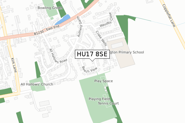
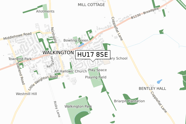
HU17 8SE lies on Beech View in Walkington, Beverley. HU17 8SE is located in the Beverley Rural electoral ward, within the unitary authority of East Riding of Yorkshire and the English Parliamentary constituency of Beverley and Holderness. The Sub Integrated Care Board (ICB) Location is NHS Humber and North Yorkshire ICB - 02Y and the police force is Humberside. This postcode has been in use since January 1980.


GetTheData
Source: OS Open Zoomstack (Ordnance Survey)
Licence: Open Government Licence (requires attribution)
Attribution: Contains OS data © Crown copyright and database right 2024
Source: Open Postcode Geo
Licence: Open Government Licence (requires attribution)
Attribution: Contains OS data © Crown copyright and database right 2024; Contains Royal Mail data © Royal Mail copyright and database right 2024; Source: Office for National Statistics licensed under the Open Government Licence v.3.0
| Easting | 500145 |
| Northing | 436940 |
| Latitude | 53.819101 |
| Longitude | -0.480285 |
GetTheData
Source: Open Postcode Geo
Licence: Open Government Licence
| Street | Beech View |
| Locality | Walkington |
| Town/City | Beverley |
| Country | England |
| Postcode District | HU17 |
| ➜ HU17 open data dashboard ➜ See where HU17 is on a map ➜ Where is Walkington? | |
GetTheData
Source: Land Registry Price Paid Data
Licence: Open Government Licence
Elevation or altitude of HU17 8SE as distance above sea level:
| Metres | Feet | |
|---|---|---|
| Elevation | 50m | 164ft |
Elevation is measured from the approximate centre of the postcode, to the nearest point on an OS contour line from OS Terrain 50, which has contour spacing of ten vertical metres.
➜ How high above sea level am I? Find the elevation of your current position using your device's GPS.
GetTheData
Source: Open Postcode Elevation
Licence: Open Government Licence
| Ward | Beverley Rural |
| Constituency | Beverley And Holderness |
GetTheData
Source: ONS Postcode Database
Licence: Open Government Licence
| January 2024 | Violence and sexual offences | On or near Parking Area | 88m |
| January 2024 | Public order | On or near Parking Area | 88m |
| November 2023 | Public order | On or near Parking Area | 88m |
| ➜ Beech View crime map and outcomes | |||
GetTheData
Source: data.police.uk
Licence: Open Government Licence
| Walkington East End (East End) | Walkington | 248m |
| Walkington East End (East End) | Walkington | 269m |
| Walkington East End (East End) | Walkington | 447m |
| Walkington East End (East End) | Walkington | 453m |
| Walkington East End (East End) | Walkington | 496m |
| Beverley Station | 4.6km |
| Cottingham Station | 6.4km |
GetTheData
Source: NaPTAN
Licence: Open Government Licence
➜ Broadband speed and availability dashboard for HU17 8SE
| Percentage of properties with Next Generation Access | 100.0% |
| Percentage of properties with Superfast Broadband | 100.0% |
| Percentage of properties with Ultrafast Broadband | 100.0% |
| Percentage of properties with Full Fibre Broadband | 100.0% |
Superfast Broadband is between 30Mbps and 300Mbps
Ultrafast Broadband is > 300Mbps
| Median download speed | 30.0Mbps |
| Average download speed | 151.0Mbps |
| Maximum download speed | 400.00Mbps |
| Median upload speed | 0.9Mbps |
| Average upload speed | 6.5Mbps |
| Maximum upload speed | 35.00Mbps |
| Percentage of properties unable to receive 2Mbps | 0.0% |
| Percentage of properties unable to receive 5Mbps | 0.0% |
| Percentage of properties unable to receive 10Mbps | 0.0% |
| Percentage of properties unable to receive 30Mbps | 0.0% |
➜ Broadband speed and availability dashboard for HU17 8SE
GetTheData
Source: Ofcom
Licence: Ofcom Terms of Use (requires attribution)
Estimated total energy consumption in HU17 8SE by fuel type, 2015.
| Consumption (kWh) | 569,051 |
|---|---|
| Meter count | 42 |
| Mean (kWh/meter) | 13,549 |
| Median (kWh/meter) | 13,317 |
| Consumption (kWh) | 181,223 |
|---|---|
| Meter count | 42 |
| Mean (kWh/meter) | 4,315 |
| Median (kWh/meter) | 3,166 |
GetTheData
Source: Postcode level gas estimates: 2015 (experimental)
Source: Postcode level electricity estimates: 2015 (experimental)
Licence: Open Government Licence
GetTheData
Source: ONS Postcode Database
Licence: Open Government Licence


➜ Get more ratings from the Food Standards Agency
GetTheData
Source: Food Standards Agency
Licence: FSA terms & conditions
| Last Collection | |||
|---|---|---|---|
| Location | Mon-Fri | Sat | Distance |
| Bentley | 16:00 | 12:00 | 2,059m |
| Normandy Avenue | 16:00 | 12:00 | 2,757m |
| Lincoln Way Post Office | 17:30 | 12:00 | 3,234m |
GetTheData
Source: Dracos
Licence: Creative Commons Attribution-ShareAlike
| Facility | Distance |
|---|---|
| Walkington Playing Field Beech View, Walkington Grass Pitches, Outdoor Tennis Courts | 158m |
| Broadgates Playing Field Broadgate, Walkington Grass Pitches | 1.9km |
| The Gym Group (Beverley) Victoria Retail Park, Wingfield Way, Beverley Health and Fitness Gym | 2.5km |
GetTheData
Source: Active Places
Licence: Open Government Licence
| School | Phase of Education | Distance |
|---|---|---|
| Walkington Primary School Crake Wells, Walkington, Beverley, HU17 8SB | Primary | 136m |
| Beverley Grammar School Queensgate, Beverley, HU17 8NF | Secondary | 3.1km |
| Bishop Burton College York Road, Bishop Burton, Beverley, HU17 8QG | 16 plus | 3.6km |
GetTheData
Source: Edubase
Licence: Open Government Licence
The below table lists the International Territorial Level (ITL) codes (formerly Nomenclature of Territorial Units for Statistics (NUTS) codes) and Local Administrative Units (LAU) codes for HU17 8SE:
| ITL 1 Code | Name |
|---|---|
| TLE | Yorkshire and The Humber |
| ITL 2 Code | Name |
| TLE1 | East Yorkshire and Northern Lincolnshire |
| ITL 3 Code | Name |
| TLE12 | East Riding of Yorkshire |
| LAU 1 Code | Name |
| E06000011 | East Riding of Yorkshire |
GetTheData
Source: ONS Postcode Directory
Licence: Open Government Licence
The below table lists the Census Output Area (OA), Lower Layer Super Output Area (LSOA), and Middle Layer Super Output Area (MSOA) for HU17 8SE:
| Code | Name | |
|---|---|---|
| OA | E00065205 | |
| LSOA | E01012921 | East Riding of Yorkshire 020B |
| MSOA | E02002703 | East Riding of Yorkshire 020 |
GetTheData
Source: ONS Postcode Directory
Licence: Open Government Licence
| HU17 8SB | Crake Wells | 84m |
| HU17 8RZ | Autherd Garth | 154m |
| HU17 8SD | Meadow Way | 173m |
| HU17 8SH | All Hallows Road | 183m |
| HU17 8SJ | All Hallows Road | 220m |
| HU17 8SA | Waudby Close | 237m |
| HU17 8RY | East End | 243m |
| HU17 8SL | Ferguson Road | 255m |
| HU17 8RX | East End | 297m |
| HU17 8SN | Kirk Lane | 410m |
GetTheData
Source: Open Postcode Geo; Land Registry Price Paid Data
Licence: Open Government Licence