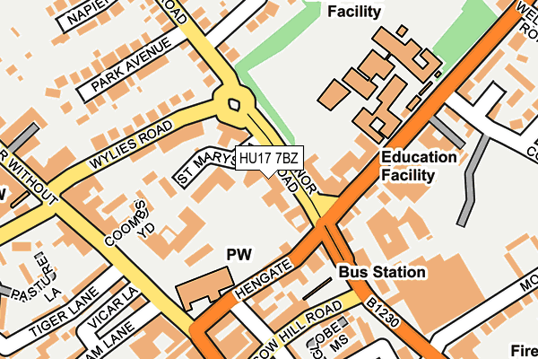
HU17 7BZ is located in the St Mary's electoral ward, within the unitary authority of East Riding of Yorkshire and the English Parliamentary constituency of Beverley and Holderness. The Sub Integrated Care Board (ICB) Location is NHS Humber and North Yorkshire ICB - 02Y and the police force is Humberside. This postcode has been in use since January 1980.


GetTheData
Source: OS OpenMap – Local (Ordnance Survey)
Source: OS VectorMap District (Ordnance Survey)
Licence: Open Government Licence (requires attribution)
| Easting | 503222 |
| Northing | 439920 |
| Latitude | 53.845274 |
| Longitude | -0.432565 |
GetTheData
Source: Open Postcode Geo
Licence: Open Government Licence
| Country | England |
| Postcode District | HU17 |
| ➜ HU17 open data dashboard ➜ See where HU17 is on a map ➜ Where is Beverley? | |
GetTheData
Source: Land Registry Price Paid Data
Licence: Open Government Licence
Elevation or altitude of HU17 7BZ as distance above sea level:
| Metres | Feet | |
|---|---|---|
| Elevation | 10m | 33ft |
Elevation is measured from the approximate centre of the postcode, to the nearest point on an OS contour line from OS Terrain 50, which has contour spacing of ten vertical metres.
➜ How high above sea level am I? Find the elevation of your current position using your device's GPS.
GetTheData
Source: Open Postcode Elevation
Licence: Open Government Licence
| Ward | St Mary's |
| Constituency | Beverley And Holderness |
GetTheData
Source: ONS Postcode Database
Licence: Open Government Licence
| January 2024 | Vehicle crime | On or near Parking Area | 311m |
| January 2024 | Violence and sexual offences | On or near Parking Area | 311m |
| January 2024 | Violence and sexual offences | On or near Parking Area | 311m |
| ➜ Get more crime data in our Crime section | |||
GetTheData
Source: data.police.uk
Licence: Open Government Licence
| Beverley Norwood (Norwood) | Beverley | 123m |
| Beverley Pizza Express (North Bar Within) | Beverley | 191m |
| Beverley Manor Road (Manor Road) | Beverley | 264m |
| Beverley Manor Road (Manor Road) | Beverley | 290m |
| Beverley York Road (York Road) | Beverley | 391m |
| Beverley Station | 0.7km |
| Arram Station | 4.4km |
GetTheData
Source: NaPTAN
Licence: Open Government Licence
GetTheData
Source: ONS Postcode Database
Licence: Open Government Licence


➜ Get more ratings from the Food Standards Agency
GetTheData
Source: Food Standards Agency
Licence: FSA terms & conditions
| Last Collection | |||
|---|---|---|---|
| Location | Mon-Fri | Sat | Distance |
| North Bar | 18:00 | 12:45 | 201m |
| Westwood Road Beverley | 17:00 | 11:45 | 477m |
| Market Place | 17:45 | 12:00 | 482m |
GetTheData
Source: Dracos
Licence: Creative Commons Attribution-ShareAlike
| Facility | Distance |
|---|---|
| Beverley High School Norwood, Beverley Sports Hall, Grass Pitches, Studio | 202m |
| Beverley Town Cricket And Recreation Club Recreation Club Lane, Beverley Grass Pitches, Squash Courts, Outdoor Tennis Courts | 459m |
| Beverley And East Riding Lawn Tennis Club Seven Corners Lane, Beverley Outdoor Tennis Courts | 477m |
GetTheData
Source: Active Places
Licence: Open Government Licence
| School | Phase of Education | Distance |
|---|---|---|
| Beverley Manor Nursery School Manor Road, Beverley, HU17 7BT | Nursery | 66m |
| Beverley High School Norwood, Beverley, HU17 9EX | Secondary | 202m |
| St Mary's Church of England Voluntary Controlled Primary School, Beverley Eden Road, Beverley, HU17 7HD | Primary | 573m |
GetTheData
Source: Edubase
Licence: Open Government Licence
The below table lists the International Territorial Level (ITL) codes (formerly Nomenclature of Territorial Units for Statistics (NUTS) codes) and Local Administrative Units (LAU) codes for HU17 7BZ:
| ITL 1 Code | Name |
|---|---|
| TLE | Yorkshire and The Humber |
| ITL 2 Code | Name |
| TLE1 | East Yorkshire and Northern Lincolnshire |
| ITL 3 Code | Name |
| TLE12 | East Riding of Yorkshire |
| LAU 1 Code | Name |
| E06000011 | East Riding of Yorkshire |
GetTheData
Source: ONS Postcode Directory
Licence: Open Government Licence
The below table lists the Census Output Area (OA), Lower Layer Super Output Area (LSOA), and Middle Layer Super Output Area (MSOA) for HU17 7BZ:
| Code | Name | |
|---|---|---|
| OA | E00065933 | |
| LSOA | E01013071 | East Riding of Yorkshire 017D |
| MSOA | E02002700 | East Riding of Yorkshire 017 |
GetTheData
Source: ONS Postcode Directory
Licence: Open Government Licence
| HU17 7GD | Regal Court | 47m |
| HU17 8BL | Hengate | 88m |
| HU17 9ET | Norwood | 107m |
| HU17 7AS | St Marys Lane | 115m |
| HU17 8BN | Hengate | 126m |
| HU17 9EH | New Walkergate | 127m |
| HU17 8DJ | Sylvester Lane | 131m |
| HU17 8DE | North Bar Within | 138m |
| HU17 8DZ | Sylvester Court | 147m |
| HU17 9EY | Norwood | 156m |
GetTheData
Source: Open Postcode Geo; Land Registry Price Paid Data
Licence: Open Government Licence