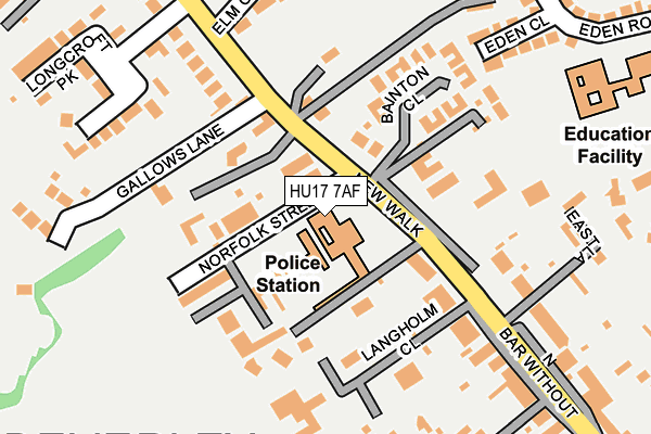
HU17 7AF is located in the St Mary's electoral ward, within the unitary authority of East Riding of Yorkshire and the English Parliamentary constituency of Beverley and Holderness. The Sub Integrated Care Board (ICB) Location is NHS Humber and North Yorkshire ICB - 02Y and the police force is Humberside. This postcode has been in use since January 1980.


GetTheData
Source: OS OpenMap – Local (Ordnance Survey)
Source: OS VectorMap District (Ordnance Survey)
Licence: Open Government Licence (requires attribution)
| Easting | 502642 |
| Northing | 440189 |
| Latitude | 53.847806 |
| Longitude | -0.441288 |
GetTheData
Source: Open Postcode Geo
Licence: Open Government Licence
| Country | England |
| Postcode District | HU17 |
| ➜ HU17 open data dashboard ➜ See where HU17 is on a map ➜ Where is Beverley? | |
GetTheData
Source: Land Registry Price Paid Data
Licence: Open Government Licence
Elevation or altitude of HU17 7AF as distance above sea level:
| Metres | Feet | |
|---|---|---|
| Elevation | 20m | 66ft |
Elevation is measured from the approximate centre of the postcode, to the nearest point on an OS contour line from OS Terrain 50, which has contour spacing of ten vertical metres.
➜ How high above sea level am I? Find the elevation of your current position using your device's GPS.
GetTheData
Source: Open Postcode Elevation
Licence: Open Government Licence
| Ward | St Mary's |
| Constituency | Beverley And Holderness |
GetTheData
Source: ONS Postcode Database
Licence: Open Government Licence
| September 2023 | Bicycle theft | On or near Seven Corners Lane | 306m |
| August 2023 | Violence and sexual offences | On or near Bainton Close | 112m |
| May 2023 | Other crime | On or near Bainton Close | 112m |
| ➜ Get more crime data in our Crime section | |||
GetTheData
Source: data.police.uk
Licence: Open Government Licence
| Beverley New Walk (New Walk) | Beverley | 75m |
| Beverley Molescroft Road (Molescroft Road) | Beverley | 150m |
| Beverley New Walk (Northbar Without) | Beverley | 171m |
| Beverley Woodhall Way (Woodhall Way) | Beverley | 402m |
| Beverley York Road (York Road) | Beverley | 422m |
| Beverley Station | 1.4km |
| Arram Station | 4.2km |
GetTheData
Source: NaPTAN
Licence: Open Government Licence
GetTheData
Source: ONS Postcode Database
Licence: Open Government Licence


➜ Get more ratings from the Food Standards Agency
GetTheData
Source: Food Standards Agency
Licence: FSA terms & conditions
| Last Collection | |||
|---|---|---|---|
| Location | Mon-Fri | Sat | Distance |
| North Bar | 18:00 | 12:45 | 506m |
| Woodhall Way Post Office | 17:15 | 11:15 | 580m |
| Beverley Delivery Office | 18:00 | 12:45 | 600m |
GetTheData
Source: Dracos
Licence: Creative Commons Attribution-ShareAlike
| Facility | Distance |
|---|---|
| Beverley And East Riding Lawn Tennis Club Seven Corners Lane, Beverley Outdoor Tennis Courts | 340m |
| Longcroft School And Sixth Form College Burton Road, Beverley Sports Hall, Artificial Grass Pitch, Health and Fitness Gym, Grass Pitches | 550m |
| Beverley High School Norwood, Beverley Sports Hall, Grass Pitches, Studio | 718m |
GetTheData
Source: Active Places
Licence: Open Government Licence
| School | Phase of Education | Distance |
|---|---|---|
| St Mary's Church of England Voluntary Controlled Primary School, Beverley Eden Road, Beverley, HU17 7HD | Primary | 300m |
| Molescroft Primary School St Leonard's Road, Molescroft, Beverley, HU17 7HF | Primary | 529m |
| Longcroft School and Sixth Form College Burton Road, Beverley, HU17 7EJ | Secondary | 550m |
GetTheData
Source: Edubase
Licence: Open Government Licence
The below table lists the International Territorial Level (ITL) codes (formerly Nomenclature of Territorial Units for Statistics (NUTS) codes) and Local Administrative Units (LAU) codes for HU17 7AF:
| ITL 1 Code | Name |
|---|---|
| TLE | Yorkshire and The Humber |
| ITL 2 Code | Name |
| TLE1 | East Yorkshire and Northern Lincolnshire |
| ITL 3 Code | Name |
| TLE12 | East Riding of Yorkshire |
| LAU 1 Code | Name |
| E06000011 | East Riding of Yorkshire |
GetTheData
Source: ONS Postcode Directory
Licence: Open Government Licence
The below table lists the Census Output Area (OA), Lower Layer Super Output Area (LSOA), and Middle Layer Super Output Area (MSOA) for HU17 7AF:
| Code | Name | |
|---|---|---|
| OA | E00065934 | |
| LSOA | E01013070 | East Riding of Yorkshire 016F |
| MSOA | E02002699 | East Riding of Yorkshire 016 |
GetTheData
Source: ONS Postcode Directory
Licence: Open Government Licence
| HU17 7DR | New Walk | 60m |
| HU17 7DN | Norfolk Street | 89m |
| HU17 7DJ | New Walk | 96m |
| HU17 7AE | New Walk | 110m |
| HU17 7DP | Hurn View | 133m |
| HU17 7DH | Langholm Close | 133m |
| HU17 7DL | Bainton Close | 158m |
| HU17 7AD | New Walk | 231m |
| HU17 7HE | Eden Close | 232m |
| HU17 7DZ | Elm Close | 233m |
GetTheData
Source: Open Postcode Geo; Land Registry Price Paid Data
Licence: Open Government Licence