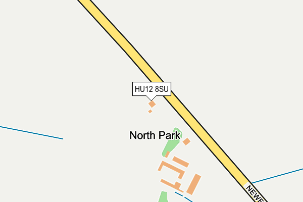
HU12 8SU lies on Newfield Lane in Lelley, Hull. HU12 8SU is located in the Mid Holderness electoral ward, within the unitary authority of East Riding of Yorkshire and the English Parliamentary constituency of Beverley and Holderness. The Sub Integrated Care Board (ICB) Location is NHS Humber and North Yorkshire ICB - 02Y and the police force is Humberside. This postcode has been in use since January 1980.


GetTheData
Source: OS OpenMap – Local (Ordnance Survey)
Source: OS VectorMap District (Ordnance Survey)
Licence: Open Government Licence (requires attribution)
| Easting | 521778 |
| Northing | 431367 |
| Latitude | 53.764426 |
| Longitude | -0.154052 |
GetTheData
Source: Open Postcode Geo
Licence: Open Government Licence
| Street | Newfield Lane |
| Locality | Lelley |
| Town/City | Hull |
| Country | England |
| Postcode District | HU12 |
| ➜ HU12 open data dashboard ➜ See where HU12 is on a map | |
GetTheData
Source: Land Registry Price Paid Data
Licence: Open Government Licence
Elevation or altitude of HU12 8SU as distance above sea level:
| Metres | Feet | |
|---|---|---|
| Elevation | 10m | 33ft |
Elevation is measured from the approximate centre of the postcode, to the nearest point on an OS contour line from OS Terrain 50, which has contour spacing of ten vertical metres.
➜ How high above sea level am I? Find the elevation of your current position using your device's GPS.
GetTheData
Source: Open Postcode Elevation
Licence: Open Government Licence
| Ward | Mid Holderness |
| Constituency | Beverley And Holderness |
GetTheData
Source: ONS Postcode Database
Licence: Open Government Licence
| Burstwick Dairy Hse Ln (Dairy House Lane) | Burstwick | 1,544m |
| Lelley Humbleton Road (Nuttles Lane) | Lelley | 1,608m |
| Elstronwick Back Lane (Back Lane) | Elstronwick | 1,718m |
| Preston Weghill Road (Weghill Road) | Preston | 1,953m |
GetTheData
Source: NaPTAN
Licence: Open Government Licence
| Percentage of properties with Next Generation Access | 33.3% |
| Percentage of properties with Superfast Broadband | 33.3% |
| Percentage of properties with Ultrafast Broadband | 33.3% |
| Percentage of properties with Full Fibre Broadband | 33.3% |
Superfast Broadband is between 30Mbps and 300Mbps
Ultrafast Broadband is > 300Mbps
| Percentage of properties unable to receive 2Mbps | 0.0% |
| Percentage of properties unable to receive 5Mbps | 0.0% |
| Percentage of properties unable to receive 10Mbps | 66.7% |
| Percentage of properties unable to receive 30Mbps | 66.7% |
GetTheData
Source: Ofcom
Licence: Ofcom Terms of Use (requires attribution)
GetTheData
Source: ONS Postcode Database
Licence: Open Government Licence

➜ Get more ratings from the Food Standards Agency
GetTheData
Source: Food Standards Agency
Licence: FSA terms & conditions
| Last Collection | |||
|---|---|---|---|
| Location | Mon-Fri | Sat | Distance |
| Lelley | 16:45 | 10:30 | 1,381m |
| Humbleton | 16:00 | 11:15 | 3,424m |
| Sproatley Post Office | 16:30 | 11:00 | 4,110m |
GetTheData
Source: Dracos
Licence: Creative Commons Attribution-ShareAlike
| Facility | Distance |
|---|---|
| Burstwick Country Golf Ellifoot Lane, Burstwick, Hull Golf | 2.9km |
| Addison Road Playing Field Addison Road, Preston, Hull Grass Pitches | 2.9km |
| South Holderness Sports Centre Station Road, Preston, Hull Sports Hall, Swimming Pool, Health and Fitness Gym | 3km |
GetTheData
Source: Active Places
Licence: Open Government Licence
| School | Phase of Education | Distance |
|---|---|---|
| Preston Primary School Station Road, Preston, Hull, HU12 8UY | Primary | 3.1km |
| Holderness Academy and Sixth Form College Station Road, Preston, Hull, HU12 8UZ | Secondary | 3.1km |
| Burton Pidsea Primary School Church Street, Burton Pidsea, Hull, HU12 9AU | Primary | 3.5km |
GetTheData
Source: Edubase
Licence: Open Government Licence
The below table lists the International Territorial Level (ITL) codes (formerly Nomenclature of Territorial Units for Statistics (NUTS) codes) and Local Administrative Units (LAU) codes for HU12 8SU:
| ITL 1 Code | Name |
|---|---|
| TLE | Yorkshire and The Humber |
| ITL 2 Code | Name |
| TLE1 | East Yorkshire and Northern Lincolnshire |
| ITL 3 Code | Name |
| TLE12 | East Riding of Yorkshire |
| LAU 1 Code | Name |
| E06000011 | East Riding of Yorkshire |
GetTheData
Source: ONS Postcode Directory
Licence: Open Government Licence
The below table lists the Census Output Area (OA), Lower Layer Super Output Area (LSOA), and Middle Layer Super Output Area (MSOA) for HU12 8SU:
| Code | Name | |
|---|---|---|
| OA | E00065736 | |
| LSOA | E01013028 | East Riding of Yorkshire 031A |
| MSOA | E02002714 | East Riding of Yorkshire 031 |
GetTheData
Source: ONS Postcode Directory
Licence: Open Government Licence
| HU12 8ST | Whites Close Lane | 477m |
| HU12 9BU | Mill Lane | 1027m |
| HU12 8SN | Main Street | 1471m |
| HU12 9BX | Fieldend Lane | 1489m |
| HU12 9HD | Daisy Hill Road | 1503m |
| HU12 9BP | 1546m | |
| HU12 9BT | Northfield Cottages | 1622m |
| HU12 8SP | Humbleton Road | 1633m |
| HU12 9BS | Wrights Cottages | 1663m |
| HU12 8SW | Nunnery Cottages | 1693m |
GetTheData
Source: Open Postcode Geo; Land Registry Price Paid Data
Licence: Open Government Licence