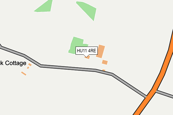
HU11 4RE lies on Hull Road in Aldbrough, Hull. HU11 4RE is located in the Mid Holderness electoral ward, within the unitary authority of East Riding of Yorkshire and the English Parliamentary constituency of Beverley and Holderness. The Sub Integrated Care Board (ICB) Location is NHS Humber and North Yorkshire ICB - 02Y and the police force is Humberside. This postcode has been in use since January 1980.


GetTheData
Source: OS OpenMap – Local (Ordnance Survey)
Source: OS VectorMap District (Ordnance Survey)
Licence: Open Government Licence (requires attribution)
| Easting | 523457 |
| Northing | 437172 |
| Latitude | 53.816179 |
| Longitude | -0.126273 |
GetTheData
Source: Open Postcode Geo
Licence: Open Government Licence
| Street | Hull Road |
| Locality | Aldbrough |
| Town/City | Hull |
| Country | England |
| Postcode District | HU11 |
| ➜ HU11 open data dashboard ➜ See where HU11 is on a map | |
GetTheData
Source: Land Registry Price Paid Data
Licence: Open Government Licence
Elevation or altitude of HU11 4RE as distance above sea level:
| Metres | Feet | |
|---|---|---|
| Elevation | 10m | 33ft |
Elevation is measured from the approximate centre of the postcode, to the nearest point on an OS contour line from OS Terrain 50, which has contour spacing of ten vertical metres.
➜ How high above sea level am I? Find the elevation of your current position using your device's GPS.
GetTheData
Source: Open Postcode Elevation
Licence: Open Government Licence
| Ward | Mid Holderness |
| Constituency | Beverley And Holderness |
GetTheData
Source: ONS Postcode Database
Licence: Open Government Licence
| Aldbrough Hornsea Road (Hornsea Road) | Aldbrough | 1,470m |
| Aldbrough Hornsea Road (Hornsea Road) | Aldbrough | 1,477m |
| Flinton Main Road (Main Road) | Flinton | 1,593m |
| Albrough High Street (High Street) | Aldbrough | 1,615m |
| Aldbrough High Street (High Street) | Aldbrough | 1,625m |
GetTheData
Source: NaPTAN
Licence: Open Government Licence
| Percentage of properties with Next Generation Access | 100.0% |
| Percentage of properties with Superfast Broadband | 0.0% |
| Percentage of properties with Ultrafast Broadband | 0.0% |
| Percentage of properties with Full Fibre Broadband | 0.0% |
Superfast Broadband is between 30Mbps and 300Mbps
Ultrafast Broadband is > 300Mbps
| Percentage of properties unable to receive 2Mbps | 0.0% |
| Percentage of properties unable to receive 5Mbps | 0.0% |
| Percentage of properties unable to receive 10Mbps | 20.0% |
| Percentage of properties unable to receive 30Mbps | 100.0% |
GetTheData
Source: Ofcom
Licence: Ofcom Terms of Use (requires attribution)
GetTheData
Source: ONS Postcode Database
Licence: Open Government Licence


➜ Get more ratings from the Food Standards Agency
GetTheData
Source: Food Standards Agency
Licence: FSA terms & conditions
| Last Collection | |||
|---|---|---|---|
| Location | Mon-Fri | Sat | Distance |
| Moors Farm | 16:00 | 11:00 | 876m |
| Flinton | 16:00 | 11:00 | 1,625m |
| Aldbrough Post Office | 16:45 | 11:30 | 1,663m |
GetTheData
Source: Dracos
Licence: Creative Commons Attribution-ShareAlike
| Facility | Distance |
|---|---|
| The Aldborough Village Hall & Memorial Recreation Field Garton Road, Aldbrough Grass Pitches, Sports Hall | 1.2km |
| Aldbrough Primary School Headlands Road, Aldbrough, Hull Grass Pitches | 1.7km |
| Humbleton Playing Fields Main Road, Humbleton, Hull Grass Pitches | 2.9km |
GetTheData
Source: Active Places
Licence: Open Government Licence
| School | Phase of Education | Distance |
|---|---|---|
| Aldbrough Primary School Headlands Road, Aldbrough, Hull, HU11 4RR | Primary | 1.7km |
| Sproatley Endowed Church of England Academy Balk Lane, Sproatley, Hull, HU11 4PR | Primary | 5km |
GetTheData
Source: Edubase
Licence: Open Government Licence
The below table lists the International Territorial Level (ITL) codes (formerly Nomenclature of Territorial Units for Statistics (NUTS) codes) and Local Administrative Units (LAU) codes for HU11 4RE:
| ITL 1 Code | Name |
|---|---|
| TLE | Yorkshire and The Humber |
| ITL 2 Code | Name |
| TLE1 | East Yorkshire and Northern Lincolnshire |
| ITL 3 Code | Name |
| TLE12 | East Riding of Yorkshire |
| LAU 1 Code | Name |
| E06000011 | East Riding of Yorkshire |
GetTheData
Source: ONS Postcode Directory
Licence: Open Government Licence
The below table lists the Census Output Area (OA), Lower Layer Super Output Area (LSOA), and Middle Layer Super Output Area (MSOA) for HU11 4RE:
| Code | Name | |
|---|---|---|
| OA | E00065720 | |
| LSOA | E01013029 | East Riding of Yorkshire 021A |
| MSOA | E02002704 | East Riding of Yorkshire 021 |
GetTheData
Source: ONS Postcode Directory
Licence: Open Government Licence
| HU11 4RF | Hull Road | 1004m |
| HU11 4QA | Garton Road | 1282m |
| HU11 4RD | Tansterne Road | 1368m |
| HU11 4QP | Garton Road | 1384m |
| HU11 4QR | Hull Road | 1387m |
| HU11 4SF | Carlton Drive | 1422m |
| HU11 4QH | Cedar Grove | 1438m |
| HU11 4RA | Carlton Lane | 1456m |
| HU11 4SH | Willow Grove | 1483m |
| HU11 4NQ | Holderness Cottages | 1508m |
GetTheData
Source: Open Postcode Geo; Land Registry Price Paid Data
Licence: Open Government Licence