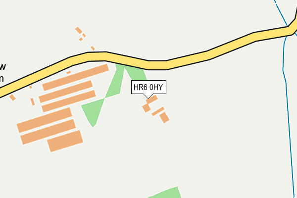
HR6 0HY is in Middleton On The Hill, Leominster. HR6 0HY is located in the Leominster North & Rural electoral ward, within the unitary authority of Herefordshire, County of and the English Parliamentary constituency of North Herefordshire. The Sub Integrated Care Board (ICB) Location is NHS Herefordshire and Worcestershire ICB - 18C and the police force is West Mercia. This postcode has been in use since January 1980.


GetTheData
Source: OS OpenMap – Local (Ordnance Survey)
Source: OS VectorMap District (Ordnance Survey)
Licence: Open Government Licence (requires attribution)
| Easting | 353910 |
| Northing | 263881 |
| Latitude | 52.271140 |
| Longitude | -2.676864 |
GetTheData
Source: Open Postcode Geo
Licence: Open Government Licence
| Locality | Middleton On The Hill |
| Town/City | Leominster |
| Country | England |
| Postcode District | HR6 |
| ➜ HR6 open data dashboard ➜ See where HR6 is on a map | |
GetTheData
Source: Land Registry Price Paid Data
Licence: Open Government Licence
Elevation or altitude of HR6 0HY as distance above sea level:
| Metres | Feet | |
|---|---|---|
| Elevation | 130m | 427ft |
Elevation is measured from the approximate centre of the postcode, to the nearest point on an OS contour line from OS Terrain 50, which has contour spacing of ten vertical metres.
➜ How high above sea level am I? Find the elevation of your current position using your device's GPS.
GetTheData
Source: Open Postcode Elevation
Licence: Open Government Licence
| Ward | Leominster North & Rural |
| Constituency | North Herefordshire |
GetTheData
Source: ONS Postcode Database
Licence: Open Government Licence
| Five Ashes (Unclassified Road) | Middleton On The Hill | 569m |
| Five Ashes (Unclassified Road) | Middleton On The Hill | 570m |
GetTheData
Source: NaPTAN
Licence: Open Government Licence
| Percentage of properties with Next Generation Access | 100.0% |
| Percentage of properties with Superfast Broadband | 85.7% |
| Percentage of properties with Ultrafast Broadband | 85.7% |
| Percentage of properties with Full Fibre Broadband | 85.7% |
Superfast Broadband is between 30Mbps and 300Mbps
Ultrafast Broadband is > 300Mbps
| Percentage of properties unable to receive 2Mbps | 0.0% |
| Percentage of properties unable to receive 5Mbps | 0.0% |
| Percentage of properties unable to receive 10Mbps | 0.0% |
| Percentage of properties unable to receive 30Mbps | 14.3% |
GetTheData
Source: Ofcom
Licence: Ofcom Terms of Use (requires attribution)
Estimated total energy consumption in HR6 0HY by fuel type, 2015.
| Consumption (kWh) | 40,269 |
|---|---|
| Meter count | 6 |
| Mean (kWh/meter) | 6,712 |
| Median (kWh/meter) | 5,714 |
GetTheData
Source: Postcode level gas estimates: 2015 (experimental)
Source: Postcode level electricity estimates: 2015 (experimental)
Licence: Open Government Licence
GetTheData
Source: ONS Postcode Database
Licence: Open Government Licence
➜ Get more ratings from the Food Standards Agency
GetTheData
Source: Food Standards Agency
Licence: FSA terms & conditions
| Last Collection | |||
|---|---|---|---|
| Location | Mon-Fri | Sat | Distance |
| Little Berrington | 15:00 | 08:00 | 4,615m |
| Cockspur Hall | 15:15 | 08:15 | 4,704m |
| St Michaels | 15:00 | 09:15 | 4,785m |
GetTheData
Source: Dracos
Licence: Creative Commons Attribution-ShareAlike
| Facility | Distance |
|---|---|
| Kimbolton St James Cofe Primary School Kimbolton, Leominster Grass Pitches | 2.7km |
| Brimfield And Little Hereford Sports Club Haynall Lane, Little Hereford, Ludlow Grass Pitches, Outdoor Tennis Courts | 4.2km |
| St Michael's Village Hall C2094 St Michaels, St Michaels Sports Hall | 4.7km |
GetTheData
Source: Active Places
Licence: Open Government Licence
| School | Phase of Education | Distance |
|---|---|---|
| Kimbolton St James CofE Primary School Kimbolton, Leominster, HR6 0HQ | Primary | 2.7km |
| Orleton CofE Primary School Orleton, Ludlow, SY8 4HQ | Primary | 5.5km |
| Westfield School Ryeland's Road, Leominster, HR6 8NZ | Not applicable | 6.8km |
GetTheData
Source: Edubase
Licence: Open Government Licence
The below table lists the International Territorial Level (ITL) codes (formerly Nomenclature of Territorial Units for Statistics (NUTS) codes) and Local Administrative Units (LAU) codes for HR6 0HY:
| ITL 1 Code | Name |
|---|---|
| TLG | West Midlands (England) |
| ITL 2 Code | Name |
| TLG1 | Herefordshire, Worcestershire and Warwickshire |
| ITL 3 Code | Name |
| TLG11 | Herefordshire, County of |
| LAU 1 Code | Name |
| E06000019 | Herefordshire, County of |
GetTheData
Source: ONS Postcode Directory
Licence: Open Government Licence
The below table lists the Census Output Area (OA), Lower Layer Super Output Area (LSOA), and Middle Layer Super Output Area (MSOA) for HR6 0HY:
| Code | Name | |
|---|---|---|
| OA | E00071194 | |
| LSOA | E01014096 | Herefordshire 001D |
| MSOA | E02002905 | Herefordshire 001 |
GetTheData
Source: ONS Postcode Directory
Licence: Open Government Licence
| SY8 4BE | 708m | |
| HR6 0HX | 1072m | |
| SY8 4BD | 1193m | |
| HR6 0HZ | The Hundred | 1385m |
| HR6 0HW | 1460m | |
| HR6 0JA | 1780m | |
| HR6 0HH | 1936m | |
| HR6 0HL | 2076m | |
| HR6 0HJ | 2095m | |
| HR6 0HR | 2102m |
GetTheData
Source: Open Postcode Geo; Land Registry Price Paid Data
Licence: Open Government Licence