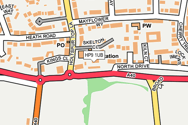
HP9 1UB lies on Oxford Road in Beaconsfield. HP9 1UB is located in the Beaconsfield electoral ward, within the unitary authority of Buckinghamshire and the English Parliamentary constituency of Beaconsfield. The Sub Integrated Care Board (ICB) Location is NHS Buckinghamshire, Oxfordshire and Berkshire West ICB - 14Y and the police force is Thames Valley. This postcode has been in use since October 2006.


GetTheData
Source: OS OpenMap – Local (Ordnance Survey)
Source: OS VectorMap District (Ordnance Survey)
Licence: Open Government Licence (requires attribution)
| Easting | 492321 |
| Northing | 189853 |
| Latitude | 51.599963 |
| Longitude | -0.668460 |
GetTheData
Source: Open Postcode Geo
Licence: Open Government Licence
| Street | Oxford Road |
| Town/City | Beaconsfield |
| Country | England |
| Postcode District | HP9 |
| ➜ HP9 open data dashboard ➜ See where HP9 is on a map ➜ Where is Beaconsfield? | |
GetTheData
Source: Land Registry Price Paid Data
Licence: Open Government Licence
Elevation or altitude of HP9 1UB as distance above sea level:
| Metres | Feet | |
|---|---|---|
| Elevation | 100m | 328ft |
Elevation is measured from the approximate centre of the postcode, to the nearest point on an OS contour line from OS Terrain 50, which has contour spacing of ten vertical metres.
➜ How high above sea level am I? Find the elevation of your current position using your device's GPS.
GetTheData
Source: Open Postcode Elevation
Licence: Open Government Licence
| Ward | Beaconsfield |
| Constituency | Beaconsfield |
GetTheData
Source: ONS Postcode Database
Licence: Open Government Licence
| November 2023 | Violence and sexual offences | On or near Beacon Close | 418m |
| October 2023 | Violence and sexual offences | On or near Beacon Close | 418m |
| October 2023 | Violence and sexual offences | On or near Beacon Close | 418m |
| ➜ Get more crime data in our Crime section | |||
GetTheData
Source: data.police.uk
Licence: Open Government Licence
| The King's Head Ph (Wycombe Road) | Holtspur | 27m |
| The King's Head Ph (Wycombe Road) | Holtspur | 142m |
| Mayflower Way | Holtspur | 228m |
| Wooburn Green Lane | Holtspur | 230m |
| Mayflower Way | Holtspur | 230m |
| Beaconsfield Station | 2.1km |
| Bourne End Station | 3.9km |
| Seer Green Station | 4.3km |
GetTheData
Source: NaPTAN
Licence: Open Government Licence
GetTheData
Source: ONS Postcode Database
Licence: Open Government Licence


➜ Get more ratings from the Food Standards Agency
GetTheData
Source: Food Standards Agency
Licence: FSA terms & conditions
| Last Collection | |||
|---|---|---|---|
| Location | Mon-Fri | Sat | Distance |
| Holtspur Top Lane Post Office | 17:00 | 12:00 | 92m |
| Holtspur | 17:15 | 12:00 | 164m |
| Pennington Road | 17:00 | 12:00 | 710m |
GetTheData
Source: Dracos
Licence: Creative Commons Attribution-ShareAlike
| Facility | Distance |
|---|---|
| The Beacon Sports Centre And Theatre Beacon Close, Beaconsfield Sports Hall, Health and Fitness Gym, Grass Pitches, Studio | 379m |
| Wooburn Green Lane Field Wooburn Green Lane, Beaconsfield Grass Pitches | 407m |
| Holtspur & Pre-school Cherry Tree Road, Beaconsfield Grass Pitches | 530m |
GetTheData
Source: Active Places
Licence: Open Government Licence
| School | Phase of Education | Distance |
|---|---|---|
| Holtspur School & Pre-School Cherry Tree Road, Holtspur, Beaconsfield, HP9 1BH | Primary | 563m |
| Wooburn Green Primary School School Road, Wooburn Green, High Wycombe, HP10 0HF | Primary | 1.3km |
| Beaconsfield High School Wattleton Road, Beaconsfield, HP9 1RR | Secondary | 1.8km |
GetTheData
Source: Edubase
Licence: Open Government Licence
The below table lists the International Territorial Level (ITL) codes (formerly Nomenclature of Territorial Units for Statistics (NUTS) codes) and Local Administrative Units (LAU) codes for HP9 1UB:
| ITL 1 Code | Name |
|---|---|
| TLJ | South East (England) |
| ITL 2 Code | Name |
| TLJ1 | Berkshire, Buckinghamshire and Oxfordshire |
| ITL 3 Code | Name |
| TLJ13 | Buckinghamshire |
| LAU 1 Code | Name |
| E06000060 | Buckinghamshire |
GetTheData
Source: ONS Postcode Directory
Licence: Open Government Licence
The below table lists the Census Output Area (OA), Lower Layer Super Output Area (LSOA), and Middle Layer Super Output Area (MSOA) for HP9 1UB:
| Code | Name | |
|---|---|---|
| OA | E00089821 | |
| LSOA | E01017801 | South Bucks 001F |
| MSOA | E02003688 | South Bucks 001 |
GetTheData
Source: ONS Postcode Directory
Licence: Open Government Licence
| HP9 1BF | Beaconsfield Mews | 42m |
| HP9 1EA | Skelton Close | 79m |
| HP9 1DW | Holtspur Top Lane | 117m |
| HP9 1DB | Heath Road | 118m |
| HP9 1UF | Mayflower Way | 124m |
| HP9 1DA | Holtspur Parade | 131m |
| HP9 1YT | Edmund Court | 139m |
| HP9 1GN | Waldenbury Place | 177m |
| HP9 1TZ | North Drive | 198m |
| HP9 1DY | Holtspur Way | 207m |
GetTheData
Source: Open Postcode Geo; Land Registry Price Paid Data
Licence: Open Government Licence