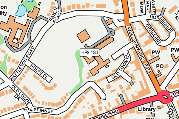
HP9 1SJ is located in the Beaconsfield electoral ward, within the unitary authority of Buckinghamshire and the English Parliamentary constituency of Beaconsfield. The Sub Integrated Care Board (ICB) Location is NHS Buckinghamshire, Oxfordshire and Berkshire West ICB - 14Y and the police force is Thames Valley. This postcode has been in use since February 1990.


GetTheData
Source: OS OpenMap – Local (Ordnance Survey)
Source: OS VectorMap District (Ordnance Survey)
Licence: Open Government Licence (requires attribution)
| Easting | 494251 |
| Northing | 190217 |
| Latitude | 51.602916 |
| Longitude | -0.640505 |
GetTheData
Source: Open Postcode Geo
Licence: Open Government Licence
| Country | England |
| Postcode District | HP9 |
| ➜ HP9 open data dashboard ➜ See where HP9 is on a map ➜ Where is Beaconsfield? | |
GetTheData
Source: Land Registry Price Paid Data
Licence: Open Government Licence
Elevation or altitude of HP9 1SJ as distance above sea level:
| Metres | Feet | |
|---|---|---|
| Elevation | 110m | 361ft |
Elevation is measured from the approximate centre of the postcode, to the nearest point on an OS contour line from OS Terrain 50, which has contour spacing of ten vertical metres.
➜ How high above sea level am I? Find the elevation of your current position using your device's GPS.
GetTheData
Source: Open Postcode Elevation
Licence: Open Government Licence
| Ward | Beaconsfield |
| Constituency | Beaconsfield |
GetTheData
Source: ONS Postcode Database
Licence: Open Government Licence
| December 2023 | Violence and sexual offences | On or near Mill Lane | 225m |
| October 2023 | Possession of weapons | On or near Parking Area | 212m |
| October 2023 | Vehicle crime | On or near Parking Area | 212m |
| ➜ Get more crime data in our Crime section | |||
GetTheData
Source: data.police.uk
Licence: Open Government Licence
| Aylesbury End | Beaconsfield Old Town | 168m |
| High School (Wattleton Road) | Beaconsfield | 181m |
| Aylesbury End | Beaconsfield Old Town | 186m |
| High School (Wattleton Road) | Beaconsfield | 193m |
| The Saracen's Head Ph (Wycombe End) | Beaconsfield Old Town | 242m |
| Beaconsfield Station | 1km |
| Seer Green Station | 2.4km |
| Bourne End Station | 5.6km |
GetTheData
Source: NaPTAN
Licence: Open Government Licence
GetTheData
Source: ONS Postcode Database
Licence: Open Government Licence


➜ Get more ratings from the Food Standards Agency
GetTheData
Source: Food Standards Agency
Licence: FSA terms & conditions
| Last Collection | |||
|---|---|---|---|
| Location | Mon-Fri | Sat | Distance |
| Old Town P.o. | 18:00 | 12:00 | 223m |
| Station Road | 17:00 | 12:00 | 435m |
| London Road | 17:30 | 12:00 | 533m |
GetTheData
Source: Dracos
Licence: Creative Commons Attribution-ShareAlike
| Facility | Distance |
|---|---|
| The Beaconsfield School Wattleton Road, Beaconsfield Grass Pitches, Sports Hall, Outdoor Tennis Courts | 0m |
| Beaconsfield High School Wattleton Road, Beaconsfield Sports Hall, Artificial Grass Pitch, Health and Fitness Gym, Grass Pitches | 252m |
| Beaconsfield Squash & Racketball Club Shepherds Lane, Beaconsfield Squash Courts | 354m |
GetTheData
Source: Active Places
Licence: Open Government Licence
| School | Phase of Education | Distance |
|---|---|---|
| The Beaconsfield School Wattleton Road, Beaconsfield, HP9 1SJ | Secondary | 0m |
| Butlers Court School Wattleton Road, Beaconsfield, HP9 1RW | Primary | 182m |
| Beaconsfield High School Wattleton Road, Beaconsfield, HP9 1RR | Secondary | 252m |
GetTheData
Source: Edubase
Licence: Open Government Licence
The below table lists the International Territorial Level (ITL) codes (formerly Nomenclature of Territorial Units for Statistics (NUTS) codes) and Local Administrative Units (LAU) codes for HP9 1SJ:
| ITL 1 Code | Name |
|---|---|
| TLJ | South East (England) |
| ITL 2 Code | Name |
| TLJ1 | Berkshire, Buckinghamshire and Oxfordshire |
| ITL 3 Code | Name |
| TLJ13 | Buckinghamshire |
| LAU 1 Code | Name |
| E06000060 | Buckinghamshire |
GetTheData
Source: ONS Postcode Directory
Licence: Open Government Licence
The below table lists the Census Output Area (OA), Lower Layer Super Output Area (LSOA), and Middle Layer Super Output Area (MSOA) for HP9 1SJ:
| Code | Name | |
|---|---|---|
| OA | E00089816 | |
| LSOA | E01017799 | South Bucks 001D |
| MSOA | E02003688 | South Bucks 001 |
GetTheData
Source: ONS Postcode Directory
Licence: Open Government Licence
| HP9 1LT | Aylesbury End | 96m |
| HP9 1LF | Old Town Close | 121m |
| HP9 1LY | Wycombe End | 146m |
| HP9 1LS | Aylesbury End | 151m |
| HP9 1SA | The Spinney | 156m |
| HP9 1NA | Factory Yard | 167m |
| HP9 1LU | Aylesbury End | 169m |
| HP9 1RU | Rolfe Close | 176m |
| HP9 1LZ | Wycombe End | 179m |
| HP9 1LW | Aylesbury End | 181m |
GetTheData
Source: Open Postcode Geo; Land Registry Price Paid Data
Licence: Open Government Licence