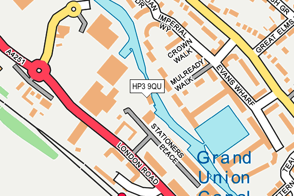
HP3 9QU is located in the Apsley and Corner Hall electoral ward, within the local authority district of Dacorum and the English Parliamentary constituency of Hemel Hempstead. The Sub Integrated Care Board (ICB) Location is NHS Hertfordshire and West Essex ICB - 06N and the police force is Hertfordshire. This postcode has been in use since December 2000.


GetTheData
Source: OS OpenMap – Local (Ordnance Survey)
Source: OS VectorMap District (Ordnance Survey)
Licence: Open Government Licence (requires attribution)
| Easting | 506322 |
| Northing | 205039 |
| Latitude | 51.733995 |
| Longitude | -0.461748 |
GetTheData
Source: Open Postcode Geo
Licence: Open Government Licence
| Country | England |
| Postcode District | HP3 |
| ➜ HP3 open data dashboard ➜ See where HP3 is on a map ➜ Where is Hemel Hempstead? | |
GetTheData
Source: Land Registry Price Paid Data
Licence: Open Government Licence
Elevation or altitude of HP3 9QU as distance above sea level:
| Metres | Feet | |
|---|---|---|
| Elevation | 80m | 262ft |
Elevation is measured from the approximate centre of the postcode, to the nearest point on an OS contour line from OS Terrain 50, which has contour spacing of ten vertical metres.
➜ How high above sea level am I? Find the elevation of your current position using your device's GPS.
GetTheData
Source: Open Postcode Elevation
Licence: Open Government Licence
| Ward | Apsley And Corner Hall |
| Constituency | Hemel Hempstead |
GetTheData
Source: ONS Postcode Database
Licence: Open Government Licence
| January 2024 | Criminal damage and arson | On or near Parking Area | 170m |
| December 2023 | Criminal damage and arson | On or near Parking Area | 170m |
| November 2023 | Anti-social behaviour | On or near Parking Area | 170m |
| ➜ Get more crime data in our Crime section | |||
GetTheData
Source: data.police.uk
Licence: Open Government Licence
| Apsley Railway Station (London Road) | Apsley | 149m |
| Apsley Railway Station (London Road) | Apsley | 160m |
| Oliver Rise (Belswains Lane) | Bennetts End | 208m |
| Oliver Rise (Belswains Lane) | Bennetts End | 217m |
| Sainsbury's (Hemel Hempstead) | Apsley | 252m |
| Apsley Station | 0.2km |
| Hemel Hempstead Station | 2.2km |
| Kings Langley Station | 3.5km |
GetTheData
Source: NaPTAN
Licence: Open Government Licence
GetTheData
Source: ONS Postcode Database
Licence: Open Government Licence


➜ Get more ratings from the Food Standards Agency
GetTheData
Source: Food Standards Agency
Licence: FSA terms & conditions
| Last Collection | |||
|---|---|---|---|
| Location | Mon-Fri | Sat | Distance |
| Dickinson Quay | 17:15 | 12:00 | 210m |
| Belswains Lane | 17:15 | 12:00 | 255m |
| Nashmills P.o. | 17:15 | 12:00 | 437m |
GetTheData
Source: Dracos
Licence: Creative Commons Attribution-ShareAlike
| Facility | Distance |
|---|---|
| Two Waters Primary School High Ridge Road, Hemel Hempstead Grass Pitches | 676m |
| Belswains Primary School Barnfield, Hemel Hempstead Grass Pitches | 698m |
| Shendish Manor Hotel & Golf Course Shendish, Hemel Hempstead Golf | 897m |
GetTheData
Source: Active Places
Licence: Open Government Licence
| School | Phase of Education | Distance |
|---|---|---|
| Nash Mills Church of England Primary School Belswains Lane, Nash Mills, Hemel Hempstead, HP3 9XB | Primary | 565m |
| Two Waters Primary School High Ridge Close, Apsley, Hemel Hempstead, HP3 0AU | Primary | 676m |
| Belswains Primary School Barnfield, Hemel Hempstead, HP3 9QJ | Primary | 698m |
GetTheData
Source: Edubase
Licence: Open Government Licence
The below table lists the International Territorial Level (ITL) codes (formerly Nomenclature of Territorial Units for Statistics (NUTS) codes) and Local Administrative Units (LAU) codes for HP3 9QU:
| ITL 1 Code | Name |
|---|---|
| TLH | East |
| ITL 2 Code | Name |
| TLH2 | Bedfordshire and Hertfordshire |
| ITL 3 Code | Name |
| TLH23 | Hertfordshire CC |
| LAU 1 Code | Name |
| E07000096 | Dacorum |
GetTheData
Source: ONS Postcode Directory
Licence: Open Government Licence
The below table lists the Census Output Area (OA), Lower Layer Super Output Area (LSOA), and Middle Layer Super Output Area (MSOA) for HP3 9QU:
| Code | Name | |
|---|---|---|
| OA | E00169633 | |
| LSOA | E01033022 | Dacorum 018G |
| MSOA | E02004873 | Dacorum 018 |
GetTheData
Source: ONS Postcode Directory
Licence: Open Government Licence
| HP3 9FS | Mulready Walk | 81m |
| HP3 9QN | Apsley Mills Retail Park | 90m |
| HP3 9WQ | Dickinson Quay | 102m |
| HP3 9WS | Crown Walk | 110m |
| HP3 9WN | Evans Wharf | 121m |
| HP3 9GE | London Road | 129m |
| HP3 9WW | Evans Wharf | 139m |
| HP3 9GF | London Road | 147m |
| HP3 9RS | Stationers Place | 147m |
| HP3 9FJ | Imperial Way | 150m |
GetTheData
Source: Open Postcode Geo; Land Registry Price Paid Data
Licence: Open Government Licence