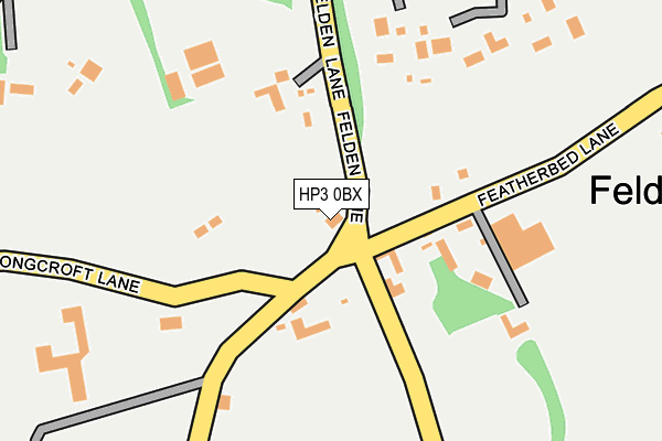
HP3 0BX is located in the Bovingdon, Flaunden and Chipperfield electoral ward, within the local authority district of Dacorum and the English Parliamentary constituency of South West Hertfordshire. The Sub Integrated Care Board (ICB) Location is NHS Hertfordshire and West Essex ICB - 06N and the police force is Hertfordshire. This postcode has been in use since January 1980.


GetTheData
Source: OS OpenMap – Local (Ordnance Survey)
Source: OS VectorMap District (Ordnance Survey)
Licence: Open Government Licence (requires attribution)
| Easting | 504054 |
| Northing | 204896 |
| Latitude | 51.733128 |
| Longitude | -0.494643 |
GetTheData
Source: Open Postcode Geo
Licence: Open Government Licence
| Country | England |
| Postcode District | HP3 |
| ➜ HP3 open data dashboard ➜ See where HP3 is on a map ➜ Where is Hemel Hempstead? | |
GetTheData
Source: Land Registry Price Paid Data
Licence: Open Government Licence
Elevation or altitude of HP3 0BX as distance above sea level:
| Metres | Feet | |
|---|---|---|
| Elevation | 150m | 492ft |
Elevation is measured from the approximate centre of the postcode, to the nearest point on an OS contour line from OS Terrain 50, which has contour spacing of ten vertical metres.
➜ How high above sea level am I? Find the elevation of your current position using your device's GPS.
GetTheData
Source: Open Postcode Elevation
Licence: Open Government Licence
| Ward | Bovingdon, Flaunden And Chipperfield |
| Constituency | South West Hertfordshire |
GetTheData
Source: ONS Postcode Database
Licence: Open Government Licence
| June 2022 | Violence and sexual offences | On or near Hospital | 252m |
| June 2022 | Anti-social behaviour | On or near Highcroft Road | 481m |
| May 2022 | Public order | On or near Hospital | 252m |
| ➜ Get more crime data in our Crime section | |||
GetTheData
Source: data.police.uk
Licence: Open Government Licence
| Sheethanger Common (Box Lane) | Felden | 761m |
| Sheethanger Common (Box Lane) | Felden | 774m |
| Boxmoor House School (Box Lane) | Felden | 801m |
| Boxmoor House School (Box Lane) | Felden | 831m |
| Meadow Way (London Road) | Felden | 1,031m |
| Hemel Hempstead Station | 1.1km |
| Apsley Station | 2.2km |
| Kings Langley Station | 4.9km |
GetTheData
Source: NaPTAN
Licence: Open Government Licence
GetTheData
Source: ONS Postcode Database
Licence: Open Government Licence


➜ Get more ratings from the Food Standards Agency
GetTheData
Source: Food Standards Agency
Licence: FSA terms & conditions
| Last Collection | |||
|---|---|---|---|
| Location | Mon-Fri | Sat | Distance |
| Bulstrode Lane | 17:00 | 09:00 | 54m |
| Upper Box Lane | 17:00 | 09:30 | 901m |
| Felden Lane | 17:00 | 09:00 | 926m |
GetTheData
Source: Dracos
Licence: Creative Commons Attribution-ShareAlike
| Facility | Distance |
|---|---|
| Boxmoor Golf Club (Closed) Box Lane, Hemel Hempstead Golf | 779m |
| Roman Fields Box Lane, Hemel Hempstead Sports Hall, Grass Pitches | 836m |
| Hemel Hempstead (Camelot) Rufc Chaulden Lane, Hemel Hempstead Health and Fitness Gym, Grass Pitches | 1.4km |
GetTheData
Source: Active Places
Licence: Open Government Licence
| School | Phase of Education | Distance |
|---|---|---|
| Roman Fields Academy 11 Box Lane, Hemel Hempstead, HP3 0DF | Not applicable | 839m |
| Westbrook Hay Westbrook Hay, London Road, Hemel Hempstead, HP1 2RF | Not applicable | 1.6km |
| St Rose's Catholic Infants School Green End Road, Boxmoor, Hemel Hempstead, HP1 1QW | Primary | 1.6km |
GetTheData
Source: Edubase
Licence: Open Government Licence
The below table lists the International Territorial Level (ITL) codes (formerly Nomenclature of Territorial Units for Statistics (NUTS) codes) and Local Administrative Units (LAU) codes for HP3 0BX:
| ITL 1 Code | Name |
|---|---|
| TLH | East |
| ITL 2 Code | Name |
| TLH2 | Bedfordshire and Hertfordshire |
| ITL 3 Code | Name |
| TLH23 | Hertfordshire CC |
| LAU 1 Code | Name |
| E07000096 | Dacorum |
GetTheData
Source: ONS Postcode Directory
Licence: Open Government Licence
The below table lists the Census Output Area (OA), Lower Layer Super Output Area (LSOA), and Middle Layer Super Output Area (MSOA) for HP3 0BX:
| Code | Name | |
|---|---|---|
| OA | E00118739 | |
| LSOA | E01023378 | Dacorum 021F |
| MSOA | E02004876 | Dacorum 021 |
GetTheData
Source: ONS Postcode Directory
Licence: Open Government Licence
| HP3 0BY | Felden Lane | 98m |
| HP3 0BN | Longcroft Lane | 251m |
| HP3 0BT | Featherbed Lane | 315m |
| HP3 0BL | 322m | |
| HP3 0BE | Felden Lane | 322m |
| HP3 0BG | Sheethanger Lane | 354m |
| HP3 0BD | Felden Drive | 391m |
| HP3 0BW | Flaunden Lane | 410m |
| HP3 0BP | Bulstrode Lane | 508m |
| HP3 0BU | Highcroft Road | 530m |
GetTheData
Source: Open Postcode Geo; Land Registry Price Paid Data
Licence: Open Government Licence