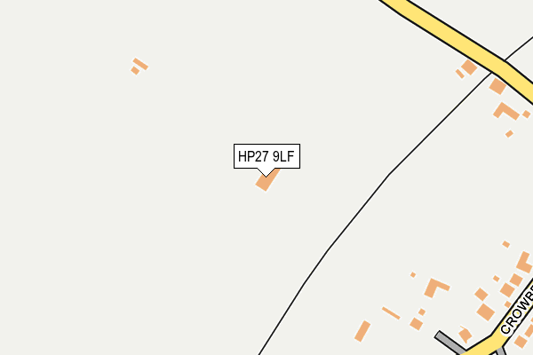
HP27 9LF is located in the The Risboroughs electoral ward, within the unitary authority of Buckinghamshire and the English Parliamentary constituency of Buckingham. The Sub Integrated Care Board (ICB) Location is NHS Buckinghamshire, Oxfordshire and Berkshire West ICB - 14Y and the police force is Thames Valley. This postcode has been in use since March 2009.


GetTheData
Source: OS OpenMap – Local (Ordnance Survey)
Source: OS VectorMap District (Ordnance Survey)
Licence: Open Government Licence (requires attribution)
| Easting | 481092 |
| Northing | 205245 |
| Latitude | 51.740053 |
| Longitude | -0.826978 |
GetTheData
Source: Open Postcode Geo
Licence: Open Government Licence
| Country | England |
| Postcode District | HP27 |
| ➜ HP27 open data dashboard ➜ See where HP27 is on a map | |
GetTheData
Source: Land Registry Price Paid Data
Licence: Open Government Licence
Elevation or altitude of HP27 9LF as distance above sea level:
| Metres | Feet | |
|---|---|---|
| Elevation | 110m | 361ft |
Elevation is measured from the approximate centre of the postcode, to the nearest point on an OS contour line from OS Terrain 50, which has contour spacing of ten vertical metres.
➜ How high above sea level am I? Find the elevation of your current position using your device's GPS.
GetTheData
Source: Open Postcode Elevation
Licence: Open Government Licence
| Ward | The Risboroughs |
| Constituency | Buckingham |
GetTheData
Source: ONS Postcode Database
Licence: Open Government Licence
| June 2022 | Anti-social behaviour | On or near Old Manor Close | 366m |
| June 2022 | Violence and sexual offences | On or near Askett Lane | 496m |
| May 2022 | Other theft | On or near Old Manor Close | 366m |
| ➜ Get more crime data in our Crime section | |||
GetTheData
Source: data.police.uk
Licence: Open Government Licence
| Crowbrook Road H&r (Crowbrook Road) | Askett | 333m |
| Crowbrook Road | Askett | 337m |
| Meadle Turn (Lower Icknield Way) | Meadle | 433m |
| Meadle Turn (Lower Icknield Way) | Meadle | 436m |
| Railway Station (Crowbrook Road) | Monks Risborough | 448m |
| Monks Risborough Station | 0.5km |
| Little Kimble Station | 1.9km |
| Princes Risborough Station | 2.7km |
GetTheData
Source: NaPTAN
Licence: Open Government Licence
GetTheData
Source: ONS Postcode Database
Licence: Open Government Licence


➜ Get more ratings from the Food Standards Agency
GetTheData
Source: Food Standards Agency
Licence: FSA terms & conditions
| Last Collection | |||
|---|---|---|---|
| Location | Mon-Fri | Sat | Distance |
| The Pond | 16:00 | 10:35 | 637m |
| Monks Risborough | 17:30 | 12:00 | 934m |
| Monks Risborough P.o. | 17:30 | 10:30 | 971m |
GetTheData
Source: Dracos
Licence: Creative Commons Attribution-ShareAlike
| Facility | Distance |
|---|---|
| Mollins Sports Ground (Closed) Mill Lane, Monks Risborough, Princes Risborough Grass Pitches | 599m |
| Peters Lane Peters Lane, Monks Risborough, Princes Risborough Grass Pitches | 1.1km |
| Princes Risborough Primary School Wellington Avenue, Princes Risborough Grass Pitches, Sports Hall | 1.2km |
GetTheData
Source: Active Places
Licence: Open Government Licence
| School | Phase of Education | Distance |
|---|---|---|
| Monks Risborough CofE Primary School Peters Lane, Princes Risborough, HP27 9LZ | Primary | 989m |
| Princes Risborough Primary School Wellington Avenue, Princes Risborough, HP27 9HY | Primary | 1.2km |
| Great Kimble Church of England School Church Lane, Great Kimble, Aylesbury, HP17 9TH | Primary | 1.6km |
GetTheData
Source: Edubase
Licence: Open Government Licence
The below table lists the International Territorial Level (ITL) codes (formerly Nomenclature of Territorial Units for Statistics (NUTS) codes) and Local Administrative Units (LAU) codes for HP27 9LF:
| ITL 1 Code | Name |
|---|---|
| TLJ | South East (England) |
| ITL 2 Code | Name |
| TLJ1 | Berkshire, Buckinghamshire and Oxfordshire |
| ITL 3 Code | Name |
| TLJ13 | Buckinghamshire |
| LAU 1 Code | Name |
| E06000060 | Buckinghamshire |
GetTheData
Source: ONS Postcode Directory
Licence: Open Government Licence
The below table lists the Census Output Area (OA), Lower Layer Super Output Area (LSOA), and Middle Layer Super Output Area (MSOA) for HP27 9LF:
| Code | Name | |
|---|---|---|
| OA | E00090452 | |
| LSOA | E01017932 | Wycombe 001D |
| MSOA | E02003696 | Wycombe 001 |
GetTheData
Source: ONS Postcode Directory
Licence: Open Government Licence
| HP27 9PT | The Hawthorns | 238m |
| HP27 9LR | Crowbrook Road | 288m |
| HP27 9LP | Crowbrook Road | 331m |
| HP27 9NA | Old Manor Close | 372m |
| HP27 9LS | Crowbrook Road | 403m |
| HP27 9LW | Crowbrook Road | 412m |
| HP27 9LN | Kingsmead | 481m |
| HP27 9LU | Askett Lane | 499m |
| HP27 9LT | 518m | |
| HP27 9LH | Mill Lane | 584m |
GetTheData
Source: Open Postcode Geo; Land Registry Price Paid Data
Licence: Open Government Licence