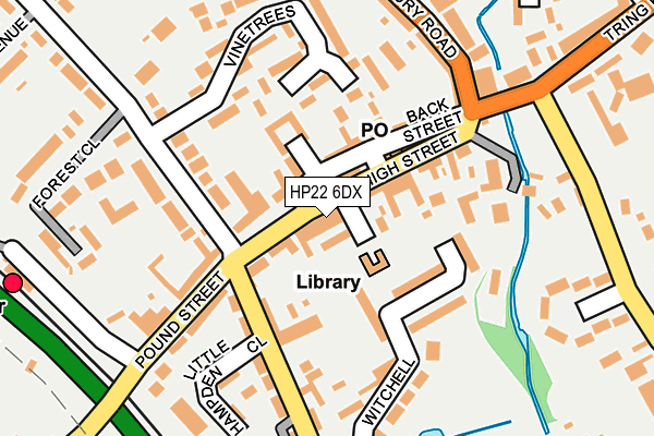
HP22 6DX is located in the Wendover, Halton and Stoke Mandeville electoral ward, within the unitary authority of Buckinghamshire and the English Parliamentary constituency of Aylesbury. The Sub Integrated Care Board (ICB) Location is NHS Buckinghamshire, Oxfordshire and Berkshire West ICB - 14Y and the police force is Thames Valley. This postcode has been in use since January 1980.


GetTheData
Source: OS OpenMap – Local (Ordnance Survey)
Source: OS VectorMap District (Ordnance Survey)
Licence: Open Government Licence (requires attribution)
| Easting | 486829 |
| Northing | 207798 |
| Latitude | 51.762143 |
| Longitude | -0.743275 |
GetTheData
Source: Open Postcode Geo
Licence: Open Government Licence
| Country | England |
| Postcode District | HP22 |
| ➜ HP22 open data dashboard ➜ See where HP22 is on a map ➜ Where is Wendover? | |
GetTheData
Source: Land Registry Price Paid Data
Licence: Open Government Licence
Elevation or altitude of HP22 6DX as distance above sea level:
| Metres | Feet | |
|---|---|---|
| Elevation | 130m | 427ft |
Elevation is measured from the approximate centre of the postcode, to the nearest point on an OS contour line from OS Terrain 50, which has contour spacing of ten vertical metres.
➜ How high above sea level am I? Find the elevation of your current position using your device's GPS.
GetTheData
Source: Open Postcode Elevation
Licence: Open Government Licence
| Ward | Wendover, Halton And Stoke Mandeville |
| Constituency | Aylesbury |
GetTheData
Source: ONS Postcode Database
Licence: Open Government Licence
| October 2023 | Criminal damage and arson | On or near Station Approach | 404m |
| September 2023 | Violence and sexual offences | On or near Station Approach | 404m |
| September 2023 | Burglary | On or near Station Approach | 404m |
| ➜ Get more crime data in our Crime section | |||
GetTheData
Source: data.police.uk
Licence: Open Government Licence
| High Street | Wendover | 63m |
| High Street | Wendover | 83m |
| Clock Tower (Aylesbury Road) | Wendover | 187m |
| Clock Tower (Aylesbury Road) | Wendover | 194m |
| Railway Station (Station Approach) | Wendover | 279m |
| Wendover Station | 0.3km |
| Stoke Mandeville Station | 4km |
| Little Kimble Station | 4.6km |
GetTheData
Source: NaPTAN
Licence: Open Government Licence
| Percentage of properties with Next Generation Access | 100.0% |
| Percentage of properties with Superfast Broadband | 100.0% |
| Percentage of properties with Ultrafast Broadband | 0.0% |
| Percentage of properties with Full Fibre Broadband | 0.0% |
Superfast Broadband is between 30Mbps and 300Mbps
Ultrafast Broadband is > 300Mbps
| Percentage of properties unable to receive 2Mbps | 0.0% |
| Percentage of properties unable to receive 5Mbps | 0.0% |
| Percentage of properties unable to receive 10Mbps | 0.0% |
| Percentage of properties unable to receive 30Mbps | 0.0% |
GetTheData
Source: Ofcom
Licence: Ofcom Terms of Use (requires attribution)
GetTheData
Source: ONS Postcode Database
Licence: Open Government Licence


➜ Get more ratings from the Food Standards Agency
GetTheData
Source: Food Standards Agency
Licence: FSA terms & conditions
| Last Collection | |||
|---|---|---|---|
| Location | Mon-Fri | Sat | Distance |
| High Street P.o. | 17:30 | 12:00 | 89m |
| Pound Street | 16:30 | 09:00 | 104m |
| Tring Road | 17:00 | 12:00 | 251m |
GetTheData
Source: Dracos
Licence: Creative Commons Attribution-ShareAlike
| Facility | Distance |
|---|---|
| Wendover Tennis And Squash Club Dobbins Lane, Wendover, Aylesbury Squash Courts, Outdoor Tennis Courts | 214m |
| The Witchell Witchell, Wendover, Aylesbury Grass Pitches | 279m |
| Ellesborough Road Ground (Closed) Ellesborough Road, Wendover, Aylesbury Grass Pitches | 404m |
GetTheData
Source: Active Places
Licence: Open Government Licence
| School | Phase of Education | Distance |
|---|---|---|
| John Colet School Wharf Road, Wendover, Aylesbury, HP22 6HF | Secondary | 564m |
| The John Hampden School Wharf Road, Wendover, Aylesbury, HP22 6HF | Primary | 610m |
| Wendover Church of England Junior School Wharf Road, Wendover, Aylesbury, HP22 6HF | Primary | 662m |
GetTheData
Source: Edubase
Licence: Open Government Licence
The below table lists the International Territorial Level (ITL) codes (formerly Nomenclature of Territorial Units for Statistics (NUTS) codes) and Local Administrative Units (LAU) codes for HP22 6DX:
| ITL 1 Code | Name |
|---|---|
| TLJ | South East (England) |
| ITL 2 Code | Name |
| TLJ1 | Berkshire, Buckinghamshire and Oxfordshire |
| ITL 3 Code | Name |
| TLJ13 | Buckinghamshire |
| LAU 1 Code | Name |
| E06000060 | Buckinghamshire |
GetTheData
Source: ONS Postcode Directory
Licence: Open Government Licence
The below table lists the Census Output Area (OA), Lower Layer Super Output Area (LSOA), and Middle Layer Super Output Area (MSOA) for HP22 6DX:
| Code | Name | |
|---|---|---|
| OA | E00089468 | |
| LSOA | E01017726 | Aylesbury Vale 024A |
| MSOA | E02003675 | Aylesbury Vale 024 |
GetTheData
Source: ONS Postcode Directory
Licence: Open Government Licence
| HP22 6DU | High Street | 50m |
| HP22 6EP | Chiltern Court | 52m |
| HP22 6EA | High Street | 54m |
| HP22 6EB | Back Street | 94m |
| HP22 6ED | Chandos Place | 102m |
| HP22 6BP | Dobbins Lane | 119m |
| HP22 6EG | Witchell | 127m |
| HP22 6BS | Vinetrees | 148m |
| HP22 6LF | Woods Place | 161m |
| HP22 6EJ | Pound Street | 173m |
GetTheData
Source: Open Postcode Geo; Land Registry Price Paid Data
Licence: Open Government Licence